Forest Research: Open Access
Open Access
ISSN: 2168-9776
ISSN: 2168-9776
Research Article - (2014) Volume 3, Issue 4
Ethiopia is one of the African countries facing problems of environmental degradation. In particular, the problem is severe in the Tigray region of Northern Ethiopia highlands where, environmental degradation is threatening many parts of the region. Efforts to contain this problem and facilitate natural rehabilitation have been made at several levels. The establishment of area enclosures, and soil and water conservation works are two of the main strategies promoted to contain land degradation and restore the natural vegetation. This study investigates the effect of area enclosures on regenerating the degraded vegetation. A comparative analysis was performed by investigating two sites: enclosed and unprotected sites. A temporal vegetation change analysis and a vegetation index differencing technique were applied to investigate the change in vegetation that has occurred in the two study sites. Multitemporal SPOT NDVI images for the period 2001 to 2009 were used for this purpose. The findings of the remote sensing analysis indicated that a consistent positive improvement in vegetation regeneration was observed in the enclosure area. This is indicative of the role of area closure, exclusion of livestock grazing and human interference from selected areas, as an important policy instrument to allow the recovery degraded vegetation provided that they are properly protected and managed.
<Keywords: NDVI; Enclosure; Degradation; Rehabilitation
Land degradation processes imply a reduction of the potential productivity of the land such as soil degradation and reduction of the quantity and diversity of natural vegetation [1]. Land degradation is one of the most common and serious environmental problems that affect two billion hectares (22.5%) of the world’s agricultural land, pasture, forest and woodland [2]. Dry lands are environmentally fragile, and as a result susceptible to degradation. Consequently, the livelihood of millions of farmers living in the dry lands around the world is threatened by degradation of arable farm land.
In Africa, land degradation is a serious problem with a considerable impact on the economies of many countries. Ethiopia is one of the several African countries faced with problems of environmental degradation [3-5]. Land degradation has been identified as the most serious environmental problem in the Ethiopian highlands (lying above 1,500 m above sea level) that comprise nearly 44 per cent of the country’s total area and about 88 per cent of the human population [6,7]. Currently, these areas are typified by degradation of vegetation cover and widespread soil degradation.
A long history of land clearing and sedentary agriculture has changed the vegetation cover and degraded the environment of the northern Ethiopian highlands. The conversion of forests, woodlands and shrub lands into croplands and cultivation of steep slopes by traditional oxplough technology have resulted in loss of natural vegetation cover and severe soil erosion [8-10]. According to the World Bank [11] report, the rate of deforestation in the highlands is estimated to be 150,000 ha per year. Forests have shrunk from the original cover of 65 per cent of the country, and 90 per cent of the highlands, to currently 2.2 per cent and 5.6 per cent respectively. As a result, land degradation has reached an alarming state in the highlands [12,13].
Rapid population growth, over-exploitation of natural resources, limited arable land, and shortage of employment opportunities in the industrial and service sectors have increased pressure on forests and grazing land resources in Ethiopia [14-16]. The inevitable humaninduced land degradation through the persistent need for food and firewood over the centuries led to the cutting down of forests on the mountain slopes.
To tackle the problems of deforestation and land degradation, the government has extensively carried out a number of rehabilitation programs supported by the World Food Program’s Food-For- Work scheme to prevent further soil erosion and other forms of environmental degradation. Soil and water conservation activities, and the establishment of area enclosures have been two of the main strategies promoted to control land degradation and restore the natural vegetation.
Accordingly, establishing area enclosures in various parts of the region has been a priority in the past decades. However, despite the emerging and promising ecological importance of area enclosures in the study region, very little scientific studies have been carried out to evaluate the effect of enclosures in the rehabilitation of degraded lands. But neither has potential use of remote sensing in monitoring vegetation regeneration after enclosures been evaluated. Important exception includes IAO (2008). IAO (2008) examined the change in vegetation cover that has occurred in area enclosure in Enderta district using two period Landsat images. However, their study failed to show the long-term temporal changes in vegetation cover that has occurred in the area. This apparent limitation provides us with the starting point of this paper [17].
The aim of this paper is to investigate the role of area enclosure in restoring degraded vegetation in a randomly chosen district that is adversely affected by heavy grazing and clearing of vegetation. A comparative analysis was performed by investigating two sites, enclosed and unprotected areas, in order to evaluate the effect of enclosures. Existing literature indicates satellite observations have proven to be a valuable data source providing timely and spatially continuous data with improved details.
Accordingly, the use of large-scale multi-temporal remotely sensed image databases has become a practical tool for monitoring changes in vegetation and assessing natural resource [18]. Thus, a range of remotely sensed vegetation indices have been used to monitor vegetation condition. In this paper, the temporal changes in vegetation that have occurred in the two study sites were examined by applying remotely sensed vegetation indices, Normalized Difference Vegetation Index in particularly, and vegetation index differencing technique. The goal of this research is thus to determine whether area enclosures are effective in regenerating vegetation cover over the course of a 9 year period from 2001 to 2009.
Description of the program
An enclosure refers to a specific land unit that is protected from the activities of a particular class of animals using appropriate barriers such as fencing to control the influence of animals [19]. Area enclosures in the Ethiopian context can be defined as the degraded land that has been excluded from human and livestock interference for rehabilitation. In principal, human and animal interference is restricted for a certain period of time to encourage natural regeneration.
Area enclosures in the Tigray region have been developed through a participatory process with local communities and due consideration was given to ways of gaining their confidence to increase their participation in natural resource management. Community members are involved in site selection and decision-making for the enclosure areas. Local communities reach an agreement before to strictly protect area enclosures from any form of grazing, harvesting grass, and tree cutting. This is supported by local rules and regulations developed by the village council. Communities are also given clear responsibilities to make decisions on issues pertaining to protection, access, management and utilization of the resources. Moreover, the village council is involved in organizing and encouraging participation in woodlots development and also nominate and finance the guards who protect the area enclosures.
The Study area
The present study focused on Tigray region, which is one of the regions in northern highlands of Ethiopia most affected by environmental degradation. This is because it has been settled for long and human population density is among the highest in the country [20,21]. Impoverishment of the ever increasing highland population and their search for subsistence income has led to massive deforestation [22,23]. In the past decades, Tigray has lost nearly all of its forests. The environmental degradation caused by deforestation, vegetation clearance and subsequent soil erosion has led to periodic crop failure even under normal rainfall conditions. Moreover, over exploitation of land resources and misuse of land by the age-old traditional system, which pays no attention to conservation methods have led to the loss of natural vegetation cover. As a result, low agricultural productivity and land degradation are pervasive [24-26].
To empirically detect the change in vegetation induced by government policy intervention of area enclosures, a study was conducted in a randomly chosen district, Enderta district. Geographically, it lies between latitudes 130-140 N and longitudes 390- 40030’ E in the southern part of Tigray region (Figure 1). The climate is predominantly semi-arid with irregular rainfall and frequent drought periods. The mean annual rainfall of the district (locally called woreda) is estimated to be less than 532 mm. Exploitative land use practices such as relentless land cultivation have resulted in most of the land being severely degraded. This area was previously densely forested and dominated by Juniper procera and Olea Africana [27]. As in many parts of the Ethiopian highlands, vegetation clearance to provide additional areas for cultivation, fuel wood and house construction has been a common practice in the woreda.

Figure 1: Geographic locations of the study sites in Enderta woreda, Southern Tigray, Ethiopia.
The study was conducted in two randomly drawn study sites: enclosed and unprotected sites (Figure 1). The area enclosure site covered a total area of 49,255 hectares enclosed for the enhancement of natural vegetation since 2001, while the unprotected land covered 16,932 hectares. The study sites were selected from the same woreda in order to prevent the influence of agro-ecology on the analysis of vegetation cover. Moreover, the two study sites have homogeneous land cover, mainly covered by natural vegetation particularly scrubs which are relatively better for vegetation change analysis than the mixed land uses.
Government official data on area enclosures indicates that by 2001 a total of 262,704 ha of degraded land in Tigray region have been enclosed for rehabilitation purposes. Areas enclosed in several districts of Tigray reached 952,000 ha by 2009, covering about 17.8 per cent of the total land (Figure 2).

Figure 2: Land cover map of Enderta woreda. The land cover map is extracted from the European Space Agency (ESA) Global Land Cover map 2009 with spatial resolution of 300 m.
SPOT-NDVI datasets
A time series of geo-referenced SPOT Vegetation ten day maximum value composite (MVC) NDVI images for the period 2001-2009 were acquired from VGT4Africa of the DevCoCast project website (http://www.vgt4africa.org). The SPOT Vegetation products have 1km spatial resolution and have a 10-day temporal resolution. The satellite data recorded by SPOT Vegetation instrument are already pre-processed in order to ensure the quality of the NDVI product [28]. The SPOT NDVI products are useful for monitoring of long-term vegetation changes and seasonality studies.
According to the seasonal calendar of the study area, all images were taken in the third decade of February. The main rainy season extends from mid-June to mid-September. This period is not an ideal time principally because vegetation differences between the two study sites cannot be captured during the wet period due to moisture differences in the landscape. The NDVI differences between the units during the rainy season will be uniform more or less. In addition, temporal variations in the NDVI reflect the vegetation’s response to weather variability and hence the dynamic change of vegetation cover that could occur due to seasonal variations cannot be prevented. In contrast, during the dry season (December to February) there is no effective rainfall, therefore only evergreen trees, bushes and shrubs can be captured with the remotely sensed images. Consequently, temporal variations in the NDVI reflect the presence of vegetation cover. Against this backdrop, February was selected as the ideal month for this study to examine the vegetation change thus preventing the dynamic change of vegetation cover that could occur due to seasonal variations.
Pre-processing of data
Before the SPOT-Vegetation NDVI products were ready for use, some pre-processing was done. Thus, ILWIS GEONETCast toolbox was used to sub-map the original images into the study sites. Then a 10-day composite NDVI map for the third decade of February was produced for both study sites for the period 2001 to 2009 to investigate the temporal change in vegetation.
NDVI-based vegetation change detection
Numerous studies have demonstrated that the Normalized Difference Vegetation Index (NDVI) has been widely applied for monitoring of the dynamic variation of biophysical parameters, land degradation, deforestation, change detection, monitoring famine early warning systems, and drought detection [1,29-36]. The vegetation condition and biomass are often correlated with NDVI [37-39]. Accordingly, for the purpose of this study NDVI, which is the most common vegetation index applied in vegetation change studies, was applied to investigate the role of area enclosure in the restoration of vegetation on the degraded lands.
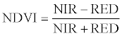
Observed NDVI trend is an important input and appears reasonable from monitoring of long-term vegetation change perspective. Accordingly, multi-temporal NDVI maps have been successfully used in many vegetation change studies to determine inter-annual variability of vegetation state [40-43]. It is determined as:
 (1)
(1)
where NIR is the reflectance in the near-infrared wavelengths and RED is the reflectance in the red wavelengths. In order to identify the temporal changes in vegetation that have occurred in the two study sites, multi-temporal NDVI maps were constructed as they aid to quantitatively analyse the temporal effects of the phenomenon [44]. The consistency of the change in vegetation was further examined by computing NDVI anomalies.
Change detection analysis was subsequently applied. Change detection is the process of identifying differences in the state of an object or phenomenon by observing it at different times [45]. Several methods are available for detecting change in satellite images. According to Hubert-Moy et al. [46], the choice of method is dependent on the area characteristics. In this study, a vegetation index differencing technique was applied for the change detection analysis, which has the advantage of emphasising differences in the spectral response of different features by reducing impacts of topographic effects [44]. Accordingly, vegetation differencing technique was applied to investigate the direction of change and examine whether vegetation conditions in 2009 was worse or better as compared to the average of the previous years. In order to perform the differencing, we first produced the average NDVI map for the years 2001-2008. The average NDVI map was then subtracted from the 2009 SPOT NDVI map to obtain the difference image.
The multi-temporal analysis indicated that the temporal NDVI maps for area enclosure demonstrate a noticeable change during the period of 2001-2009, while no change was observed for the unprotected area (Figures 3 and 4). A snapshot of the vegetation condition on the area enclosure clearly shows a consistent increase in the NDVI values between the period 2001 and 2009 as indicated in Figure 3. Figure 3 further shows that the vegetation condition in the enclosed area was very poor at the beginning of the study period and remarkable change was observed over time indicating the effect of protection time on vegetation cover. The enclosed site became greener over the 9 year time period of the study as deduced by the multi-temporal maps. The positive increase in NDVI values indicates high green leaf biomass, canopy closure, or leaf area [47,48]. This change is attributed to its closure from livestock interference and indiscriminate tree felling, which actually fostered regeneration of vegetation cover in the area.

Figure 3: Temporal NDVI maps on area enclosure for the period 2001-2009

Figure 4: Temporal NDVI maps on unprotected area for the period 2001-2009
Moreover, the dominant vegetation type of the enclosure area is described as dense mixed bush land dominated by Euclea shimperi locally known as “Kilio”. The cover types are in the average range between 1m and 3m in height and with canopy cover of between 50 and 80 per cent. In the month of February, it also consists of dry grasses with some green herbaceous species such as Rumex abyssinicus locally known as “Hohot”, Aloe barbadensis locally known as “ika” and Ocimun lamiifolium. On this basis, the increasing positive change in the multi-temporal NDVI values observed in the area enclosure is strong evidence that it is mostly related to improved vegetation as a result of the protection of the area from human and livestock interference, which are amongst the main causes of deforestation. The establishment of area enclosures guarantees to improve the recovery process of vegetation in the degraded areas.
On the contrary, Figure 4 shows a decrease in the NDVI values between the period 2001 and 2009 in the unprotected area. The temporal NDVI maps for the unprotected area shows a better vegetation condition at the beginning of the study period compared to the enclosure area. However, the vegetation starts to decline dramatically since the year 2003. This is mainly attributed to the increasing population, which is growing at a very rapid rate of about 3 per cent annually and their persistent increased demand for cropland, subsistent income and fuel wood that led to vegetation clearance at an alarming rate in the area. Moreover, majority of the people in the Enderta woreda are engaged in subsistence mixed farming. Accordingly, dependence on land for livelihood, absence of alternative employment opportunities, low productivity of cultivated land and the associated poverty have driven vegetation clearance. The unprotected area is currently under a great pressure of wood collection as many people are collecting and transporting wood for sale to nearby urban areas. The findings of the multi-temporal analysis on the two study sites showed the significance of area enclosures in the restoration of vegetation on degraded lands.
The temporal change in vegetation conditions that have occurred in both sites were further analysed by determining NDVI anomalies, which is computed by subtracting the long-term average NDVI (2001-2009) from the corresponding NDVI values in each year (Figure 5). The result of the temporal analysis reveals a consistent positive increase in NDVI anomaly in the area enclosure, while the NDVI anomaly for the unprotected area indicates a declining trend and exhibits variability over time accentuated with positive and negative anomalies. In the period 2001 to 2009, a linear trend line fit (R2=0.73) every year there is 8.03 NDVI increase in the area enclosure, while the NDVI anomaly in the unprotected area tends to decline by 3.62 (R2=0.57) annually indicating a declining trend in vegetation cover. The findings prove that there is strong evidence that enclosure areas appear to be successful in regenerating natural vegetation on degraded drylands. Although the comparison is done for the dry season, we also verified the results by examining the effect of other exogenous factors mainly rainfall.

Figure 5: Average NDVI anomalies for area enclosure and unprotected areas vis-à-vis seasonal rainfall (June – September) in Mekelle Airport station for the period 2001-2009.
One climatic station namely Mekelle airport, which is appropriate and nearby the selected study sites was considered to investigate the effect of rainfall. Rainfall for the main rain season at Mekelle airport station tended to decline annually by 8.9 mm y-1 for the period 2001 to 2009 (Figure 5). During the nine years of rainfall recording, mean seasonal rainfall amounts were below the mean in four years. The rainfall pattern over the study area exhibits variability’s over time with a high coefficient of variation (25%) accentuated with positive and negative anomalies. Moreover, the study woreda has experienced both dry and wet years over the last 9 years. From the analysis, we found that seasonal rainfall in the study woreda does not show an increasing trend over the period 2001-2009, and thus the effect of rainfall on the observed vegetation was not significant. Consequently, it can be stated that the observed increasing trend in vegetation health in the enclosed area is attributed to the protection of the area from human and livestock interference, which is an outcome of the conservation policies. Similarly, in Tanzania positive trends in NDVI values in woodland and forest pixels have been associated to changes in conservation policies [18].
Furthermore, vegetation index differencing technique was applied to detect the direction of change in vegetation over the period 2001 to 2009. According to Dobson et al. [49], the basic premise for image differencing is that subtraction results in an image dataset where values less than or greater than zero indicate areas of change. Accordingly, the vegetation index difference for both study sites revealed that a positive change in the vegetation cover is observed in 2009 compared to the 8 years average for the enclosed area, while no change was observed in the unprotected area (Figure 6). The vegetation change detection further indicated that 11 per cent (5,030 hectare) of the protected area showed a substantial increase over the last 9 years when compared with the average NDVI of the previous 8 years. 57 per cent (26,924 hectare) of the protected area showed a moderate change and 32 per cent of the area does not show a change over the period. Feoli (1994), as cited in Aerts et al. [50], reported a direct correlation between vegetation cover and the length of protection time. However, the results of the vegetation index difference for the unprotected are indicated that no change in 2009 compared to the 8 years average (Figure 6). This again indicated that areas that are protected from human and animal intrusion have a good chance of regeneration than unprotected areas.

Figure 6: Classified NDVI difference map for area enclosure and unprotected area, Enderta woreda
The vegetation change analysis therefore showed evidence of vegetation restoration of previously degraded lands due to establishment of enclosure. It was also evident that despite the study sites experience uniform rainfall amounts, the enclosure area had improved NDVI reading than the unprotected area. Therefore, the key difference was due to the ‘with’ and ‘without’ government intervention to protect the areas.
The findings of the remote sensing analysis provide evidence that a consistent positive improvement in vegetation regeneration is observed in the area enclosure site. This indicates the role of area enclosures, exclusion of livestock grazing and human interference from selected areas, as an important instrument to allow regeneration of degraded vegetation with concomitant benefits for reversing land degradation. Establishment of enclosures is therefore a good policy instrument provided that they are properly protected and managed. It is a cheap method for the restoration of degraded lands as natural processes lead to the revival of the vegetation without any human intervention and financial investment [51,52].
Similar findings have been reported in studies by IAO [17], Palik et al. [53] and Hobbs and Harris [54]. Aerts et al. [50] also regarded area enclosure as a powerful tool for environmental rehabilitation. This general finding further echoes the findings of Kindeya [55]; Mengistu et al. [52], Muluberhan et al. [56] and Nyssen J. et al. [57] where similar encouraging results on area enclosures in Tigray region have been reported. Descheemaeker et al. [58] also reported area enclosures as an important measures to combat land degradation and increase biomass production. The Nyssen et al. [57] study on the impacts of environmental rehabilitation in Tigray also revealed that sheet and rill erosion rates have decreased, spring discharge, vegetation cover and crop production have improved.
As it is noted earlier in section 1.1, the involvement of local communities in the rehabilitation program has also contributed a lot to the success of the area enclosure program. Devolution of natural resource governance to the lowest level; to those who are close to the problems of natural resource is also one of the important instruments introduced in the environmental rehabilitation measures. Involving community members in site selection and decision-making for the enclosure areas has created a sense of ownership and the community’s commitment for effective protection and sustainable management of the resources. Enforceable community laws are also crucial for the success of conservation efforts in the region. The involvement of the community members in designing conservation strategies is showing a great success in achieving the goals set for the projects.
By and large, the strategy of area enclosure is vital to halt and reverse land degradation. The establishment of area enclosures is indeed one of the best solutions to stop further land degradation and to promote reclamation. Thus, based on the findings of our analysis we conclude that the strategy of area enclosure is an effective policy measure to control land degradation and restore natural vegetation on the degraded lands.
A long history of land clearing and sedentary agriculture has changed the vegetation cover and degraded the environment of the northern Ethiopian highlands. The conversion of forests, woodlands and shrub lands into croplands and cultivation of steep slopes by traditional ox-plough technology have resulted in loss of natural vegetation cover. The study region is one of the regions in northern Ethiopia most affected by environmental degradation. In the past decades, Tigray has lost nearly all of its forests. The environmental degradation caused by deforestation, vegetation clearance and subsequent soil erosion has led to periodic crop failure even under normal rainfall conditions.
In order to reverse the problems of deforestation and land degradation, the establishment of area enclosures have been promoted to as strategy control land degradation and restore the natural vegetation. Subsequently, establishing area enclosures has been a priority in various parts of the region for the past decade. Hence, investigating the effect of area enclosures in regenerating the natural vegetation on the degraded areas was the primary objective of this study. The findings of the remote sensing analysis indicated that a consistent positive improvement in vegetation regeneration was observed in the enclosure area. This indicates the role of area closure, exclusion of livestock grazing and human interference from selected areas, as an important policy instrument to allow the recovery degraded vegetation provided that they are properly protected and managed.
The strategy of area enclosure coupled with community based resource management practice is a key factor for the observed restoration of natural vegetation cover. Concomitant to this finding, our paper demonstrates the contribution of remote sensing to applications in policy evaluation. Finally, we recommend that further study in other parts of the region is required to gain an informed understanding of the roles played by area enclosures in the restoration of the degraded vegetation in this environmentally very dynamic region of the northern part of Ethiopia.
However, like all studies, ours is not without limitation. First, our analysis is restricted to the examination of multi-temporal maps and the finding is not supported by ground truth data for both study sites. Though is multi-temporal NDVI images have been successful to determine inter-annual variability of vegetation state, the generalization of the results might be limited due to the lack of field data. This limitation should be kept in mind when evaluating the conclusions of our study.
The authors gratefully acknowledge the Flemish Institute for Technological Research NV (GEONETCast - VGT4AFRICA) for their kind help in providing the SPOT images used in this study. The comments of the anonymous reviewers are also gratefully acknowledged