Journal of Geography & Natural Disasters
Open Access
ISSN: 2167-0587
ISSN: 2167-0587
Research Article - (2014) Volume 4, Issue 1
This paper pays attention on measuring and assessing the coastal flood hazard risk through quantification of flood intensity and impacts across the different Gram Panchayats (GPs) in Balasore block, Odisha, India. With respect to the June, 2008 flood event, enormity of flooding has been calculated for each GP using normalised values of measurable parameters relating flood characteristics. Thus, a Flood Magnitude Rank (FMR) has been assigned to each of the GPs according to degree of flooding severity. Similarly, Flood Impact Rank (FIR) for each GP has been derived from damage database. The product of FMR and FIR gives Flood Severity Score (FSS) of a GP which when multiplied by probability of flood event occurrence yields Flood Hazard Score (FHS) for the GP. The analysis helps dividing the study area into five flood risk zones viz. a) Very Low (FHS Below 2.0653); b) Low (FHS 2.0653 – 3.2755); c) Moderate (FHS 3.2755 – 4.4857); d) High (FHS 4.4857 – 5.6959) and e) Very high (FHS Above 5.6959), respectively. Joydebkasba, Parikhi, Bahabalpur, Sartha, Srikona falls in very high flood hazard risk class while, Patrapada, Sindhia, Rasalpur 2 tend to have very low risk from flood hazards. The rest 19 GPs along with the Balasore town of the area under study come under different risk classes in between the above two extreme classes according to their flood hazard scores.
Keywords: Flood hazard score; Flood magnitude rank; Flood impact rank; Gram panchayat; Probability; Recurrence interval
The coastal areas are exposed to variety of hazards as these are the zones of interaction between marine and terrestrial systems and hazardous processes that originate from both land and sea of coastal areas. Diversity makes them very sensitive to those processes and responses are highly complex also. In the context of growing importance of the coastal zones because of high productivity of the ecosystem, increasing concentration of population, industrial development, more intensive resource exploitation, expanding recreational activities etc. – concern about coastal hazards has increased and there is a need for effective coastal management to reduce these impacts of disaster events. The Swaminathan committee has recommended vulnerability as an important consideration in coastal zone management. Assessment of the physical sensitivity and exposure of coasts to hazards is an essential component for any comprehensive coastal vulnerability study. During the last few decades, a plethora of literatures on coastal risk assessment methods have been produced consequent upon the recognition of global climate change and resultant sea level rise to put the coastal habitats and coastal communities into real threats [1,2].
IPCC’s coastal zone management sub group (CZMS) developed a common methodology (CM) that involves seven steps which was employed to assess vulnerability of various coastal nations to predicted sea level rise (IPCC–CZMS, 1992). This method considered probable impacts of global sea level rise on population, economic sector, ethnicity, and social assets and on agricultural productions. But the data for one or many parameters considered in it were either inadequate or not easily available [3]. Kay and waterman [4] developed a four step methodology to overcome this limitation associated with CM. The four stages were physical and biological environment study of the area under consideration; vulnerable and cultural system; links between different parts of the area and finally, formulation of management strategy. This method was criticized by Harvey et al. [5], on the ground that physical, biological environment of the study area was poorly defined and man induced coastal hazards were not properly considered. Hervey and his colleagues developed an eight-step methodology in which the above discrepancies were removed. Most important contribution in this regard came from Gronitz et al. [6] that considered parameters like relief, rock type, landform, tectonics and shoreline shift for calculating Coastal Vulnerability Index (CVI). This method has been employed by United States Geological Survey (USGS) to map vulnerability of coastal stretches throughout USA. But no consideration of socioeconomic data has been logically criticized [7-9]. Any assessment of coastal vulnerability without reference to social aspect is not useful [3]. Accordingly, the social vulnerability index [10] and CVI were combined to develop Coastal Social Vulnerability Index (CSoVI) where poverty, population, development, ethnicity, age and urbanization were emphasized along with the physical parameters [11]. Furthermore, exposure of a place to physical hazards has been measured in terms of Place Vulnerability Index (PVI) [12].
In the coastal parts of the state of Odisha, India, flood hazards are generally caused by tropical cyclones and very rarely by tsunamis. The degree of flooding depends upon scale of the storm, height of storm surge and the tide level at the time of the event. Global sea level rise will be an increasingly important factor if predicted rise in sea level do occur. River estuaries may witness severe estuarine flooding with combined effects of a storm surge and river flood caused by rain storm inland. Coastal flooding is the most severe hazard in many coastal locations around the Bay of Bengal.
The present study area constitutes a part of the alluvium coast of Dugdugi and Burahbalam delta plain. It extends from Dugdugi river mouth to Rasalpur 1 along the Bay of Bengal coast of Odisha. The study area lies between 21°20’25”N to 21°39’55”N and 85°50’45”E to 87°12’37”E (Figure 1). The area is a coastal alluvial tract with an unconsolidated substrate, which is also geomorphologically dynamic, rich in habitat diversity and locationally prone to hazard like tropical cyclone induced tidal waves, storm surges and consequent coastal flooding. It is a monotonously flat alluvium surface lying between 2.5 m. to 3.5 m. above MSL. Geologically the area is characterized by ordinary alluvium deposits of the Holocene to recent origin brought down by the Dugdugi, Burahbalam and also Subarnarekha river. The area has a natural gradient to the east and south east direction which has been followed by the river Subarnarekha. The study area is mostly covered by the sandy clay and silty loam soils developed under brackish environment. The pH of the soil varies between 6.5 and 8.0 (pre monsoon) and 6.2 and 8.2 (post monsoon). This type of soil has led to a high water retaining capacity of the area. The climatic variations of the study area are more significant between monsoon and pre monsoon seasons. Temperature varies from a minimum of 9°C in winter to a maximum of 38°C in summer. Relative humidity ranges between 90% – 96% in most of the months. Low atmospheric pressure is recorded during summer and monsoon period. Wind dominantly blows from the offshore areas. There is no forest land in the study area. Some grasses e.g. Sesuvium Portolacrustum, Ipomia Bioloba and some herbs like Lantena camera, Akanthesia, Calatropis gigantia are found in the study area. Trees like Casuarina, Eucalyptus and Acacia auriculiformis are planted in this area while Coconut, Banana, Bamboo and Mango are indigenous floral species.

Figure 1: Location Map of the Study Area.
Extensively low gradient coastal plain topography (1:18000) and relatively lowlying flat surface (1.7m to 2.5 m. surface elevation) of Balasore coastal area are highly susceptible to flooding activities. The range of flooding are also in the deltaic lowlands, as the high and saline water table and poor drainage circumstances of the region give buoyancy the flood water to spread over large areas. The duration of flooding is related to the spread of drainage over the tidal marshes or swamps and the duration of the flood itself. The micro tidal condition as well as the Balasore tidal swamps retards the speed of drainage during floods. Seasonality is often a vital factor in flood risk. In Odisha coastal plain 48 percent of cyclones that cause flooding on the coastal lowlands occur between October and November. However in the month of May few cyclones (7%) that cause coastal flooding occur due to the coincidence of onshore strong winds with the spring high tides. Local high seas, high rate of downstream discharge in the coastal plain, and the higher annual tidal level amplify the flooding activities in the cyclones that occur particularly in the season of retreating monsoon (October- November) in this region.
Assessment of the flood hazard includes characterization of the flooding in the terms of depth, duration of inundated condition, extent and velocity etc. Furthermore, the height of storm surge in low lying coastal areas is another important criterion for evaluating flood hazards. Damage to human life, properties and infrastructure caused by flood hazard is another easily measurable component of the flood hazard intensity. Field data sheet has been prepared in the proper format to generate database for flood intensity assessment in accordance to random sampling survey. Substantial number of samples (28×5) within the study area has been considered from each Gram Panchayat (GP) as the sample unit, depending on the scale of study.
The present study is based on Gram Panchayat (GP) wise secondary data collected from Gram Panchayat office, Block Development Office, District Natural Hazard Management Office of Balasore district, Odisha and primary data collected aftermath of June, 2008 flood event through intensive field survey using predesigned questionnaire at randomly sampled households to represent the concerned GP. The study has been conducted considering Gram Panchayat (GP) as the spatial unit. A Gram Panchayat (GP) is the smallest administrative unit for which disaster damage database is maintained and variations in flooding characteristics is not expected below this scale of geography when the natural setting of the terrain under study is considered. Moreover, the socio-economic and demographic features of the population exhibit an acceptable degree of homogeneity at the Gram Panchayat level.
In estimating the Flood Magnitude Rank (FMR) of a GP four parameters have been considered, namely depth of flood; flood velocity; percentage of area under inundation and distance from sea shore. On the other hand, seven indicators have been selected to enumerate Flood Impact Rank (FIR) for a GP. They are percentage of fully damaged houses; percentage of partly damaged houses; number of people died per thousand; number of cattle died per thousand of cattle population; monetary equivalent of crop damage per hector of net cropped area; monetary equivalent of fishery damage as a percentage of total value of fish production; length of road damaged as a percentage of the total length of roads in the these GPs. By use of these data, Flood Hazard Score for each GP has been calculated which gives a quantitative measure of flood risk associated with a GP. Calculation of Flood Hazard Score (FHS) involves following steps
Step I: Computing flood magnitude and flood intensity score
Flood magnitude similar to that of 2008 flood event has been characterized quantitatively using the four parameters mentioned flood velocity, percentage of area under inundation and distance from sea shore have been obtained from secondary sources supplemented by field survey. Those data for all the 32 GPs have been standardized to make them dimension and scale free and also to make them comparable. Then those standardized scores for the aforesaid parameters have been averaged to get GP wise Flood Magnitude Score (FMS)
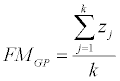 (1)
(1)
Where, j, physical parameters of hazard; k, number of physical parameters of hazard to be taken; z, normalized physical parameter for the hazard considered.
GP wise damage data can similarly be combined into a Flood Intensity Score as follows
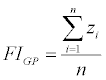 (2)
(2)
Where, i, damaged parameters of hazard; n, number of damaged parameters of hazard to be taken.
Step II: Obtaining flood severity score
For the given flood episode, GPs wise standardised values of FMGP and FIGP can be ranked on a 10 point scale (Table 1) to get the Flood Magnitude Rank and also the Flood Impact Rank (FIR)
Flood Severity Score of each and every GP has been quantified by the product of FMR and FIR.
| Standardised Value | < -3 | -3 to -2 | -2 to -1 | -1 to 0 | 0 to 1 | 1 to 2 | 2 to 3 | >3 |
| Flood Magnitude Rank (FMR) Flood Impact Rank (FIR) | 1 | 2 | 3 | 4 | 5 | 6 | 8 | 10 |
Table 1: Ranking of Flood Magnitude & Flood Impact from Standard Scores.
FSS = FMR× FIR (3)
Step III: Assessing Probability of flooding
Probability (p) of the occurrence of said flood of a given magnitude is computed from recurrence interval (also called the return period). Flood recurrence interval has been computed on the basis of last 40 years worth of data. The recurrence interval (T) is defined as the average number of years between two successive floods or similar severity. Recurrence Interval (T) is given by
 (4)
(4)
Where, n, No. of years in record; m, No. of occurrences of flood of similar severity
The probability (p) of occurrence of said floods of a given severity is expresses by taking the inverse of recurrence interval (T)
 (5)
(5)
Step IV: Calculating Flood Hazard Score
Finally, the Flood Hazard Score (FHS) is calculated by multiplying the Flood Severity Score (FSS) (Table 2) and the associated probability value
| GP Code | GP Name. | Average standard score of hazard magnitude | Flood Magnitude Rank (FMR) | Average standard score of hazard damage | Flood Impact Rank (FIR) | Flood Severity Score (FSS) | Probability (p) | Flood Hazard Score (FHS) |
|---|---|---|---|---|---|---|---|---|
| 1 | Rasalpur 1 | 0.70206644 | 5 | -1.08738 | 3 | 15 | 0.07317 | 1.0975 |
| 2 | Sashanga | 0.06822948 | 5 | -0.374754 | 4 | 20 | 0.09756 | 1.9512 |
| 3 | Joydebkasba | 0.69124481 | 5 | 1.0237712 | 6 | 30 | 0.14634 | 4.3902 |
| 4 | Saragaon | -0.674384 | 4 | -0.754703 | 4 | 16 | 0.09756 | 1.5609 |
| 5 | Genguti | -0.5040695 | 4 | -0.430088 | 4 | 16 | 0.09756 | 1.5609 |
| 6 | Gudu | 0.3194201 | 5 | -0.017723 | 4 | 20 | 0.09756 | 1.9512 |
| 7 | Padmapuri | 0.08017966 | 5 | -0.463611 | 4 | 20 | 0.09756 | 1.9512 |
| 8 | Ranasahi | 0.41308439 | 5 | -0.000134 | 4 | 20 | 0.09756 | 1.9512 |
| 9 | Patrapada | -1.0838472 | 3 | -1.151759 | 3 | 9 | 0.07317 | 0.6585 |
| 10 | Parikhi | 0.93988099 | 5 | 1.5748355 | 6 | 30 | 0.14634 | 4.3902 |
| 11 | Bahabalpur | 0.79483691 | 5 | 1.2433755 | 6 | 30 | 0.14634 | 4.3902 |
| 12 | Gopinathpur | -0.2723026 | 4 | -0.105180 | 4 | 16 | 0.09756 | 1.5609 |
| 13 | Chhanua | -0.3384952 | 4 | -0.186472 | 4 | 16 | 0.09756 | 1.5609 |
| 14 | Sindhia | -0.6615708 | 4 | -0.231161 | 4 | 16 | 0.09756 | 1.5609 |
| 15 | Olanda Saragaon | -0.5988353 | 4 | -0.095099 | 4 | 16 | 0.09756 | 1.5609 |
| 16 | Odangi | -0.7014093 | 4 | -0.893605 | 4 | 16 | 0.09756 | 1.5609 |
| 17 | Nagram | -0.7476162 | 4 | -0.875540 | 4 | 16 | 0.09756 | 1.5609 |
| 18 | Baunla | -0.7351087 | 4 | -0.823503 | 4 | 16 | 0.09756 | 1.5609 |
| 19 | Haldipada | -1.056316 | 4 | -0.939552 | 4 | 16 | 0.09756 | 1.5609 |
| 20 | Kasipada | -0.9827968 | 4 | -0.848826 | 4 | 16 | 0.09756 | 1.5609 |
| 21 | Sartha | 1.2745164 | 3 | 2.1505299 | 8 | 24 | 0.19512 | 4.6829 |
| 22 | Kashaphala | 0.8717318 | 5 | -1.186939 | 3 | 15 | 0.07317 | 1.0975 |
| 23 | Srirampur | 0.6848103 | 5 | 0.5890416 | 5 | 25 | 0.12195 | 3.0487 |
| 24 | Rasalpur 2 | -0.7077841 | 4 | -1.148350 | 3 | 12 | 0.07317 | 0.8780 |
| 25 | Hidigaon | 0.6405789 | 5 | -1.248117 | 3 | 15 | 0.07317 | 1.0975 |
| 26 | Srikona | 0.9681347 | 5 | 1.5495563 | 6 | 30 | 0.14634 | 4.3902 |
| 27 | Kuradiha | -0.6420300 | 4 | -0.725454 | 4 | 16 | 0.09756 | 1.5609 |
| 28 | Balasore Town | -1.4024427 | 3 | -1.080589 | 4 | 12 | 0.09756 | 1.1707 |
Table 2: Result of Average Standard Score, Flood Magnitude Rank (FMR), Flood Impact Rank (FIR), Flood severity Score (FSS), Probability value (p) and Flood Hazard Score (FHS).
FHS = FSS × P (6)
Geomorphologically, the present study area belongs to the Subarnarekha delta Chenier plain along the western bank of the Burahbalam River of Odisha are arrangements of complex, diverse and fragile ecosystems which are simply unique in nature. Coastal ecosystem, such as wetlands, beaches, lagoon, estuaries, sand dunes, and mangroves, besides performing crucial coastal protections, provide rich swamping and breeding grounds for marine creatures, feeding grounds for birds, recreational grounds for tourists and available resources for the local communities. These ecosystems, are threatened by development related activities along the Balasore coast. The area is represented by regressive younger beach ridges and mudflats and floodplains appearing as depressed zones, after altered into agricultural field. The southernmost sea front part of Balasore block is composed of beach barrier complex and wash over deposits. Generally speaking, the Balasore block is dominantly a part of Burahbalam flood plain formed due to westward avulsion of the river. Interactions among marine transgression processes, huge supply of sediments and predominant wave tide dynamics have been responsible for the development of this sandy flat area surrounded by the Bhadrak district in the west, young chenier complex to the east and north and beach barrier complex and wash over deposits to the south.
Geomorphological signatures suggest that this coastal area has probably started to witness a phase of marine transgression. Frequency and intensity of the cyclones have increased to a certain extent. Cyclone induced storm surges and torrential rain in upper catchment of Burahbalam and Dugdugi river have been found to be responsible for flooding of the study area intensity and severity of which are experienced to have increased, may be due to recent climate and environment changes.
In this study it has been tried to understand, the degree of flood hazard risk across the Gram Panchayats in Balasore block, Odisha. All the Gram Panchayats (27 in number along with Balasore municipal area) of the studied C.D. block have been classed under five categories of flood hazard risk - starting from Very Low through intermediate classes to Very High (Table 3) and accordingly a map (Figure 2) has been prepared on the basis of calculated flood hazard score of each of the GPs to visualised spatial variability of risk within the block. Result shows that Joydebkasba, Parikhi, Bahabalpur, Sartha, Srikona GPs belong to very high flood risk zone which may be attributed to their vulnerable geomorphic locations. Joydebkasba, Parikhi, Bahabalpur, Srikona is located at the sea front and hence, prone to coastal flooding. Moreover, river Burahbalam and Dugdugi carries large volume of discharge loaded with huge quantity of sediments. This flow of discharge receives resistance in its drainage from the strong southwesterly monsoon wind and resultant cross-shore current, waves and high magnitude tide inflow. This causes accumulation of huge water at and near Burahbalam and Dugdugi river mouth and flooding at Joydebkasba, Parikhi, Bahabalpur, Srikona GP. On the other hand this area is only 0.5m - 1m high above the sea level which makes the area more vulnerable to flooding. The landward margin of the block under study is characterised by intricate network of tidal inlets along which sea waters can enter into the said GP in question and cause flooding even in the event of a low storm surge or a wave of moderate magnitude. The above stated GP is barely exposed to sea without any sand dune which generally acts as a natural buffer against sea. Sparse mangrove patches, which could be found in this area even few years back, have disappeared due to change in sedimentological properties of the shore deposits that constitute substrate for mangrove swamps. Land use pattern of the area has undergone such changes that have increased probability of flooding. The area gets flooded in two different ways – firstly due to spilling of river Burahbalam and Dugdugi (Sweet water flood) and coastal flooding (Saline flood) due to high magnitude wave or storm surge. These GPs are thickly populated because people here have easy access to marine resources which these coastal dwellers utilize for earning livelihood. Rasalpur-1, Sashanga, Gudu, Padmapuri, Ranasahi, Kashaphala, Rasalpur-2 and Hidigaon.

Figure 2: Flood Hazard Risks Zone
| Flood Hazard Score | Assigned Attribute | G.P Code No. | Identified G.P |
|---|---|---|---|
| < 0.8551 – 2.0653 | Very low | 9,14,24 | Patrapada, Sindhia, Rasalpur-I |
| 2.0653 – 3.2755 | Low | 1,22,25, Balasore Town | Rasalpur-II, Kashaphala, Hidigaon, Balasore Town |
| 3.2755 – 4.4857 | Moderate | 2, 4, 5, 6, 7, 8, 12, 13, 14, 15, 16, 17, 18, 19, 20, | Sashanga, Saragaon, Genguti, Gudu, Padmapuri, Ranasahi, Gopinathpur, Chhanua, Sindhia, Olanda Saragaon, Odangi, Nagram, Baunla, Haldipada, Kasipada |
| 4.4857 – 5.6959 | High | 23 | Srirampur |
| > 5.6959 | Very high | 3, 10, 11, 21, 26 | Joydebkasba, Parikhi, Bahabalpur, Sartha, Srikona |
Table 3: Gram Panchayat Wise Distribution of Flood Hazard Score with Their Assigned.
Therefore, damage volume is very high even in the event of a moderate intensity flood. Sartha and Srirampur GP located along the eastern bank of river Dugdugi where the river follows a meandering course. Due to high degree of sinuosity in the estuarine section of Dugdugi, gradient flow of river discharge gets largely obstructed particularly during monsoon. Torrential rainfall in its gigantic catchment contributes a huge volume of discharge that fails to get drained seamlessly. As such, this river often spills in rainy season to cause reverine flood in those two GPs. Moreover, during high astronomical tide phase, considerable huge volume of ocean water ingresses through this funnel shaped estuary of Dugdugi river in the form of tidal bore which restricts river discharge to be drained into sea. As a consequence, water level in river valley becomes high enough to spill over its banks causing flood. Funnelling effect of tidal water as it enters into the estuary is a major cause of flooding in Sartha and Srirampur.
Patrapada, Sindhia, Rasalpur 2 G.P lies in the very low flood hazard class. The 19 G.Ps along with the Balasore Township in balance belong to other intermediate flood hazard classes according to the flood hazard score, they have received. It is fascinating to note that, in spite of being located far away from the sea, Sartha and Srirampur G.Ps has very high to high risk of flood hazard. The GPs under low and very low flood hazard risk zone experience low intensity and low magnitude flood episodes spilling of river. Duration of flood water stay in those areas is also considerably short.
Land use alteration in the block has been responsible for frequent flooding in the area. Aquaculture has emerged as a profitable economic activity currently. Hence, vast stretches of laws have been given to fish farming ponds where high earthen embankments have been constructed around the ponds which restrict the flow water to spread over flood plain and causing the flood situation to become more severe. River engineering in the form of embankment construction along the both banks of river Burahbalam and Dugdugi have caused sedimentation to be restricted between the banks along leaving no scope for sediment distribution over the floodplain. This has reduced capacity of the river valley and increased a huge quantify of sediment to deposit near its mouth causing gradual narrowing of the channel thereby.
The flood impact assessment results have been summarized in a graph plot of averaged standard values of seven considered hazard impact parameters calculated for every GP (Figure 3). Out of the seven indices fisheries, crop and road damages intensity is very high at the coast facing GPs along with the GPs located along the river bank because there are no such settlement sites are present in the active river flood plain and also the foreshore region. These mentioned regions have mainly been used for primary activities like agriculture and fisheries. All the settlements have been developed on the top of the back barrier dune to defend the frequent natural disaster. On the other hand, the coastal GPs having interior locations are mostly suffers from crop and road damage and in terms of number of population affected because this area is densely populated.

Figure 3: Flood Impact Variability across Gram Panchayats.
Flood Magnitude Rank (FMR) and Flood Intensity Rank (FIR) received by each of the GPs have been represented by radar chart which compares between the two aspects of flood hazard for the GPs. It shows that in cases of GPs like Rasalpur-1, Sashanga, Gudu, Padmapuri, Ranasahi, Kashaphala, Rasalpur-2 and Hidigaon flood intensity or damage impacts of flooding is much less in spite of high magnitude of flood (Figure 4). It may be explained in terms of the protective measures undertaken for mitigation of flood impacts in those GPs. For example, in Hidigaon GP sea wall has been constructed for shore line protection. Besides, number of cyclone and flood shelters has been installed near Ranasahi and Kashaphala which immensely help in reduction of loss due to flood. Awareness programme and training camps are being organised to make local communities capable of combating the flood situation. In Kashaphala and Rasalpur-2 GPs reverine embankments are heightened under National Rural Employment Guarantee Act programme. Above all, the floods and cyclones are now being predicted precisely by use of modern technology and preparedness has also been strengthened than ever before. All these have contributed largely in reducing the impacts of high intensity flood in many of the GPs of Balasore block.

Figure 4: Radar Chart shows the spatial gradient between FMR and FIR.
The Balasore block, Odisha, India consisting of 27 Gram Panchayats along with a municipal area is located at the sea front on the right bank of river Burahbalam. Due to its geomorphologically vulnerable situation, the area is prone to frequent flooding induced by hazardous processes that organised both from land and ocean. Spatial variability of flood hazard risk among the Gram Panchayats has been assessed quantitatively considering both magnitude of flood represented by it physical characteristics and intensity of flood measured from damage impacts. Combination of these two aspects of flood hazard along with its probability of occurrence yields a flood hazard score for each of the Gram Panchayats. The analysis clearly demonstrates that the GPs located along the river bank and those exposed to the sea, due to absence of any natural barrier, have high risk of flooding while GPs of interior location are in zone of lower risk. Progressively declining capacity of river Dugdugi and Burahbalam to hold huge volume of water received from high magnitude rain storm events has augmented this flooding situation. In flow of tidal water along the river channel at the time of monsoonal discharge makes this situation critical. Storm surge during cyclone episodes, high astronomical tide lead ocean water to enter along tidal inlets that floods many of the GPs under study. Moreover, embankments given around the fish ponds are also responsible for intensifying the flood situations. The study too shows that protective measures against floods have effectively reduced the damage impacts of even high magnitude floods. The GPs also vary with represent to types of damage caused by flood.
The essence of this work lies in the fact that it explores the causes, nature and types of flooding along with degree of flood hazard impacts at a reasonably lower scale of geography. The study helps to understand the varying nature of flood in different Gram Panchayats of the block. At the same time it reveals the volume of loss of lives and properties suffered in each Gram Panchayat which is not always linearly dependant on physical severity of the flood. As such the study is helpful for taking GP specific planning decisions of flood management. Moreover, this type of study can be carried out in any coastal block for coastal hazard mapping and also for assessing risk associated with other coastal hazards along with the flood.