Journal of Geography & Natural Disasters
Open Access
ISSN: 2167-0587
ISSN: 2167-0587
Research Article - (2013) Volume 3, Issue 1
Climate hazards are a significant challenge for human and environmental systems in the Gobi Desert, Asia. Drought and extreme cold events frame ecological productivity and livelihood viability in the region. To investigate hazard impact this study uses the Standard Precipitation Index (SPI) to identify drought in southern Mongolia from 1970-2006. It then examines the relationship of drought with climate factors and its interaction with local human and livestock populations. Stressing the extreme winter disasters of 1999-2001 the study then evaluates the resilience of human-environment systems in the Gobi .Results indicate that drought is recurrent in the region, reaching extreme intensity most recently in 2005-2006. In contrast to the prevailing concept of drought impacting severe winters, the study did not find a connection between the two natural hazards. The principal long-term correlation of drought is with human population rather than natural factors, extreme conditions, or livestock numbers. Findings reflect human and landscape resilience when encountering drought and extreme winter conditions.
Keywords: Drought; Dzud; Hazard; Mongolia; Standard precipitation index
Home to the world’s “greatest concentration of areas of rapid landcover changes, and in particular dryland degradation” [1], Asia is now impacted by changing climates, increasing aridification, rapid socioeconomic and political transition, and evolving land use practices that affect both the physical and human geography [2-4].
Within the region the Gobi Desert environment, shared by southern Mongolia and northern China, is experiencing shifting biophysical and anthropogenic dimensions. A warming climate, increased precipitation volatility, and natural phenomena such as drought and dzud (extreme cold winter weather) impact the landscape [5-7] economic, population, development and land use pressures affect human well-being. Such factors create ecological and livelihood dynamics that challenge system functionality. While natural processes are shared with other regions, ecosystem determinants are distinctly tied to local landscapes. Research embedded in the Asian environment is critical to assess today’s dominant ecological concerns and address their future implications [8,9]
Pastoralism is the dominant rural livelihood in Mongolia and is practiced in cold dryland conditions [10]. Political and socioeconomic transition since 1990 has changed the herding model from a collective, state supported approach to one featuring privatized livestock and individual responsibility. On the steppe grasslands environmental challenges impact herding livelihoods with the natural hazards of drought and dzud (extreme winter conditions) prevalent yet infrequently researched [11]. These natural hazards are significant because they impact the physical environment that provides the resource base for pastoralists’ livestock [12]. As livelihoods are stressed by hazard episodes questions of vulnerability and resilience are framed by the landscape and herders’ ability to mitigate risks. The common perception at the governmental and international levels is that drought and dzud are linked though the cause/effect relationship is unclear [13,14]. Clarification of hazard interaction and systemic impact is essential to understanding and addressing pastoral environments in the Gobi.
Social ecological systems
In the Gobi Desert the physical environment cannot be examined in isolation from herder action and impact [15,16]. This is essential when considering how subtle fluctuations in natural conditions or human action can impact livelihood and grassland productivity. The intertwined roles of man and nature have shaped the steppe-failure to recognize this would render any conclusion incomplete [17]. The two forces can be linked by a social-ecological system (SES) theory foundation that combines bio-physical and social components that enable conceptual analysis addressing the vulnerability, adaptation and resilience of systems [18,19]. The strength of these analytical strategies is their relevance to the Gobi Desert and ability to geographically integrate human and physical factors [5,20,21] Using social-ecological system theory this paper examines how rangelands can experience disturbance, such as grazing or drought, yet maintain functioning. It also evaluates how flexibility in biophysical and human systems supports continued range productivity [20].
Vulnerability is composed of a system’s exposure and susceptibility to external factors, sensitivity to disturbance, and coping capacity [22]. Focus has been on human risk and the likelihood of an individual or group being exposed to and adversely impacted by a hazard [23]. Vulnerability considers forces that have a limiting or detrimental effect on a system resulting from stresses or events beyond normal system variability that can originate internally or externally. This places social constraints and response capacity at the centre of analysis rather than attempting to interpret physical conditions [24,25]. Regionally vulnerability can be applied to the role of pastoralists reacting to external hazards and shifting socio-economic forces that may limit their livelihoods. Vulnerability exists within a social context; here it relates to the impact of hazards on people, livelihoods and communities.
Resilience theory probes the ability of a system to maintain basic structure and functioning when encountering disturbance and disruption. It allows examination of ecosystem adaptability to changing conditions regardless of cause and asks if a system can return to a stable state [26-28]. Resilience, in highlighting the systemic ability of an actor or environment to cope with alteration, conceives of a system returning to a stable state without lasting negative consequences [21,29]. This suggests a process that can encompass changing physical dynamics and social patterns and allow for recognition of multiple time-scales within a system. Rather than drawing definitive conclusions, the theory presents conditions and states at a point in time, acknowledging that circumstances, such as those in the Gobi, are evolving rather than fixed. The ability to encompass variability and volatility within a system is the inherent strength of resilience and makes it relevant to the region [7].
Mongolian rangelands
Two natural hazards dominate in the Gobi region – drought and extreme winter dzuds. The former inhibits vegetation growth, reduces livestock summer weight gain, and leads to livestock concentration around water points and overgrazing; the latter happens when severe environmental conditions restrict the ability of animals to forage and threatens livestock survival (Table 1) [30]. Drought affects more people globally than any other type of hazard and can have negative environmental, social and economic impacts [31]. Meteorological drought is generally regarded as significant negative variation from mean precipitation which can develop into a severe climatic event affecting water-related processes and vulnerable communities [31-33]. Extreme winter conditions, known as dzud, occur when cold, snow, and/or ice limit forage potential, often resulting in high livestock mortality rates from starvation. Temperatures in rural Mongolia can reach -40°C, causing a snow or ice ‘crust’ that prevents livestock from foraging. Unique to pastoralism in Inner Asia, limited reports of dzuds suggest they take place from once in three to once in seven years, often in combination with drought [13,34].
| Natural Disasters | |
|---|---|
| Year | Type of Disaster |
| 1944-45 | Dzud + drought |
| 1954-55 | Dzud |
| 1956-57 | Dzud |
| 1967-68 | Dzud+ drought |
| 1976-77 | Dzud |
| 1986-87 | Dzud |
| 1993-94 | Dzud |
| 1996-97 | Dzud |
| 1999-00 | Dzud+ drought |
| 2000-01 | Dzud+ drought |
from U.N. in Reading et al. [58]
Table 1: Recent drought and dzud events in Mongolia.
Low precipitation and high climatic variability in this dryland environment impact the landscape and affect pastoralism, the dominant rural lifestyle. Serious climatic events occur with increasing frequency on Mongolian grasslands that are identified as highly degraded, with this resulting in an intensification of natural hazards [3,35,36]. Pastoral livelihoods, practiced in open-range grasslands, remain subject to changing landscape conditions.
Articles and reports on natural disasters in Mongolia state that summer droughts in 1999 and 2000 caused serious dzuds in 1999-2000 and 2000-2001 [5,10,12,34]. Work recognizes show water and forage resources affect livestock conditions and herder well-being and then infer a causal role of summer droughts in initiating dzud events. However, the relationship between drought and dzud is implied rather than clearly documented in the region [9]. Better understanding of these natural factors is essential for human well-being and improved pasture management. This paper addresses the impact of hazards by first establishing a drought record for the region. It then assesses drought interaction with extreme winter events, human population, and livestock numbers during the 1999-2001 disaster in southern Mongolia. The study then evaluates systemic vulnerability and resilience in the region.
Study area
Five meteorological stations (Arvaheer, Bulgan, Dalanzadgad, Mandalgovi, Saixan Ovoo) in south-central Mongolia were selected to reflect the steppe to desert-steppe zone encompassing >50% of the country (Figure 1). This region is situated between the Hangai Mountains to the north and the Chinese border to the south and consists of Dundgovi, Ovorhangai, and Omnogovi Provinces, an area of approximately 300,000 km2. The terrain is comprised of rolling gravel plains at an elevation of 1000 to 2000 meters above sea level. In this ecosystem rainfall and Coefficient of Variation (CV) are telling statistics as they confirm substantial precipitation variability over the study period, particularly in the key summer months (Table 2). High precipitation variability implies a non-equilibrium environment as noted by prior study [13,37]. The area has a harsh continental climate with distinct seasons and large daily and annual temperature fluctuation. In Omnogovi 49%, Ovorhangai 57%, and Dundgovi 63% of the population is engaged in weather-dependent pastoral livelihoods [38].

Figure 1: Map of Mongolia with study provinces; location of meteorological stations.
| Precipitation | Coefficient of Variation | |||
|---|---|---|---|---|
| Mean | Min - Max | Annual | Summer | |
| Arvaheer | 231 | 119 - 378 | 27.3 | 60.1 |
| Bulgan | 122 | 57 - 261 | 35 | 87.8 |
| Dalanzadgad | 122 | 51 - 235 | 33.5 | 71.8 |
| Mandalgovi | 147 | 72 - 243 | 31.6 | 60.8 |
| Saixan Ovoo | 115 | 59 - 268 | 39.5 | 76.2 |
Table 2: Precipitation and Coefficient of Variation records, 1970-2006.
Drought and the standard precipitation index
Drought is the most common natural hazard with great potential spatial and temporal extent [31] as a slow-onset hazard drought can be difficult to identify - initiation, length, severity and termination are hard to measure. Emerging as below-average precipitation over a prolonged time period drought is a poorly understood weather phenomena. The potentially detrimental effects of precipitation deficiency can have negative environmental, economic and social consequences when severe drought episodes occur, affecting livelihoods, communities and water resources [33]. Major drought categories include meteorological–a lack of precipitation, hydrological–shortage of water supply, such as stream flow and groundwater and agricultural–a lack of water and soil moisture for plant growth [6] The consequences and extent of drought make identification important yet measurement remains a geophysical challenge.
Uncertainty over drought events, frequent occurrence, climate variability and increased demand for water has led to efforts to improve drought comprehension [39] Several approaches have been developed to strengthen understanding of drought dynamics and improve prediction and management. Mishra and Singh (2011) identify the components of drought modeling that begin with forecasting and probabilistic characterization of drought through multiple analysis techniques. Work then assesses spatial and temporal investigation of drought and assimilating land data for modelling. Precipitation indices, remote sensing data, atmospheric patterns, (e.g. El Nino, Sea Surface Temperature), Global Climate Models and climate change assessments are integral to modelling efforts [40] Risk assessment, advanced warning and policy and decision-making can be improved through effective use of drought modelling.
In dryland regions environments remain sensitive to precipitation fluctuation and shortages. High precipitation variability and large precipitation coefficients of variance reflect non-equilibrium systems [13,35].
At the same time climate factors including temperature, wind, low humidity and high evapotranspiration can heighten drought intensity. In arid and semi-arid zones water scarcity and climate conditions can heighten drought impact on livelihoods and landscapes. As part of climate change impact the IPCC (2007) identifies warming temperatures, altered precipitation events and intensities and increased volatility in East Asian dryland regions. These factors may affect drought episodes and community exposure to extreme dry events that impact ecological productivity, socio-economic costs and human well-being.
Several indices have been developed to assess drought including the Standardized Precipitation Index and the Palmer Drought Severity Index. Prior research has evaluated index effectiveness and found the Standardized Precipitation Index (SPI) to be a robust drought measurement tool [31]. The SPI provides statistical consistency, identification of short and long-term drought episodes, and is effective in areas, such as Mongolia, where limited data availability can restrict drought quantification [39,41]. The index identifies the probability distribution of precipitation for a chosen time period at the selected meteorological station. Based on standard deviation, results reflect how a value deviates from the long-term mean.
The Standardized Precipitation Index (SPI) was used to assess anomalous and extreme precipitation and drought events in the Gobi Desert from 1970-2006 [33,42,43]. Based on meteorological data, the SPI gives a numeric value to precipitation that allows monitoring of drought at different time scales and enables comparison across regions and varied climatic zones. The index transforms precipitation data to follow a normal distribution. Analysis applies a gamma distribution to the selected monthly time period. The subsequent function gives the cumulative probability for precipitation at the selected meteorological station. This calculates onset, magnitude, duration and frequency of drought occurrence. SPI is calculated as follows:
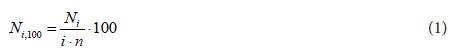
Where Ni,100 is the number of droughts for timescale i in 100 years; Ni is the number of drought months for i in the n-year set and n is the number of years in the data set [44]. The SPI reflects the probability of precipitation at selected timescales measured by the number of standard deviations the observed value is from the long-term mean [41].
Using meteorological data from the Institute of Hydrology and Meteorology drought was examined at 3, 6, 12, and 24 month time scales. Employing SPI software from the U.S. National Drought Mitigation Center drought occurrence was examined at multiple timescales to identify spatial and temporal drought dynamics at meteorological stations in Mongolia. The SPI was calculated through the end of August to monitor drought during the critical summer plant growth season. Seasonal precipitation (≥60%) is concentrate in June, July, and August due to Mongolia’s short (90-130 frost-free days) vegetation growth and intensive grazing season [13]. Additional data was obtained from the government records.
Using the Standard Precipitation Index wet and dry conditions across the region were established. Results show cyclical fluctuation with broadly wetter conditions in the 1970’s and 1990’s, a notably drier period in the 1980’s, and alternating wet-dry episodes in the 2000’s with 2006 a particularly dry year (Figure 2). Drought rates varied within and between sites and at different timescales. Events fluctuated with Arvaheer and Bulgan below estimated probability at each measurement whilst Dalanzadgad in drought 25% more of the time than Arvaheer. Moderate and extreme drought rates were slightly below average whereas severe levels were somewhat elevated (Table 3).

Figure 2: Standard Precipitation Index at 12 months through August for 5 stations, 1970-2006.
| Months in Drought (% time indrought ) | ||||
|---|---|---|---|---|
| Arvaheer | 3-month | 6-month | 12-month | 24-month |
| Moderate | 32 (7.2) | 36 (8.1) | 37 (8.3) | 16 (3.6) |
| Severe | 18 (4.0) | 9 (2.0) | 11 (2.5) | 26 (5.9) |
| Extreme | 9 (2.0) | 11 (2.5) | 13 (2.9) | 18 (4.1) |
| Total 59 (13.3) | 56 (12.6) | 61 (13.7) | 60 (13.5) | |
| Bulgan | ||||
| Moderate | 32 (7.2) | 38 (8.6) | 40 (9.0) | 28 (6.3) |
| Severe | 23 (5.1) | 25 (5.6) | 22 (4.9) | 29 (6.5) |
| Extreme | 10 (2.2) | 6 (1.4) | 8 (1.8) | 5 (1.1) |
| Total65 (14.6) | 69 (15.5) | 70 (15.7) | 62 (13.9) | |
| Dalanzadgad | ||||
| Moderate | 31 (7.0) | 53 (11.9) | 62 (13.9) | 34 (7.7) |
| Severe | 19 (4.3) | 17 (3.8) | 19 (4.3) | 23 (5.1) |
| Extreme | 10 (2.2) | 7 (1.6) | 8 (1.8) | 12 (2.7) |
| Total 60 (13.5) | 77 (17.3) | 89 (20.1) | 69 (15.5) | |
| Mandajgovi | ||||
| Moderate | 37 (8.3) | 36 (8.1) | 34 (7.6) | 44 (9.9) |
| Severe | 25 (5.6) | 24(5.4) | 19 (4.2) | 18 (4.1) |
| Extreme | 4 (0.9) | 6 (1.4) | 10 (2.2) | 14 (3.1) |
| Total66 (14.8) | 66 (14.9) | 63 (14.1) | 76 (17.1) | |
| SaixanOvoo | ||||
| Moderate | 46 (10.3) | 40 (9.0) | 41 (9.2) | 32 (7.2) |
| Severe | 23 (5.1) | 12 (2.7) | 16 (3.6) | 29 (6.5) |
| Extreme | 3 (0.6) | 12 (2.7) | 0 (0) | 1 (0.2) |
| Total 72 (16.2) | 64 (14.4) | 57 (12.8) | 62 (13.9) | |
Table 3: Months in drought 1970-2006.
At moderate and severe levels drought occurred at multiple sites and different timescales. Saixan Ovoo SPI values were significantly related with all sites at all timescales (P=0.05) whereas Mandalgovi was least related (50% of episodes) to other sites (P=0.05). Patterns emerged between sites with Mandalgovi appearing to follow latitude-influenced relationships with Arvaheer and Saixan Ovoo whereas Dalanzadgad had similarities with Bulgan, Saixan Ovoo, and Arvaheer. Bulgan’s relationships were greater with the two nearest sites, Dalanzadgad and Saixan Ovoo. Arvaheer’s distribution was consistent with all but Bulgan. Numbers of inter-site correlations were the same at 3, 6, and 12 months and slightly increased at SPI 24-month.
Spatial continuity of droughts
The magnitude of drought events fluctuated between stations. Mapping shows spatial drought coverage at decadal intervals (Figure 3) and at different timescales in 2006 (Figure 4). Distribution was not spatially consistent nor were there uniform patterns over time. Within the same year drought identification and coverage were timescale-dependent. In 2006 Arvaheer was in extreme drought at all time periods whereas Mandalgovi and Dalanzadgad moved into extreme drought at longer durations. At the same time Bulgan and Saixan Ovoo fluctuated between mildly wet and dry episodes, only reaching moderate drought conditions. Drought intensity, duration and year of occurrence differed amongst the stations; the most severe event was ongoing at Arvaheer at the end of the study (Table 4).

Figure 3: Spatial drought at ten year intervals, calculated at 12-month scale (A = Arvaheer, B = Bulgan, D = Dalanzadgad, M = Mandalgovi, S = Saixan Ovoo).

Figure 4: Drought at short and long term time scales, calculated at 12-month scale (A = Arvaheer, B = Bulgan, D = Dalanzadgad, M = Mandalgovi, S = Saixan Ovoo).
| Station | Intensity | Onset | End | Duration | ||
|---|---|---|---|---|---|---|
| peak | year/month | year/month | months | |||
| Arvaheer | -3.66 | 2006 | 6 | ongoing | ~ | 7+ |
| Bulgan | -2.77 | 1978 | 10 | 1980 | 3 | 18 |
| Dalanzadgad | -2.54 | 2005 | 7 | 2006 | 9 | 15 |
| Mandalgovi | -2.51 | 1980 | 7 | 1980 | 12 | 7 |
| Bulgan | -2.42 | 1984 | 9 | 1985 | 8 | 12 |
| Mandalgovi | -2.41 | 2005 | 6 | ongoing | ~ | 18+ |
| Arvaheer | -2.41 | 2002 | 8 | 2003 | 6 | 11 |
| Bulgan | -2.28 | 1972 | 8 | 1973 | 5 | 10 |
| Arvaheer | -2.22 | 1978 | 7 | 1979 | 6 | 12 |
| Bulgan | -2.08 | 1970 | 12 | 1971 | 5 | 6 |
Table 4: Significant drought episodes, 1970-2006.
dzud of 1999–2001
Investigation of the 1999-2001 drought-dzud events, identified as Mongolia’s worst natural disaster, focused on climate data for 1998 through 2003 in Omnogovi Province [5] The 1999 and 2000 SPI values for Dalanzadgad and Bulgan show neither site experienced drought at any timescale. The 1999 12-month SPI values were mild and in 2000 changed to wet conditions (Figure 5). In July and August 2001 both sites became drought stricken at a 12-month scale. Dalanzadgad reached drought status at each time scales in 2002 whereas drought at Bulgan occurred at 3 and 24 months. From August 2002 through April 2003 the two sites experienced a 24-month drought, reaching extreme intensity in August. In May 2003 both sites shifted to wet conditions.

Figure 5: 12-month SPI records, 1998-2003.
During 1999–2002 mean January temperatures were generally warmer at both sites than the long-term averages; 2000-01 was ~3°C colder whereas 2002 was 4.8°C and 3.8°C warmer than historic norms at the two sites. Winter precipitation (December, January and February) in 1999-2001 was normal or slightly low at both sites [6]. High precipitation in December 2001 was followed by above-average temperatures and preceded livestock losses in 2002. The human population fell by 50% in both districts in 2001 (Figure 6); recovery for human populations started in 2003 with livestock numbers rebounding in 2004 as vegetation cover increased.

Figure 6: Human and livestock populations in Dalanzadgad and Bulgan, 1991-2006.
dzud and drought; non-drought years
Examination of other historic dzuds (1987-88, 1994-94, 1997-98) at both sites showed that drought was not present during these years. Five of the six dzud periods (3 in Bulgan, 3 in Dalanzadgad) had above average rainfall with a precipitation decline the year after the dzud. Livestock numbers increased five of the six years, human populations increased during four of the years and decreased slightly (2%) two years. In brief, an analysis of dzuds found there were no significant correlations between dzud years and livestock, precipitation, or January average temperatures.
Time series analysis was used to investigate the relation of non-drought years to livestock, precipitation, and January and July temperatures since 1981 at the 12-month time scale (through August). Results showed that livestock numbers and July temperatures were significantly related (P = 0.01) at both sites. Results did not find other significant associations. Non-drought years showed less correlation with environmental factors than drought years.
Research identified drought as a recurrent natural hazard in the Gobi region of Mongolia. The most salient factors are the variability of drought events over time, their site-specificity and duration. There are several implications for human populations: unpredictability in pasture resources for pastoral livelihoods, climate limitations on potential agricultural production in the steppe zone, marginality of desert-steppe areas experiencing drought and the ongoing threat to livelihoods dependent on the natural environment for sustenance and survival. Additionally, the conventional understanding is that drought precedes or intensifies a dzud [14]. However, results found that dzuds were not preceded or concurrent with 12-month droughts, nor were years of extreme drought followed by identified dzud conditions. Similarly, in South Gobi Province of the 1987, 1994, 1997, 1999–2000 and 2000–2001 (Reading 2006) are also uncorrelated with drought. Rather than climatic or ecological variables, the strongest long-term correlation of drought is with pastoralist movements as populations adapt to drought stress through mobility [6]. Drought frequency and intensity showed a moderate link with natural factors but limited influence on livestock numbers. This study suggests that drought and dzud are de-coupled in the southern Gobi; thus the prevailing concept needs more thorough examination, particularly when dzud is defined by stock losses rather than meteorological data alone [30].
Study findings question the oft-cited detrimental effect of drought as they did not magnify nor indicate of extreme winter conditions in the region [34,45]. Drought is a commonplace event and only one of several environmental challenges affecting this arid region. Accurate knowledge of regional drought conditions is essential information for herder decision-making and livelihood well-being. In addition to documenting historical patterns, the SPI can serve as a predictive tool for both the immediate future, through identifying precipitation shortfalls at selected timescales, and generating long-term drought probability perspectives [39].
Resilience
Results suggest variable climate patterns (thus fluctuating pasture conditions) and repeated drought events occur without significantly altering the physical landscape. Human resilience enables shifting herding forces and livestock numbers to be encompassed. In the region both physical and human systems adjust to often serious perturbations (drought, dzud, political and economic change) on the steppe, a process that allows the environment to maintain sufficient productivity in its dryland setting for pastoralism to continue as a viable livelihood. On the steppe continued land cover variability represents fluctuation rather than an identifiable move to an altered state.
The nature of pastoral livelihood strategies emphasizes efficient use of limited physical resources and adaptability to the country’s transitioning socio-economic and physical conditions. Today herders address economic pressures, evolving social perspectives and environmental conditions with traditional mobility patterns, water access, and herd composition decisions that accommodate existing resources. Whereas a rigid system would have limited coping abilities, pastoralists’ flexible livelihood approach maintains productivity in a fluid environment and a range of volatile conditions. Socio-economic processes include a shift to goats for income generation, adjustment to a lack of infrastructure or emergency fodder through personal adaptation and expense, a move away from herding as a career choice, greater herder differentiation and increased expenses. Concurrently natural and human-influenced disturbances abound in pastoralism [30]. Vegetation cover fluctuation, drought episodes, and drying surface water sources combine with reduced wells and increased livestock numbers to affect the grassland. Despite these challenges, the countryside has seen the expansion of herds and the continued dependence of a large percentage of the population on pastoralism as herders adjust livelihoods to maintain viability [10].
Falkenmark and Rockstrom [28] state that resilience reflects the capacity to ‘adapt, recover, develop and remain flexible’. This is relevant in the Gobi as variable conditions are prevalent yet do not disrupt environmental functioning [20] By encompassing changing conditions systems are adaptive; this contrasts with vulnerability which identifies a system as reactive and having limited ability to cope with perturbations. The Gobi environment and pastoralism include mechanisms (e.g. spatial fluctuation in vegetation cover, seasonal pastures, mobility) to reduce hazard impact on landscapes and livelihoods. The inherent systemic variability exemplified by drought patterns and the long record of regional pastoralism suggests a history of encountering and resolving disturbances. Thus vulnerability-the notion of exposure and susceptibility to external factors - is a less relevant model than resilience in the region, particularly when linking human-environment processes. Study findings suggest developed coping skills limit herder vulnerability in the Gobi and that natural and learned resilience is a pastoral strength in Mongolia.
Research on resilience in other dryland regions highlights the importance of maintaining ecological balances for landscape viability and pastoral coping skills, such as when dealing with drought [46]. Most grassland regions are identified as undergoing rapid change with each rangeland facing localized physical and institutional conditions [20] How Mongolia adapts to disturbance and reorganization will depend on forces (e.g. economics, precipitation) that shape the environment and policy that enables herding to be practiced at adequate spatial and temporal scales to maintain viability. Plummer and Armitage’s assertion that resilience encompasses ecology, economics, and society are relevant to the Gobi Desert [47].
Observations on resilience segue into evaluating sustainability [16] Exhibited resilience in steppe pasture systems can be regarded as an important part of sustainability; Maler states that resilience and sustainable development share a single conceptual framework [48]. The Gobi region exemplifies this cohesion as findings suggest that pastoral livelihoods can continue to be productive without threatening environmental functionality [49]. Challenges such as water access and economic pressures affect both sustainable development and future systemic resilience. In Walker and Abel’s (2002) four stages of range development Mongolia is at the initial, extensive phase of livestock movement with low human and livestock density, self reliance and strong ecological-household linkage. At this level the steppe shows sustainability; evolution beyond current range dynamics will call for new evaluation [20].
Prior work on sustainability in Mongolia highlighted uncertainty about the impact of policy, institutional support, and socio-economic pressures in the countryside. Scientists stressed continued mobility, management flexibility, and communal rangeland use, factors that contribute to resiliency, as key strategies as well as the need for herders to be involved with range management and regulation through a participatory process [50]. Ojima and Chuluun identified ecologically-based land use, including redrawing administrative boundaries for better resource access, investment in infrastructure, building more wells to facilitate mobility and pasture access and improved services as essential [51]. Further, strengthening grazing regulation, related services, and economic viability are important for sustainable rangeland use [10].
A regional perspective on the social-ecological debate can improve knowledge of the Gobi region. This involves greater understanding of systems in northern China, a region with a similar pastoral history. Different development patterns and a shift to settled livestock rising in China exemplifies how political and economic systems can impact pastoralism in a shared landscape. China represents an alternate range model that involves a marked change from open grazing to fenced enclosures and intensified practices [52]. It also highlights potential implications for ecosystem sustainability and livelihood well-being as dynamics focus on economic production in a well-organized, government controlled pastoral system that is integrated into a larger society. Issues of pastoral viability, vulnerability and long-term resilience contrast with Mongolian circumstances and can be evaluated with similar investigation. In China particular attention is given to poor management practices and high desertification rates in northern China that question the viability of this approach on the steppe [53,54]. As degradation has become a major steppe concern awareness of Chinese conditions can inform debate and management in Mongolia. Though political and economic organization differs from Mongolia’s governance system, the comparison highlights existing forms of livestock development on the plateau that may develop in Mongolia in a modified form.
Research in northern China identifies several causes of recent land cover change. These include inappropriate land use, over-cultivation in marginal areas, irrational water use, climate change, resource exploitation, population pressure, property rights/fencing, and loss of traditional management strategies [52,55,56]. Several factors (water, mining, land tenure, customary practices) are relevant; examination of the Chinese paradigm can inform discussion and action in Mongolia. By studying its neighbour’s land use patterns and basing decisions on steppe conditions and bio-physical parameters Mongolia can limit the need for future ecological restoration that is ongoing in China [57,58]. Chinese researchers have concluded that, “Mongolian nomadic culture has advantages over agrarian culture in ecology and environmental care, sustainable utilization of grasslands, and in sustainable human social economic development in the region” [4]. This suggests that a combination of existing pastoral strengths with modern knowledge and skills can maintain ecological viability and socio-economic well-being in Mongolia.
The study finds that drought and localized extreme weather events in Mongolia are unassociated. Development design and relief-aid efforts would be more productive recognizing that these hazards may be unconnected. Further, by acknowledge ginger salient strategies that are a part of pastoralists’ traditional ability to accommodate drought, for example through migration, the need for external support when dealing with dzuds that threaten livestock survival would be decoupled from drought aid per se. Establishment of adequate risk management strategies could then improve herders’ ability to cope with drought and dzuds.
Addressing environmental issues across the Mongolian plateaus hared with China adds to the understanding of a region that receives increasing political and economical attention whilst documentation of physical processes is limited. This work presents material that can be compared with other pastoral areas and provides a factual basis for regional development and policy debate. Expanded research is required to aid the identification of drought risks and the degree of pastoralist exposure to precipitation deficiency over multiple time intervals in this arid region.
The author thanks the British Academy and the Royal Geographical Society for research support. Dr. Batbuyan and Dr. Tsolmon provided much insight on conditions in the Gobi desert and Mongolian society. The Mongolian Institute of Geography and National Agency for Meteorology, Hydrology and Environment Monitoring assisted with data and information. Reviewer comments enriched the paper.