Journal of Physical Chemistry & Biophysics
Open Access
ISSN: 2161-0398
ISSN: 2161-0398
Research Article - (2013) Volume 3, Issue 4
This work aims to evaluate the soil radon gas concentration levels at different depths in Wadi Nasieb area. The area under investigation is located about 40 km east of Abu Zeneima town in the south western part of Sinai Peninsula. It is bounded by Long. 33°22’/ and 33°25’/ E and Lat. 29°10’ 30” and 29°05’/ N, The radon gas concentration were measured using CR-39 etch track detectors in both summer and winter times at different depths (25, 50, 75 and 100 cm) covering several geological formation. Twenty one stations were chosen to cover several geological formations in the studied area. According to the obtained data, these stations were classified to three main sets of stations (low, medium and high level stations) the obtained results were as follows: i) For low level zone the soil radon concentration ranges from 1.035 ± 0.098 to 1.857 ± 0.160 (KBq/m3) in summer and from 0.628 ± 0.116 to 1.421 ± 0.180 (K Bq/m3) in winter, ii) For the medium level zone, it ranges from 1.742 ± 0.168 to 4.347 ± 0.359 (KBq/m3) in summer and from 1.108 ± 0.153 to 2.996 ± 0.202 (K Bq/m3) in winter, iii) For high level zone, it ranges from 10.370 ± 0.402 to 21.361 ± 0.410 (K Bq/m3) in summer and 7.224 ± 0.228 to 13.088 ± 0.369 (K Bq/m3) in winter. The highest values of soil radon concentration obtained are found in station (9) in both seasons at all depths. This may be related to the high uranium content for this geological formation. As expected, the data show that the values of radon gas and its progeny concentrations increases as depth increases. The concentration of radon at a depth of 100 cm is about twice higher than the value of radon concentration at a depth of 25 cm.
<Keywords: Concentration levels; Wadi Nasieb; Uranium series
Naturally Radon (Rn) is found as a product of the radioactive decay series (Uranium series - Thorium series-Actinium series). During the decay of Uranium series it produces Radium 226Ra isotope which decays to radon 222Rn with a half-life of (3.82days). Also Thoron 220Rn is the result of the decay of Thorium in the Thorium series, it has a half-life time of (54.4) seconds. Finally Actinon 219Rn is the result of the decay of Actinium in the Actinium series, it has a half-life time of (3.92) seconds. All these isotopes decay by alpha emission unless actinon is also a gamma emitter. The abundance of actinon (219Rn, t1/2 = 3.92 s) in gases from geological sources is limited due to its short half-life, which means that most of it will decay during the slow exhalation processes from rocks and soils, and also due to the fact that the precursor, 235U, constitutes only 0.7% of natural uranium. The abundance of 232Th in the Earth’s crust is around three times higher than that of 238U, but since the half-life of 232Th is longer by nearly the same factor, the average rate of production of 220Rn (t1/2 = 54.4 s) and 222Rn (t1/2 = 3.82 d) is about the same [1]. However, the shorter half-life of thoron results in a greater proportion of it decaying before it can be from the ground [2]. Thus, radon alone is usually considered as being important in studies of household radon levels. At least 80% of the radon emitted into the atmosphere comes from the top few meters of the ground. The radon emanation rate varies from one place to another due to differences in radium concentration and soil parameters such as moisture content, porosity, permeability, and grain size [2], Radon Emanation and migration in the Earth and the atmosphere have been the subject of numerous studies, in Egypt [3] and all over the world [4].
The gas radon measured stations in the present study cover the whole area of Wadi Naseib and inserted in the different rock units (Figure 1).

Figure 1: Geological map of wadi Nasib area, Ahmed El said Shata, 2013.
The aim of the present work is to Study the relation between radon gas concentration and Uranium concentration (ppm) at different depths and find relationship between the radon gas concentration with depth and also the Uranium concentration (ppm), as well as soil parameters such as moisture content, porosity, permeability, and grain size.
Geological setting
The Wadi Nasieb area is a part of south western Sinai, Egypt (Figure 1) and is occupied by basement rocks of Late Proterozoic age, which unconformably overlain by Paleozoic rocks. Wadi Naseib area is located about 40 km east of Abu Zeneima town in the south western part of Sinai Peninsula. It is bounded by Lat. 29°10’ 30” and 29° 05’/ N and Long. 33°22’ and 33°25’ E (Figure 1).
Measurement technique
Measurements were carried out by employing twenty one tubes of length 100 cm. Each one was fitted with a four pieces of CR-39 plastic foil 500 μm thick and (1 cm×1 cm) in cross section. These detectors are sensitive to α-particles and are widely used for radon and its progeny measurements [5]. The detectors were fixed inside the pipe at different depths 25, 50, 75 and 100 cm from its top side and covered from the top with metallic cover and from the bottom with filter paper. This configuration was used in order to maintain the same calibration conditions and to stop the thoron (220Rn) from entering the tube, while allowing the radon gas to pass through the tube, for the selected measuring tube (Figure 2).

Figure 2: Schematic diagram showing the tube under the soil surface and the CR-39 at different depths.
Twenty one holes of 10 cm in diameter and 100 cm in depth were dug in each chosen point of measurement (Station). Every station was filled with a tube fixed with CR-39 detectors at different depths (25, 50, 75 and 100 cm). The detectors were mounted in such a way that the sensitive surfaces facing the air coming from the underground , taking due care that there was nothing to obstruct the detectors. Then each hole was refilled with soil. The α-particles originating from radon and its progeny were registered as tracks in the detectors, if α-particles from radon and its progeny have their energies in the range of about 1.7- 4.1 MeV [6].
Thus, the radon progeny, which plate out on the surface of the detectors will not be detected because their α-particles are too energetic. The detectors were left in each station for approximately four weekslong enough for the 222Rn to reach equilibrium with its long-lived parent, radium and for a significant number of tracks resulting from its alpha decay to be registered on the CR-39 detector.
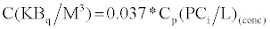
After exposure, the detectors were retrieved and etched for 8 hours in 6.25 N NaOH solutions at 70 ± 1°C in the laboratory. Subsequently the detectors were thoroughly scanned using an optical microscope at a magnification of 400X to count the number of alpha tracks per cm2 registered on the plastic detectors. The radon gas concentration (pCi/l) was determined using the relation.
 (1)
(1)
Where (P) is the corrected track density (number of tracks per cm2), (K) is the calibration factor ((tracks. Cm2.d-1). (pCi/l)-1) and (t) is the total time of exposure. The radon concentrations in KBq.m-3 were calculated by using the relation:
 (2)
(2)
The allover numbers of the measured stations were classified into three main zones according to the measured Rn- Gas concentration, Table 1 shows the station numbers that belongs to each zone, while Table 2 shows the lithology of each station.
| Zone Type | Station number |
|---|---|
| Low level zone | 1,6,7,8,10,11,13,14,19,20 |
| Medium level zone | 2,3,4,5,12,21 |
| High level zone | 9,15,16,17,18 |
Table 1: Classification of the station.
| Station number | Latitude | Longitude | Lithology | U (ppm) |
|---|---|---|---|---|
| 1 | 29° 03' 56" N | 33° 23' 08"E | Channel fill-Quaternary deposits | 2 |
| 2 | 29° 03' 53" N | 33° 23' 20"E | Channel fill-Quaternary deposits | 3 |
| 3 | 29° 03' 47" N | 33° 23' 24"E | Channel fill-Quaternary deposits | 3 |
| 4 | 29° 03' 42" N | 33° 23' 28"E | Channel fill-Quaternary deposits | 1 |
| 5 | 29° 03' 34" N | 33° 23' 24"E | Channel fill-Quaternary deposits | 1 |
| 6 | 29° 03' 33" N | 33° 23' 23"E | Channel fill-Quaternary deposits | 12 |
| 7 | 29° 03' 37" N | 33° 23' 32"E | Sandstones of Abu Thora in down-thown of W. Naseib major fault | 1 |
| 8 | 29° 03' 33" N | 33° 23' 33"E | Sandstones of Abu Thora in down-thown of W. Naseib major fault | 3 |
| 9 | 29° 03' 34" N | 33° 23' 54"E | Kaolinite and gibbsite bearing shale | 89 |
| 10 | 29° 02' 21" N | 33° 23' 57"E | Kaolinite and gibbsite bearing shale | 2 |
| 11 | 29° 02' 13" N | 33° 23' 53"E | Kaolinite and gibbsite bearing shale | 9 |
| 12 | 29° 02' 06" N | 33° 23' 42"E | Middle marl of Um Bogma Fm. | 10 |
| 13 | 29° 01' 57" N | 33° 23' 33"E | Aeolian sand over Abu Thora Fm. | 1 |
| 14 | 29° 01' 57" N | 33° 23' 28"E | Aeolian sand over Abu Thora Fm. | 1 |
| 15 | 29° 02' 03" N | 33° 02' 27"E | Gibbsite bearing shale | 13 |
| 16 | 29° 02' 06" N | 33° 02' 33"E | Gibbsite bearing shale | 14 |
| 17 | 29° 01' 44" N | 33° 24' 08"E | Gibbsite bearing marl | 15 |
| 18 | 29° 01' 24" N | 33° 24' 12"E | Marly dolostone of Um Bogma Fm. | 2 |
| 19 | 29° 01' 19" N | 33° 24' 12"E | Fractured Marly dolostone in G. El Allouga | 11 |
| 20 | 29° 01' 20" N | 33° 24' 08"E | Black and varicoloured shale | 39 |
| 21 | 29° 01' 30" N | 33° 24' 11"E | Kaolinite and gibbsite in base of Abu Thora Fm. | 3 |
Table 2: Lithology of the measured stations in W. Naseib, include locations.
First for the low level zone
Table 3 is shown that, they obtained ratios are nearly the same for the upper two depths (25 and 50 cm) with slightly higher measurements in summer than winter time reflecting the effects of the meteorological condition such as pressure and air temperature. Also the same behaviour can be noted for the lower two depths (75 and 100 cm) but with decreasing the ratio indicating a close readings between the two seasons which may reflect the effect of uranium content and the porosity and permeability of the hosting rocks in these depths.
| Average Radon concentration (K Bq/m3) at different depths | Average of the measured radon concentration In summer(S) | Average of the measured radon concentration In winter(W) | Ratio S/W |
|---|---|---|---|
| At 25 cm | 1.035 ± 0.098 | 0.628 ± 0.116 | 1.64 |
| At 50 cm | 1.318 ± 0.126 | 0.784 ± 0.121 | 1.68 |
| At 75 cm | 1.451 ± 0.129 | 0.972 ± 0.163 | 1.49 |
| At 100 cm | 1.857 ± 0.160 | 1.421 ± 0.180 | 1.30 |
Table 3: Average of the measured radon concentration in summer and winter and the ratio between them at different depths in the low level zone.
Second for medium level zone
Table 4 is shown that, they obtained ratios are ranged from 1.219 to 1.572. The slightly great ratio at 100 depth (slight difference between summer and winter readings) may be due to water movements in the deep layers, again the ratio decrease while depth decreases reflects the effect of U-content, while the great ratio near the surface reflects the effect of aeration ore porosity near the surface.
| Average Radon concentration (K Bq/m3) at different depths | Average of the measured radon concentration In summer (S) | Average of the measured radon concentration In winter (W) | Ratio S/W |
|---|---|---|---|
| At 25 cm | 1.742 ± 0.168 | 1.108 ± 0.153 | 1.572 |
| At 50 cm | 2.546 ± 0.254 | 1.957 ± 0.477 | 1.300 |
| At 75 cm | 3.053 ± 0.265 | 2.503 ± 0.263 | 1.219 |
| At 100 cm | 4.347 ± 0.359 | 2.996 ± 0.202 | 1.450 |
Table 4: Ratio between average radon concentration in summer and winter at different depths in the medium level zone.
Third for high level zone
From the Table 5 we can show that: the ratio is high and nearly constant while depths increases, and it is smaller in less depth, which may be indicates to the effect of porosity and permeability as well as uranium content in the depth sits, while another factor such as aeration must be introduced as an effective factor on the upper stations near the ground surfaces.
| Average Radon concentration (K Bq/m3) at different depths | Average of the measured radon concentration In summer (S) | Average of the measured radon concentration In winter (W) | Ratio S/W |
|---|---|---|---|
| At 25 cm | 10.370 ± 0.402 | 7.224 ± 0.228 | 1.435 |
| At 50 cm | 14.228 ± 0.348 | 8.570 ± 0.151 | 1.660 |
| At 75 cm | 16.590 ± 0.297 | 10.378 ± 0.202 | 1.598 |
| At 100 cm | 21.361 ± 0.410 | 13.088 ± 0.369 | 1.632 |
Table 5: Ratio between average radon concentration in summer and winter at different depths in the high level zone.
A systematic increase of soil radon concentration levels with depth is observed for all three zones (low-medium-high) and for both seasons. The observed variations with depth, for all three zones (low-mediumhigh), follow a similar pattern. Figures 4,6,8,10,12 and 14 shows the data points for the low level zone, the medium level zone and high level zone in both the summer and winter, respectively. They indicate that the variations of soil radon concentrations exhibit, at a first sight, a linear pattern.

Figure 3: Soil radon concentration in summer for the low level zone at different depths.

Figure 4: Average soil radon concentration level in the low level zone in summer.

Figure 5: Soil radon concentration in winter for the low level zone at different depths.

Figure 6: Average soil radon concentration level in the low level zone in winter.

Figure 7: Soil radon concentration in summer for the medium level zone at different depths.

Figure 8: Average soil radon concentration level in the medium level zone in summer.

Figure 9: Soil radon concentration in winter for the medium level zone at different depths.

Figure 10: Average soil radon concentration level in the medium level zone in winter.

Figure 11: Soil radon concentration in summer for the high level zone at different depths.

Figure 12: Average soil radon concentration level in the high level zone in summer.

Figure 13: Soil radon concentration in winter for the high level zone at different depths.

Figure 14: Average soil radon concentration level in the high level zone in winter.
At a depth of 100 cm, the highest values for soil radon concentration in summer and winter are observed in station (9) (32.831 ± 0.410 and 27.156 ± 0.389 (K Bq/m3) as shown in Figure 11 and 13, respectively). At the same depth the corresponding lowest values are measured in station (14) (1.104 ± 0.086 (K Bq/m3) in summer as shown in Figure 3) and station (7) (0.676 ± 0.081 (K Bq/m3) in winter as shown in Figure 5). Intermediate values are observed for the other all station (Figure 7 and 9). According to radiometric measurements station (9) (Kaolinite and gibbsite bearing shale) in the studied region contains the highest content of uranium (89 ppm) and has the highest porosity which allows radon gas to migrate and diffuse easily. This would explain the higher radon concentration levels obtained for station (9) compared to the others.
It is to be noticed that the radon concentration at the depth 100 cm is almost twice the radon concentration at the depth 25 cm. This is due to the fact that moisture in these geological formations concentrates in the 20-30 cm below the surface, in addition to the effect of the atmospheric pressure which suppresses the diffusion of radon upward.
The measured soil radon concentration levels in winter were systematically lower than in summer and this is true for all the studied formations. This result reflects the changes in porosity, permeability and moisture content of the soil covering the geological formation between the two seasons. It shows, in particular, that moisture, which is more important in winter, dissolves radon gas and thus inhibits radon diffusion.
If we assume that the contribution of soil radon to indoor radon is of the order 100:1 [7] taken at a depth of 50 cm, then the corresponding expected indoor radon concentration levels for the low, medium and high level zone in Bq/m3 13, 25 and 142 in summer, respectively. In winter these figures become 8, 20 and 86, respectively.
From the above obtained results we can conclude that:
a. Great dependency of soil radon concentration levels on depth in all three level zones (low, medium and high level zone), this dependency may be referred to many factors such as: i) Characteristics of the soil that covering the studied formations, ii) The values of U-content for the host rock, iii) Properties of each of the rock formation.
b. Significant seasonal variations of soil radon concentration levels were found between summer and winter seasons especially at low depths which indicate the effect of air movement on the ground surface.
c. The largest values of soil radon concentration obtained in the case station (9) seem to be due to the higher content in uranium in this formation.
d. Using the obtained results for summer and winter we can determine the radon exhalation rates and the radon concentration at the surface of the soil covering each geological formation, which is very important because it contributes to a greater extent to the indoor radon concentration levels which is considered to be a health hazard. The obtained values of indoor radon concentration levels derived from our results, for both seasons, are below the standard action level (4 pCi/L=148 Bqm-3) [8].