Forest Research: Open Access
Open Access
ISSN: 2168-9776
ISSN: 2168-9776
Research - (2020)Volume 9, Issue 2
One of the initial steps in management of forests and reduction of fire damages is to identify areas susceptible to this phenomenon. In this study, zonation of fire hazard was performed in Babahur forest area of Dorud city of Iran using statistical modeling method and analytical hierarchy process. Then, performance of the two methods was evaluated. In this study, sixty three areas, including burned and unburned lands, were detected totally. Then, quantitative values of some effective parameters in forest fires like temperature, wind speed, rainfall, altitude, aspect, slope, distance from residential area and vegetation cover, distance from river and road, were estimated using data and maps obtained from the Geographical Information System (GIS) and remote sensing (RS) as well as field studies. Finally, the model was presented through regression analysis and then its performance was tested and validated. Based on correlation rate, main factors that influenced fires in multiple regression analysis were vegetation cover percent (r= 0.79) and rainfall (r= -0.34), respectively. In the first step of fire hazard zonation through analytical hierarchy process (AHP), 45 samples including burned areas were identified. Between studied factors, temperature with a coefficient of determination of 0.402 was the most important factor affecting the occurrence of fire in the studied area. Then, Intra-layer and extra-layer valuation of fire factors was performed. Maps of fire factors were developed in GIS and fire hazard zonation map was prepared through combining the layers of fire factors according to their weights. Also, the fire hazard zonation map was prepared through multiple regression analysis and analytical hierarchy process. Comparison of their results through estimation of accuracy and performance of the maps indicated the higher capability of the statistical modeling approach in fire risk assessment in studied area.
GIS; Lorestan; RS; Temperature; Wild fire; Wind speed
Fire is a destructive factor for most of natural ecosystems (especially forests) and exerts significant damages to these areas every year. Todays, fire is considered as the most common destructive factor of natural ecosystems after drought and human urban and agricultural activities [1]. In another way, considering the correct planning, fire could be also considered as a proper solution of ecosystem management [2]. Then, the important point which requires special attention before fire occurrence is to prevent fire outbreak [3].
Studies on fire management help administrators and planners of firefighting to determine the effects of fire on various ecosystems and to plan more advanced management programs for confronting this crisis [4]. Nowadays, in many countries the policies are designed merely for forest firefighting. Its show that these countries have no plan to deter and prevent fire [5]. However, Food and Agriculture Organization of the United Nations (FAO) and its committee established in 1998 in Rome, started to recommend the world countries about the prevention of fire. Forest fires primarily occur by human factors due to negligence of unaware persons. Then, fire hazard zonation map could be considered as a crisis management tool for sustainable managing plans of forest areas [6]. Numerous studies have been conducted worldwide for mapping of fire hazard, for example Dong et al. [7] prepared the map of fire risk in Jilin, China, using spatial data. The final map of fire hazard was prepared in GIS through integration of three hazard maps, including combustible materials-based hazard map, topography-based hazard map, and human activity-based hazard map. Also, Sowmya and Somashekar [8] assessed the use of remote sensing and GIS in mapping of fire risk. The parameters used in this study included vegetation, slope, distance from road, and distance from residential areas. They studied burned areas using temperature data of satellite thermal band from 1989 to 2006. Based on susceptibility to fire, areas have been divided into four different classes, from very high to low susceptibility. In another study, Huyen et al. [9] prepared the fire hazard map of Son La forest area in northwestern Vietnam in GIS through combining the parameters effective on fire and using multi-criteria valuation for weighting layers.
Among the studies carried out on forest fires in Iran could refer to Akbari et al. [10] study entitled presenting a simple quick model for preparing fire hazard map in forest areas using satellite imagery and Digital Elevation Model that in their study three factors of slope, aspect, and normalized difference vegetation index (NDVI) were considered and high-risk areas were identified through modeling and applying of them on the image. Also, Mohammadi et al. [11] prepared fire hazard map of a part of forests of Paveh County using GIS and AHP. Their results showed that 90% of burned areas are high-risk. In another study, Mahdavi et al. [12] specified the fire hazard zonation map in forests and pastures of Ilam County using satellite imagery and GIS based on vegetation (land use), physiographic, climatic, human, and distance from road and river factors. They provided five classes of forest fire hazard from very high to very low. By matching the map with real fire locations, they found that 50% of fires were occurred in high-risk areas and 40% in hazardous areas of fire hazard zones. The present study aim is to investigate and to zone fire hazard and compare multiple regression analysis and analytic hierarchy process (AHP) in assessment of fire risk in Babahur region of Dorud City in Lorestan. By attention to that every year we lost a large surface of forest areas of west Iran naming Zagros forest, this kind of research should be highlighted in this areas. Also, because of importance of the study area as a valuable stand that composited from natural species, its role in conservation of the soil and water and enhancing the biodiversity, this study could help the local mangers of these natural areas to prevent the fire in this region.
Study area
This study done in Babahur forest region that is located in the southwest of Dorud City in Lorestan Province at the eastern longitude of 3’83’00" to 33’26’50" and the northern latitude 36'91'70" to 3712'60" in the UTM image system (Zone 39) (Figure 1). This area has about 4500 hectares of natural resources, its average annual rainfall is 670 mm and its average annual temperature is 16°C. The predominant slope of the region is 20- 60% and soil texture is almost calcareous clay.

Figure 1: Study area location on Iran and Lorestan province map.
More than 70% of the area is covered by oak (Quercus brantii Lindl.) trees. After oak, almonds (Amygdalus reuteri Boiss.) have the highest frequency between the plant species of this region. This study is almost faced with fire occurrence during last year’s (Figure 2).

Figure 2: Study area during the fire.
Data collection
The precise locations of fire were first identified and their surface areas were estimated and recorded using a GPS device. The topographic maps 2002 of Iranian national cartographic center in a scale of 1:25000 were used to prepare the maps of digital elevation model (DEM), slope, aspect, distance from river, distance from road, distance from residential areas and their related classes. Vegetation and land use maps were provided using remote sensing data (visual interpretation of satellite images), topographic maps, and field visits. The meteorological data over a period of thirty years were obtained from Lorestan meteorological organization and maps of monthly wind speed, annual rainfall, and maximum monthly temperature were provided using meteorological data in GIS.
Presenting model through multiple regression analysis (Statistical model)
At first, 45 sites with previous fire incidents and 18 sites without previous fire incidents were studied and then the influencing factors including slope, aspect, distance from road, distance from river, distance from residential areas, vegetation, annual wind speed, average annual rainfall and maximum monthly temperature were estimated for each site using maps prepared in GIS. The exact surface areas of burned locations along with the data of fireinfluencing factors were then entered in SPSS and the correlation between the fire areas and the factors affecting the occurrence of fire was estimated. Fire area was considered as a dependent variable and the affecting factors as independent variables. The model was presented through regression analysis or multiple regression analysis. The first step was to normalize the data; then two linear models were provided through applying Stepwise and Enter procedures and according to correlation coefficient of R2=0.62 for Stepwise method and R2=0.7 for Enter method, the models were significant. Six out of 10 variables had the greatest impact on linear regression model in Enter method, including vegetation, wind, rainfall, temperature, slope and distance from river. After presenting models, their performance and validity were determined. In the validation phase of the model, 15 previous fire areas were studied which were not used for model presenting. Fires areas were estimated with the models whose performances were evaluated through verification of the model estimates. Assessment of models performance for estimation of fire risk in 15 samples of validation phase approved the capability of the proposed model in estimating the risk of fire. Finally, the models presented in GIS were used to assess the risk of forest fires in Dorud City. For classification or zoning of model’s layers of factors or fire-influencing factors, the cumulative curve of each factor was plotted against fire risk (fire area). To do so, the maps of model’s factors were converted to raster format and then the models were performed and the fire hazard maps were prepared and classified through overlap analysis in GIS.
Presenting models through analytic hierarchy process (AHP)
The effective factors were selected and valuated at first. Valuation was firstly intra-layer and according to the history of research and plotting of cumulative curve, each factor was categorized to different classes and each class was evaluated. Extra-layer valuation was performed next through analytic hierarchy process (AHP). Therefore, a questionnaire was prepared and provided to forestry experts at Natural Resources offices, and then the importance coefficient of each layer was separately calculated using the two by two comparison method. Summing and geometric averaging were performed using weighted overlay. The final obtained form was approved with an error rate of 0.07. After valuation of factors, the maps were overlapped and eventually a fire hazard map was prepared.
The geometric mean of each factor was calculated from the following equation:
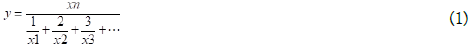
Where xn is the total number of the forms and × 1 is the numerical value of each criterion. The Morgan method was used to calculate the sample size required for weighted outlay (Equation 2).
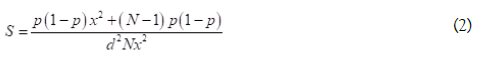
Where N is the number of population, S the number of required samples, P the population ratio = 0.5, d the precision degree of population ratio = 0.05, and × 2 the degree of freedom = 3.8.
In this way, 30 persons were considered as the population who were the professors and experts of forestry sector (N=30) and the required sample size was calculated as 27 (S=27) using Equation 2. Form 27 completed forms, 3 had an error rate of more than 0.1 which were discarded and the final AHP form was prepared from geometric mean of 24 questionnaires.
Correlation analysis was performed to determine the factors affecting fire and the amount of their participation or importance rate in fire occurrence, the results of which are showed in Table 1. The results of Stepwise multiple regression analysis (R2=0.628) are provided to present the following linear model:

The Linear model obtained from Enter method (R2=0.7) is provided in Equation (4)

In these equations, S is the fire area in hectare, C the vegetation percent, V the mean wind speed in the region in knot, T the maximum monthly temperature in °C, P the mean annual rainfall in mm, S the land aspect in degree, and Lw the distance from residential areas in meter. The main factors in Enter method were wind speed, vegetation percent, mean annual rainfall, and maximum monthly temperature; they were vegetation, distance from residential areas, and land aspect in Stepwise method.
| Slope | Aspect | Altitude | Distance from road | Distance from river | |
|---|---|---|---|---|---|
| -0.290 | 0.202 | -0.156 | -0.276 | -0.283 | Fire area |
| Distance from residential area | Vegetation | Wind | Rainfall | Temperature | |
| 0.1 | 0.793 | 0.270 | -0.349 | 0.191 | Fire area |
Table 1: Correlation between the fire area and the influencing factors.
The performance of Enter and Stepwise models was evaluated and approved through comparing the values estimated by the model and the values obtained from fire areas in 15 samples of validation phase. The predicted map of fire susceptible points obtained from combining of four layers of vegetation percent, mean annual rainfall, maximum monthly temperature, and wind speed was combined with the occurred fires which is presented in Figure 3.

Figure 3: Fire hazard zonation map in enter method and past fire location.
The prediction map of fire susceptible areas obtained from combining of three layers of vegetation, land slope, and distance from residential areas was combined with the occurred fires and is presented in Figure 4.

Figure 4: Fire hazard zonation map in stepwise method and past fire location.
Presenting models through analytic hierarchy process (AHP)
The results of extra-layer valuation as can be seen, in output diagram of AHP, the temperature layer with an impact factor of 0.402 had the greatest weight in predicting the fire-susceptible points and was followed by the layers of human factors, vegetation, aspect, rainfall, distance from road, wind speed, distance from river, and slope (Figure 5).

Figure 5: Extra-layer valuation results from AHP.
The prediction map of areas susceptible to fire obtained from combining the 10 layers was combined with previous fires and is presented in Figure 6.

Figure 6: Fire hazard zonation map in AHP method and past fire area.
Validation of models
According to the results, it can be stated that simulation accuracy in Enter, Stepwise, and AHP methods was correct in 88.5%, 66.5%, and about 80%, respectively.
The result of current study shows that based on correlation rate, main factors that influencing fires in multiple regression analysis were vegetation cover percent, mean annual precipitation, slope, distance from river, distance from road, annual wind speed, aspect, monthly maximum temperature, altitude, and distance from residential areas, respectively that from which vegetation cover percent and rainfall had the greatest impact on the incidence of fire. In studies carried out by Mohammadi et al. [11,13-15], vegetation factor was considered as plant type. Since approximately
90% of vegetation in the West forests are oak plant types which differ in fuel types, this criterion was considered as vegetation class. Vegetation percent and wind are directly and fire and rainfall area, distance from river, distance from road, and slope are inversely related to fire area. Janbazghobadi et al. [16] examined the susceptible areas of fire in the forests of Iran and found that most fires occur in the dense forest stands, as well as in forest areas with medium vegetation cover and lowest fires observed in the open forests and the shrub lands that are consistent with the results of the present study.
In AHP method, the influential factors based on the obtained values were temperature, distance from residential areas, vegetation percent, aspect, rainfall, distance from road, wind speed, distance from river, and slope, respectively, and temperature with an coefficient of determination of 0.402 was the most important factor affecting the occurrence of fire in the studied area. The results of Beyranvand and Mahmoudi-Sarab [17,18] also showed that temperature is an important factor in forest fire occurrence too. The results of Zarekar et al. [19] study also showed that proximity to roads and residential areas is one of the main factors that even have more effect than topographic factors in occurrence of fire and play a significant role in destruction of forests. In multiple regression analysis, the weights given to each of the impacting factors were calculated by statistical analysis in SPSS.
However, in AHP the weighs of each affecting factor was calculated using the experts opinions. In multiple regression analysis, the most important affecting factor of fire occurrence was vegetation, while it was temperature in AHP. Spatial variation of temperature was low in the region because the region area is limited.
In terms of zonation, spatial distribution or variation is considered in area unit; the temperature is grossly changing in the study area (throughout the year), but its spatial variation is limited; however, the percentage of vegetation has a dramatic spatial variation. In multiple regression analysis, the exact fire area was considered in modeling while in AHP, the fire area or its severity was not contributed in mapping of fire hazard. From 45 fire incidents, 40 incidents were located at high risk and very high risk areas in Enter method and 30 incidents were located at high risk and very high risk areas in Stepwise method. In AHP, 36 incidents were at high risk and very high risk areas. According to greater overlap of previous fires areas with high risk and very high risk zones in fire hazard zonation map in Enter method, higher performance of multiple regression analysis is confirmed when compared with AHP. Pahlavani et al. [20] also determined the factors affecting forest fires using three methods of multiple linear regression, logistic regression and adaptive regression spline that adaptive regression spline and multiple linear regressions showed the best result of modeling the studied factors.
The study area has an impressive extent of high-risk zones. These results indicate the relatively high risk of Dorud forests. Therefore, preventive measures are essential to avoid future fires in the forests of this region. In this study, 36 fires from 45 total fires are located in high-risk and dangerous areas, which can be said to be 80% accurate. Then, the results of the present study can be used to protect the forests of the region.
Citation: Darvishi L, Daryaei MG, Kouchi AHS, (2020) Comparison of Statistical Modeling and AHP Methods in Fire Risk Assessment in Oak Forests of Iran. Fores Res 9:229. doi: 10.35248/2168-9776.20.9.229
Received: 09-Jun-2020 Accepted: 16-Jun-2020 Published: 23-Jun-2020 , DOI: 10.35248/2168-9776.20.9.229
Copyright: © 2020 Darvishi L, et al. This is an open-access article distributed under the terms of the Creative Commons Attribution License, which permits unrestricted use, distribution, and reproduction in any medium, provided the original author and source are credited.