Journal of Geology & Geophysics
Open Access
ISSN: 2381-8719
ISSN: 2381-8719
Research Article - (2024)Volume 13, Issue 2
The ground magnetic investigation is fast becoming a powerful geophysical tool to resolve environmental challenges. It involves the application of basic geophysical methods and principles to detect environmental contaminants. This article presents the outcomes of the investigation carried out at Ahmadu Bello University Geophysical Test Site (ABUGTS) to simulate a broad range of features usually encountered in environmental contexts to enhance the understanding of the subsurface information. The Total Magnetic Field (TMF) of the natural subsoil of the site was obtained before the installation of buried targets to identify the possible existing buried materials that could alter or influence geophysical data. Laboratory test was carried out on the buried targets to determine the magnetic susceptibility, electrical conductivity, density, volume and mass. Interpretation of the data acquired before installing the buried targets shows no significant variations in the earth’s total magnetic field within the site. Minor and insignificant magnetic anomalies were distributed across the site without buried targets, which may simply be attributed to the inhomogeneous nature of the site consisting of both consolidated and loose subsurface. The TMF obtained after the buried targets indicates significant magnetic field variations with four major and three minor magnetic anomalies in different locations. The large buried ferromagnetic objects show strong signals and smaller ferromagnetic objects generate minor anomalies with the precise prediction of the buried target position. A magnetic anomaly map of the site indicates significant magnetic distortion in the places where the buried targets were installed. However, the magnetometer fails to capture some targets, which may be due to the size and depth of the target. The magnetic method is a very powerful, convenient, cheap, and time-saving geophysical tool for investigating buried targets and is more effective in detecting large metallic targets.
Experimental site; Buried targets; Magnetic field; Magnetic anomalies; Ferromagnetic objects
Environmental and engineering studies increasingly use a geophysical investigation to resolve societal challenges. The application of geophysical methods involves basic principles of geophysics to study the subsurface structures hidden from human sight [1]. Identifying the illegal underground disposal of ferromagnetic containers with hazardous waste materials that are detrimental to environment matrices is quite significant in Nigeria. Generally, identifying and locating buried ferromagnetic volume tanks can be carried out by various geophysical techniques such as electrical resistivity, electromagnetic, seismic, magnetic etc., [2-4]. Magnetic methods can be employed in environmental and engineering investigations to locate buried metallic materials such as the detection of buried storage tanks, drums, cables, pipes, and other ferromagnetic containers by mapping the magnetic variations (magnetic anomalies) to assist in the planning and design of construction projects and environmental remediation activities [5,6].
However, magnetic surveys are not without limitations as it is considered sensitive to the nearby magnetic materials and can be easily influenced by cultural noise (e.g., metal fences) and natural variations in the Earth's magnetic field [7]. GESs are normally designed with a keen interest to suit a particular purpose such as environmental studies, engineering applications, and archaeological investigations [1,8]. The application of geophysical techniques in identifying geotechnical excavation and possible environmental contaminants is essential in urban environments because it can prevent geo hazards and minimize environmental risk [6,9]. A remarkable study shows that an accurate prediction of the position of buried targets by using magnetic field measurement is important for future investigation of trenchless technologies in environmental studies [10]. However, subsurface investigations are usually associated with a certain level of complexity [8]. To minimize these uncertainties, the magnetic survey was carried out at Ahmadu Bello University Geophysical Experimental Site (ABUGES) to better understand of magnetic response or effects generated by various buried targets. A ground magnetic survey is a geophysical technique widely used in archaeological investigation, environmental studies, and engineering applications for locating buried structures and military-fabricated ferromagnetic objects with volume-higher susceptibilities [11]. This article explains the outcomes of the investigation carried out at Ahmadu Bello University (ABU) Geophysical Experimental Site (GES) also known as the Geophysical Test Site (GTS) to simulate a broad range of features usually encountered in environmental investigations. The concept behind the development of the ABUGES was to create subsurface anomalies and determine whether the buried metallic and non-metallic targets such as metallic pipe, steel drums, concrete blocks, and plastic buckets etc., at the site can be detected by various geophysical methods [8]. GES contains several buried targets with known physical properties, geometries, orientations, and depths [5,6,12,13]. The ABUGES is designed and constructed on a lateritic-clayed ground where steel drums, metallic pipes and 4-cylinder engine block had previously buried at 0.3 m-1.5 m depth within the top thickness overburden soil layers of the site. The site is located on the geographical coordinate of latitude 11°12'11'' N to 11°11'28'' N and longitude 007°35'42'' E to 007°35'34'' E (Figure 1). It is bordered by Ahmadu Bello University Teaching Hospital (ABUTH) in the south and Bomo village in the northeast [14], and is about 3 km from the ABU ain campus. The site is largely overwhelmed with the ancient basement rocks of Nigeria, which have been subjected to various weathered activities and different episodes of folding and faulting [15]. The Basement complex regions are largely made up of different rocks such as; meta-sediment quartz, migmatites, schist, and biotite gneisses and the younger granites are usually associated with distinct surface exposure [16]. The region experiences an average annual rainfall of 1200 mm with temperatures ranging from 15℃ - 34℃ [17]. Recently, a study applied to the 2D Electrical Resistivity Tomography (ERT) on gravels buried in two locations within the site to evaluate the reliability of an open-source inversion software (ResIPy) on a 2D ERT data [18]. The results show a positive correlation with the conventional RES2DINV software and are consequently confirmed as reliable software for 2D ERT data. This study installed more subsurface targets different from the existing targets within the site to exploit the magnetic responses on different burial scenarios to enhance environmental investigation.

Figure 1: Map describing the site with existing and current buried targets.
There are several activities in this study leading to the results obtained from this work. A variety of geophysical instruments including a total intensity magnetometer, Global Positioning System (GPS), range poles, measuring tape, Kappa-meter etc., were employed for this study.
The site buried targets/materials
The GTS targets were spatially distributed across the current target along four lines. The metallic targets such as steel drums, metallic pipes and 4-cylinder engine block (Figure 2), were selected to generate electromagnetic, magnetic, and electric responses and it cut across three lines of the site. The targets were installed within a 55 m × 55 m flat empty field test site to establish the magnetic signal of steel drum, metallic pipes, and engine block. The site was gridded with twelve profiles and twelve stations on each profile (Figure 3). The profiles and stations were 5 m spacing apart with a total of 144 data points. There are two existing targets at ABUGTS [18]. This study installed additional new target thirteen (13) targets at the controlled test site of both magnetic and non-magnetic materials buried in different locations and depths aimed at enhancing engineering investigations and environmental studies. The magnetic targets include five steel drums of the same sizes and materials, six metallic pipes of different sizes and materials and one 4-cylinder engine block, while the non-magnetic buried targets include twelve (12) plastic buckets of the same sizes and materials, thin layer floor tile and a single layer rectangular concrete block.

Figure 2: Some of the installed metallic targets and dimensions of buried targets within the GTS. (a) Magnetic surveying, (b) Vertically buried steel drum, (c) Dimensions of steel drum, (d) Three vertically buried pipes, (e) 4-cylinder engine block, (f) Two horizontally buried pipes, (g) Two horizontally buried steel drum and (h) Sample soil for density estimation, (i) Horizontally buried steel drum.

Figure 3: Map describing the 55 m × 55 m spatial distribution of the buried targets and the 2D model arrays of buried targets at various
locations showing the depths, orientations and geometries within the host soil. Note:  Metallic iron pipe,
  Empty steel drum,
  Single layer floor tiles,
  Metallic engine
block,
Metallic engine
block,  Grinding point,
  Gridding lines.
The site field data acquisitions and method
The geophysical data acquisition occurred in March 2023, after a period of rainy region and twelve (12) months after the target installation at the site. Magnetic data is typically acquired using magnetometers, which measure the strength and direction of magnetic fields. In the survey, a ground magnetometer (ENVI PRO magnetometer from Scintrex Limited) was employed to measure and record the Total Magnetic Field (TMF) at regular intervals (5 m grid spacing) along specific survey lines at the site. 12 survey lines (profiles) were created with 12 data stations. Two survey lines were taken as a loop. The TMF was measured along with the time and geographical coordinates (latitude and longitude). Figure 3 is a typical example of the buried target arrangement at the site. The data were fed into an automatic computer program (Surfer 11 version) for contouring, which reveals the variation in TMF of the site before and after buried targets (Figures 4 and 5). The ground magnetometer operates on the principle of the force F between two magnetic poles of strength m1 and m2 separated by the distance (r) is given by;
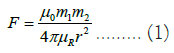

Figure 4: ABUGTS total magnetic field measurement before the burying of targets.

Figure 5: ABUGTS total magnetic field measurement after burying of few targets. Note: 1=Inclined metallic pipe; 2=Horizontal metallic pipes; 3=Vertical metallic pipes; 5=Single-layer floor tiles; 6=Double-layer floor tiles, 7=A single rectangular concrete block; 8=Vertical empty steel drum, 9=Horizontal steel drums; 10=4-cylinder block engine of a car; 11=Horizontal-filled steel drum; 12=Vertical filled; plastic buckets; and 13=Horizontal filled plastic buckets.
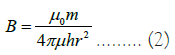
Where, μ0 and μR are constant corresponding to the magnetic permeability of the vacuum and the relative magnetic permeability of the medium separating the poles; m1 and m2 are the strengths of the two magnetic monopoles, and r is the distance between the two poles. The force is attractive if the poles are unlike and repulsive if they are alike. The magnetic field B due to the pole of strength m at a distance r from the pole is defined as a force exerted on a unit positive force at that point.
All substances (including the surface and subsurface rocks) are magnetic at an atomic scale [19]. The phenomenon in which a material acquires magnetization when placed within a magnetic field but loses it when it is removed from the field is termed induced magnetization or magnetic polarization. It results from the alignment of the elementary dipoles within the material parallel to the direction of the external field but of opposite polarity. The intensity of induced magnetization, I is proportional to the strength of the external field, H:
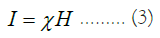
Where χ is a dimensionless proportionality constant for the particular magnetic material called susceptibility. It can take on either negative or positive values. Negative values imply that the induced magnetic field is in the opposite direction as the inducing field, while positive values imply that the induced magnetic field, I, is in the same direction as the inducing field, H. In magnetic surveying, magnetic susceptibility is the fundamental material property spatial distribution is the target to be determined. That is, magnetic susceptibility is analogous to density in gravity prospecting.
The laboratory test
A study noted that one of the major reasons for burying subsurface targets at an experimental site is to create anomalies of faults within the host soil [4]. The density of the host soil and the buried targets were estimated to ensure anomalies were created (Table 1). Other properties of the metallic buried targets such as electrical resistivity and magnetic susceptibility were measured in the laboratory using Kappa meter to ensure adequate information (Table 1). The laboratory test was done on the extracted material as a sample from the three metallic materials.
| Sample | Magnetic susceptibility | Resistance (Ω) | Resistivity (Ωm) | Conductivity (Ω-1m-1) | Density (gcm-3) |
|---|---|---|---|---|---|
| A | 0.296167 | 0.08373 | 0.01461 | 68.4181 | 4.78 |
| B | 0.079157 | 0.08332 | 0.02012 | 49.6596 | 5.76 |
| C | 0.0718 | 0.08113 | 0.01415 | 70.6714 | 7.38 |
Table 1: Laboratory estimation of parameters of the buried metallic targets: 0.407 kg, 1,696 kgm-3.
The steel drums buried target: The five steel drums have equal dimensions of 87.5 cm long and 57.5 cm diameter buried in different orientations (vertically and horizontally). Two drums (one empty and the second sand-filled) were buried in a horizontal position. The third drum was buried in a vertical position, while the last two drums were buried together in a horizontal position. The mass of the steel drums were measured to be 21 Kg. The five steel drums with buried in three different locations and depths. The laboratory estimation of the magnetic susceptibility of the steel drums (Table 1).
The metallic pipes buried targets: A total of six metallic pipes of the same material but different dimensions were buried in different orientations (inclined, vertically and horizontally) within the site. A single pile of dimension (5 cm diameter and 300 cm length) was buried at an inclined angle (26°), while two pipes of dimension (7 cm diameter and 200 cm length) were buried in a horizontal position. Another three metallic pipes of the same size (7 cm diameter and 100 m length) were buried in a vertical position. The laboratory was done on the extracted sample (Table 1).
The 4-cylinder block engine: The 4-cylinder engine block has a dimension of 23 cm × 21 cm × 21 cm buried at 1.2 m in a horizontal position. The laboratory density and magnetic susceptibility of the 4-cylinder engine block were measured and recorded in Table 1. The 4-cylinder engine block weighed 38 kg.
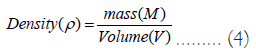
The host soil: A sample of the host soil taken to laboratory where the volume and mass were determined to be 0.00024 m3 and 0.407 kg respectively. Consequently, the density of the host soil was evaluated by equation (4) to be 1,696 kgm-3, after determining the volume of the sample soil from the dimensions such as length, breast, and width.
A preliminary complete magnetic survey before installing subsurface targets within the site to register the background magnetic responses without buried targets. Figure 4 shows the earth’s Total Magnetic Field (TMF) distributions across the site without the interference of the subsurface targets, while Figure 5 displays the TMF of the site after buried targets. The earth’s TMF of the site is highly variable in values ranging from 34966 nT to 44510 nT with an average TMF of 40580 nT (Figure 4). This was aimed at detecting if there is/are any exiting possibly excavated, underground utilities, and man-dumped materials such as tin cans, cables, and other materials that could alter or influence geophysical data at the site). However, the data acquired at the site before buried targets shows no significant variations in the earth’s total magnetic field within the site. Minor and insignificant magnetic anomalies were distributed across the site without buried targets, which may simply be attributed to the inhomogeneous nature of the site consisting of both consolidated and loose subsurface.
Figure 5 shows the TMF of the current target of ABUGTS after some subsurface targets subsurface have been buried. Interestingly, Figure 5 shows some major and significant variations (magnetic anomalies) in four locations. These four major anomalies were encountered at locations 4, 8, 9 and 11 where a vertical empty steel drum, two horizontal steel drums, a horizontal filled steel drum and a horizontal empty steel drum were buried respectively. However, the results show no significant variation in other locations (1-7, 10, 12 and 13) where both metallic and non-metallic targets were buried. For instance, there were minor magnetic anomalies noted at locations 2 and 10 where two metallic pipes, floor tiles and a 4-cylinder block engine were respectively buried. The minor magnetic anomalies emerged at locations 2 and 10 maybe as a result of small ferromagnetic targets buried in those locations. The major magnetic anomalies emerged at locations where large magnetic materials were buried, while the minor anomalies emerged at the position where small magnetic materials such as 4-cylinder block engines, and metallic pipes were buried. This may be due to the depth of the buried or the small size of both the engine block and metallic pipe. Undetected metallic pipes buried at positions 1 and 3 could be considered as a challenging subsurface target that would test the limits of the present and future equipment resolution and field techniques. However, we got some unexpected, there was no signal or magnetic variation noted in locations 1 and 3 where a 3 m long by 0.05 m metallic pipe and three vertical metallic pipes were placed at an inclined angle of 25° and in the horizontal position. This may be a result of the size and depth of the buried.
Implications of this study on environment and security
Magnetic surveys can be used in environmental investigation for studying and monitoring the changes in magnetic properties of the Earth's crust to evaluate the impact of human activities on the environment. A study of this kind at an experimental geophysical site records typical and standard magnetic responses or signatures of the known targets to enhance environmental information. This information can be very critical in the location of subsurface targets in regions where little or no subsurface information is available. According to some remarkable studies, in construction works, it is important to determine the position of the unknown subsurface structures to ensure the host environment is secure and fit for the implementation of works [4,8,10]. Magnetic data is a vital tool used in identifying buried contaminated containers, especially the ferromagnetic extractions that can pose various threats to environmental and public health. However, environmental investigations are usually associated with a high level of complexity due to the high level of interference from the existing built structures and buried utilities. For instance, a study conducted in the United Kingdom indicates that over four million holes are dug by utility companies every year from the construction works [20], which could complicate environmental security. This article can enhance the mapping of surface sediment magnetic characteristics and the presence of Heavy Metals (HMs), which invariably confirm the application of the magnetic technique in environmental studies, engineering investigation, and military objects fabricated of thin ferromagnetic sheets. The application of magnetic investigation is a vital geophysical tool to determine the correlation between the HMs and magnetic susceptibility in surface sediments for monitoring environmental health. Consequently, environmental investigations through geophysical means become difficult and ambiguous. The knowledge of magnetic responses or effects over various known buried targets can be applied in detecting illegal buried metallic weapons and dangerous objects is significant in securing the lives and properties of the citizens, especially in security-challenged zones. This study plays a critical role in reducing this potential interference in environmental and engineering studies to assist the planning and design of construction projects and environmental remediation activities.
Magnetic characterization of the site was successfully carried out to study the changes in magnetic properties site before and after buried targets. The interpreted data of the magnetic geophysical methods were successfully used to identify the locations of the buried targets and the magnetic anomalies generated. The results show many emergencies of minor and major magnetic anomalies at the site. The minor magnetic anomalies emerging from the site without buried targets suggest the loose and consolidated subsurface nature of the site. However, several minor and major magnetic anomalies were encountered over the site with buried targets. The dominant magnetic anomalies appear to be the larger buried targets such as steel drums, which are mostly buried at depths of less than two meters from the ground surface. However, the results show that the magnetometer could not detect the presence of some buried targets such as inclined buried metallic pipes of 3 m diameter and some other non-metallic targets. On the contrary, there is a minor magnetic anomaly that emerged at a location with non-magnetic material like floor tiles which be to unexpected magnetic interference since the magnetic method is very sensitive to any possible nearby ferromagnetic magnetic materials and can easily be influenced by natural variations in the Earth's magnetic field. Therefore, magnetic data should be acquired and processed with special treatment with considerable precaution, alongside complementary integrated geophysical methods to enhance the accuracy and reliability of magnetic survey results. Though there several other non-metallic targets were not detected at all by the magnetometer. The undetected metallic buried target at the site provided challenging subsurface targets that would test the limits of the present and future equipment resolution and field techniques. Thus, the need to improve the detectability in the field techniques and manufacturing of the future geophysical equipment. As a result, the magnetic technique is very effective in detecting large metallic targets such as steel drums, storage tanks, bombs, etc. The existing geophysical measurement methods are in good shape, however, there is a need for improvement as the demand for geophysical investigation increases. In conclusion, the magnetic technique proves to be a very convenient, cheap, time-saving and powerful geophysical tool for investigating buried targets, especially metallic objects. Moreover, a sophisticated geophysical magnetometer with high resolution should be applied to acquire data at the test site to detect undetected smaller buried magnetic materials in the future.
Ethical approval
I declare that this research is original work carried out by all the authors and that no part of this work has been previously published in any journal. All information provided in this work has been duly acknowledged in the text and the references provided.
Competing interests
The authors declare no conflicting interest
Funding: This research did not receive any specific grant from funding agencies in the public, commercial, or not-for-profit sectors.
Availability of data and materials
All the materials and data used for this research are available.
Author contribution
Joseph Omeiza Alao, Kolawole Muyideen Lawal, Bala Bello Muhammad Dewu, Jimoh Raimi; designed the conceptualization, methodology, software, validation, formal analysis, investigation, resources, data curation, writing-original draft, writing-review and editing, visualization, supervision, project, administration and funding acquisition.
Acknowledgements
The authors are grateful to the Department of Physics, Ahmadu Bello University, Zaria, Nigeria, for providing all the necessary materials to support this work.
[Crossref] [Google Scholar] [PubMed]
Citation: Alao JO, Lawal KM, Dewu BBM, Raimi J (2024) Characterization of Buried Targets at an Experimental Geophysical Site Using Ground Magnetic Geophysical Methods. J Geol Geophys. 12:1163.
Received: 07-Nov-2023, Manuscript No. JGG-23-27948; Editor assigned: 09-Nov-2023, Pre QC No. JGG-23-27948 (PQ); Reviewed: 23-Nov-2023, QC No. JGG-23-27948; Revised: 30-Nov-2023, Manuscript No. JGG-23-27948 (R); Published: 08-Dec-2023 , DOI: 10.35248/2381-8719.24.13.1163
Copyright: © 2024 Alao JO, et al. This is an open-access article distributed under the terms of the Creative Commons Attribution License, which permits unrestricted use, distribution, and reproduction in any medium, provided the original author and source are credited.