Journal of Geology & Geophysics
Open Access
ISSN: 2381-8719
ISSN: 2381-8719
Research Article - (2022)Volume 11, Issue 2
There are six sand seas in Northeast Africa; the biggest is the Great Sand Sea (GSS) which is located around the border between Egypt and Libya. The surrounding oases are completely dependent on groundwater as a source of water, with the decline of water levels and the countries’ need to land reclamation to save the shortage of food, investigating the possibilities of groundwater accumulation in GSS will influence the future development. There is more than 3000 m thick of groundwater accumulation reaches belonging Nubian Sandstone multilayer system and Post Eocene aquifers. The regional groundwater flow is from SW to NE owing to structural elements. The average estimated groundwater storage in the Nubian Aquifer is ~94 × 1012 m3 and ~ 12.5 × 10¹² m3 in other aquifers. Exploration of GSS in eastern Sahara and similar desert regions will change the future of the world.
Sand sea; Groundwater; Shortage of food
The term “sand sea” is often used because the mega-dunes resemble the waves of the ocean [1]. The minimum area of a sand sea is 5000 km2 with dune coverage of at least 50%, whereas dune fields cover smaller areas with dune coverage less than 50% [2,3]. He recorded 6 sand seas in Egypt. Great Sand Sea (GSS) acquired its name after Rohlfs who mentioned to the west of Dakhla and Farafra [4]. Bagnold, et al. called it "The Libyan Sand Sea" [5]. The Great Sand Sea is not confined to Egypt alone, but it extends into Libya in the west (Figure 1). In Egypt, it extends for about 600 km from the southern margins of Siwa Depression in the north to the northern scarps of the Gilf Kebir and Abu Ras plateaus in the south, with a varying width between 60 and 200 km from east to west, with an area of more than 114,000 km2. The Great Sand Sea is the seventh- largest Sand Sea in Africa and the 15th largest Sand Sea in the world [6]. The eastern Sahara of North Africa is one of the driest regions of the earth, where the received solar radiation is capable of evaporating over 200 times the amount of rainfall. Rainfall is extremely variable and unpredictable, although, this region is now hyper-arid and subjected to the action of strong winds from the north. The average annual precipitation is 0.7, 1.6, 7.5, and 9.5 in Dakhla, et al., 2.9 in Tazerbo, and 3 mm/year in Farafra Oasis [7-9]. Geological and archaeological evidences indicate that it is hosted much wetter climates in the past [10]. It may responsible for storing most of the water in underlying porous "Nubian Sandstone" rocks.

Figure 1: Great sand sea in Northeast Africa.
Topographically, the height diminishes from 750 m Above Sea Level (ASL) just to the north of the Gilf Kebir to 50-25 m ASL just to the south of the Siwa Depression in the north. There are three dune forms namely; linear/longitudinal (the dominant), transverse, and star dunes [4,5,11-13]. The length of linear sand dunes varies between 50 km and 120 km that increase southward with width varies between 100 m and 3.0 km and height ranges between 20 m and 70 m [13]. The GSS is composed mostly of medium to the fine fraction that was reworked during the arid phases of the Pleistocene and Holocene [1]. The main sources of sand are Siwa Depression [3], and the Nubian Sandstone, and other sediments in the southern part of the Western Desert [11,14]. They were transported and deposited by the Gilf Drainage System originating from the south and east during the Oligo-Miocene period [15], after the rifting of the Red Sea [16,17] as a part of a regional drainage system called the Ancient River Nile system.
From the structural point of view, GSS lies in a stable shelf belt in the southern part and an unstable shelf belt in the north. The uplift of the Egyptian craton started intermittently in the Paleozoic with the rise of many parts of southern Egypt, from the Eastern Desert to Gebel Uweinat and the Gilf Kebir Plateau resulting in a general slope to the northwest creating a depo- center, an embryonic stage of the major Siwa Basin [18-20]. The Caledonian and Hercynian Orogenies with other upheavals during the Cretaceous, Tertiary caused the major structural and tectonic features (uplifts, subsidence, folding, faulting, tilting, and intrusions) such as Dakhla synclinal basin that tending NE-SW and Kharga uplift that trending N-S. The irregular-raised surface of southern Egypt created a series of structurally controlled sub- basins; the inter-basin tectonic highs became the sites of the many arches that crossed Egypt from the southwest to northeast dividing the surface into discrete drainage basins. Gilf River is restricted in the eastern part of the site of existing GSS (Figure 2) during Late Oligocene-Miocene [21]. It flowed over Precambrian igneous and Paleozoic sandstone in the south crossing northward Mesozoic and Cenozoic classics and carbonates [22]. Much of that water would have seeped into the rocks beneath the sands that may host vast groundwater resources [10].

Figure 2: The Egyptian drainage systems during the Late Oligocene–Miocene.
The GSS and surrounding oases conditions necessitated a complete dependence on groundwater resources for future development. Groundwater levels in the oases have decreased and the known resources are becoming scarce. Therefore, the need exists to pursue the investigation of the possibilities of groundwater accumulation in GSS for sustainability and extended land reclamation to save the shortage of food. It is hoped that the ideas presented in this paper will influence the strategy of groundwater exploration of GSS in eastern Sahara and similar desert regions worldwide (Figure 3).

Figure 3: High-pass filtered Bouguer anomaly map Aero-gravity of GSS and its vicinities.
The study is based on:
• Surface data includes remote sensing, topographic (1:100,000 and 1:50,000), and geological maps after Conant, et al., Protic and Conoco Coral and Egyptian General Petroleum Corporation [23- 25].
• Bouguer gravity anomaly map Aero-gravity.
• Magnetic and seismic data [26].
• Data of oil and groundwater wells carried from different Companies, and the interpreted geophysical data.
• Surface and subsurface data were integrated into a Geographic Information System (GIS) for studying the surface and subsurface lithology and structures.
• Fieldwork was carried out by collecting the hydrogeological data (e.g. well location, depth to water, and some well logs).
• Nineteen (19) groundwater samples are collected from the drilled wells.
Subsurface Geology
Subsurface geology was necessary for GSS to delineate the groundwater aquifers thicknesses, facies, and relationships. Compiled chrono-stratigraphic column (Figure 4) of GSS and surrounding was made [27-32]. Besides data obtained from Pallas, et al. [33-37]. From a water resources point of view, the probable eight (4) water bearings in the GSS are Post Eocene, Cretaceous (Bahariya, Kharita, and Alam El Beuib), Jurassic (Bahrein), and Paleozoic (Carboniferous, Devonian, Silurian, and Cambro- Ordovician) which are separated by shale and carbonates. Based on composite logs of available oil and water wells (Figure 5a and Tables 1A and 1B) and literature, they are discussed as follows:
| No. | Country | Location | Well name | Latitude | Longitude | Total depth (m) | Ground level (m) | Water level (m) |
|---|---|---|---|---|---|---|---|---|
| 1 | Egypt | North | Sifa-1 | 29.916 | 25.000 | 2271 | ||
| 2 | Siwa | El Desouqy-1 | 28.416 | 25.500 | 4141 | 112 | ||
| 3 | Siwa-1 | 29.083 | 25.500 | 3410 | 47 | |||
| 4 | Zeitun-1 | 29.250 | 25.666 | 3523 | -8 | |||
| 5 | Ghazalat-A-IX | 28.965 | 25.278 | 5456 | 81 | |||
| 6 | Sobek -2X | 28.966 | 25.278 | 1981 | 100 | |||
| 7 | Faghur -2X | 30.166 | 26.116 | 4054 | 193 | |||
| 8 | WRQ -1 | 30.333 | 26.916 | 4827 | 105 | |||
| 9 | Ghazalat -1 | 29.950 | 27.008 | 3069 | -7 | -100 | ||
| 10 | Gib Afia-2 | 29.640 | 26.34 | 2950 | 187 | -100 | ||
| 11 | Ein Hussein-1 | 29.450 | 26.833 | 1898 | -77 | -105 | ||
| 12 | Kifar-1 | 26.936 | 29.531 | 2990 | -77 | |||
| 13 | Ghorab-1 | 29.666 | 26.366 | 3264 | 107 | |||
| 14 | Foram-1 | 27.666 | 25.083 | 3923 | 151 | |||
| 15 | Bahrein- 1 | 28.800 | 26.500 | 3033 | 57 | |||
| 16 | Bah- aria | Bahariya- 1 | 28.416 | 28.950 | 1837 | 98 | -50 | |
| 17 | El Qassa | 28.928 | 28.242 | 142 | 25 | |||
| 18 | El Heiz | 27.88 | 28.59 | 148 | 25 | |||
| 19 | Farfara | Abu Minqar–G | 26.501 | 27.662 | 642 | 120 | ||
| 20 | W35 | 26.783 | 27.822 | 1025 | 103 | 25 | ||
| 21 | Ain Dalla | 27.320 | 27.334 | 80 | ||||
| 22 | Sheikh Marzok | 26.824 | 27.856 | 97 | ||||
| 23 | Ammonite-1 | 26.859 | 26.408 | 2395 | 228 | 50 | ||
| 24 | Khargha | Paris -20 | 24.790 | 30.588 | 35 | |||
| 25 | Garmashin-12 | 25.178 | 30.616 | 36 | ||||
| 26 | Phosphate 27 | 25.355 | 30.325 | 173 | ||||
| 27 | W. Sand Dune | 24.989 | 30.729 | 83 | ||||
| 28 | N. Abu-Bayan | 24.386 | 30.626 | 102 | ||||
| 29 | Dakhla | Qour El Malek | 25.986 | 27.966 | 226 | |||
| 30 | El Zayat-1 | 25.238 | 29.732 | 163 | ||||
| 31 | Mut Airport | 25.421 | 29.002 | 170 | ||||
| 32 | South Mut | 24.946 | 29.096 | 367 | 100 |
Table 1A: Location and some hydrogeological parameters of selected oil and water wells in GSS and surrounding in Egypt.
| No. | Country | Location | Well name | Latitude | Longitude | Ground level (m) | Water level (m) |
| 1 | Libya | B 1-31 | 30.065 | 23.416 | 59 | 50 | |
| 3 | Jalo | 41-EP3C | 30.001 | 20.527 | 34 | ||
| 4 | Oil-water | 29.923 | 22.194 | 48 | |||
| 5 | Oil-water | 29.530 | 22.198 | 67 | |||
| 6 | JE-01 | 28.782 | 20.774 | 116 | -75 | ||
| 7 | JCN | 28.721 | 21.146 | 107 | -25 | ||
| 2 | Jaghboub | Oil-water | 29.589 | 24.200 | 31 | ||
| 8 | W 31-82 | 29.025 | 23.340 | 95 | |||
| 9 | W 21-82 | 29.022 | 24.248 | 85 | |||
| 10 | W 44-82 | 29.000 | 23.633 | 94 | |||
| 11 | Oil-water | 28.731 | 23.050 | 135 | 75 | ||
| 12 | Sarir | Oil-water | 28.004 | 22.938 | 143 | 150 | |
| 13 | PZ-18 DP | 27.786 | 22.058 | 107 | |||
| 14 | 58d | 27.595 | 21.153 | 167 | |||
| 15 | 55s | 27.460 | 21.456 | 154 | |||
| 16 | EX-1 | 27.340 | 20.700 | 192 | |||
| 17 | Great sand sea | Oil-water | 28.568 | 23.831 | 143 | 100 | |
| 18 | Oil-water | 28.493 | 22.966 | 131 | |||
| 19 | Oil-water | 28.217 | 24.932 | 131 | |||
| 20 | Oil-water | 27.443 | 23.423 | 155 | 150 | ||
| 21 | Oil-water | 27.283 | 23.954 | 198 | |||
| 22 | Oil-water | 26.769 | 24.320 | 240 | 200 | ||
| 23 | Oil-water | 26.667 | 23.323 | 227 | |||
| 24 | Tazerbo | Site 1 s | 26.007 | 21.839 | 226 | ||
| 25 | PZ-218 | 25.550 | 21.910 | 227 | |||
| 26 | Site 12 s | 24.981 | 21.601 | 330 | -50 | ||
| 27 | Site 11 s | 24.754 | 21.600 | 342 | |||
| 28 | Kufra | P 1 | 24.233 | 23.265 | 411 | 300 | |
| 29 | P 25 | 24.003 | 23.157 | 426 | |||
| 30 | P 10 | 23.890 | 23.451 | 450 | 550 |
Table 1B: Location and some hydrogeological parameters of selected oil and water wells in GSS and surrounding in Libya.

Figure 4: Compiled chrono-stratigraphic column of GSS and surrounding and hydrogeological characteristics.

Figure 5: Locations map of the selected oil and water wells and directions of cross-sections (a) and depth to the basement in GSS and its vicinities.
Basement: Proterozoic basement rocks of North African Craton are exposed in the Red Sea Hills and the southwestern corner of Egypt at Gebel Uweinat at the border with Libya and Sudan. In southern Libya, they occur on the border with Chad in the Tibesti- Ghiarabub Mountains and the Mourizidie near the Libyan border with Chad and Niger. Some drilled oil and water wells in Egypt (36) and Libya (30) (Figure 5a and Tables 1A and 1B) have been selected to delineate the subsurface geologic setting of GSS. Some of them reach the basement such as El Desouqy-1, Foram-1, Ammonite-1, Baharaiya-1, Foram-1, at depths 4141, 3923, 2395, and 1718 m. The depth in other parts was extracted mostly based on regional geophysical studies (such as gravity and magnetic) and literature. The basement relief map reflects the structurally high in southern and eastern parts, and the main basin of deposition is recorded in the northern part with three depo-centers and the maximum depth reach about -4400 m in 11E well (Figure 5b). It is dissected by a lot of NE, NW, and N-S fault systems that control the basin configuration. Ahmed et al. mentioned the occurrence of NE-SW trending Pelusium mega shear system in the Western Desert of Egypt and eastern Libya (including most portions of GSS) from gravity (Figure 3) [38]. Negative Bouguer gravity anomaly is a mega basin with 3-4 km sedimentary sequences, that are mostly filled by Paleozoic–Upper Cretaceous sandstone in the Dakhla basin [39]. The same basin was recorded by Schandelmeier, et al. and is separated from the Western Desert of Egypt by plunging Kharga uplift [40,41].
Paleozoic: The Paleozoic rocks crop out near the basement contact in Chad, Sudan, Libya, and Egypt, with maximum thickness 1500 m in Ennedi in NE Chad, and in subsurface attain a maximum thickness of about 2000 m [7], but they sunk below the younger sediments in GSS. They are penetrated by El Desouqy-1, Foram-1, Ammonite-1, Baharaiya-1, Foram-1 deep wells. They were represented in GSS by Cambro-Ordovician, Silurian, Devonian, and Carboniferous periods that composed by Siwa (Shifah, Kohla, and Basur Fm) and Faghur (Zeitoun, Disouqy, Shiffah, and Safi Fm) groups. They are deposited related to various orogenic episodes created depo-centers throughout the Late Proterozoic and Paleozoic times in which were deposited thick tectono-stratigraphic sequences of fluviatile to shallow-marine sediments [26]. They are discussed as follows:
• Cambro-Ordovician sediments are exposed at Gebel Hawewsh and attain a thickness of about 500 m [7]. They are penetrated in GSS by about 5 wells, overlain unconformably basement rocks, and underlain Khola Fm of Silurian. The thickness of the period shows the impact of basement topography which is thin (180 m in 31E) in the southern part and increases northward in the three depocenter to 460 m in 11E well (Figure 6a). They consist of coarse sand and gravel with shale intercalation. The top of sediments reflects the continuous structural setting of the basement with maximum depth reaches to -4020 in 10L (Figure 6b).

Figure 6: Isopach map (a) and structure contour map of the top of Cambro-Ordovician (b) in GSS and its vicinities.
• Silurian rocks are exposed in a few locations in SE Libya and NW Sudan, with thickness reach to 300 m [7]. The Silurian sediments are underlain Zeitoun Fm of Devonian and made up of Kohla (sandstone with shale intercalation) and Basur (sandstone, siltstone, and thin limestone) Fms. They are deposited under a deltaic, fluvioglacial, and tidal environment [42,43]. The isopach of the period reflects a thin section in the southern part that increases northward, except the presence of depo-center to the east that reaches 1380 m thick in well No. 20E (Figure 7a). The top of the period reflects approximately the same configuration of the basement basin (Figure 7b).

Figure 7: Isopach map (a) and structure contour map of the top of Silurian (b) in GSS and its vicinities.
• Devonian sediments are exposed to the south of GSS with thickness reach to 600 m [7]. Devonian deposits covered Disouqy Fm of Carboniferous. The shape of the Silurian basin much controls the distribution and thickness of Devonian sediments, but with the extension of the main depo-center southward that has maximum thickness reach to 1440 m in 23E well (Figure 8a). It consists of Zeitoun (sandstone with shale in the southern part and claystone and shale with limestone interbeds northward

Figure 8: Isopach map (a) and structure contour map of the top of Devonian (b) in GSS and its vicinities.
• That deposited under continental to marine conditions).
• Carboniferous rocks are exposed to the south with thickness reach to 500 m of multi-colored continental sandstone [7]. Carboniferous sediments are overlain unconformably by Jurassic and/or Lower Cretaceous. The Devonian depo-center basin was shifted northwestward with a maximum thickness of about 580 m in 18 L (Figure 9a). It is divided into Disouqy, Diffah, and lower part of Safi Fms; consists of sandstone with shale interbeds in the south and shale and limestone northward that reflect changes from continental to marine northward. They constitute the northern part of the Faghur group that recorded by Dahi, et al. [44], underlies the border region between Egypt and Libya with its axis in Egypt (Figure 9b). The top Carboniferous shows structurally high (-440 m in 31E) in the southeastern part and low (-2060 m) in 22L northwestward. The Hercynian Orogeny is a major Late Paleozoic tectonic and basin inversion event that affected the whole of North Africa [45] with the probable removal of a thick Paleozoic section due to erosion caused by regional uplift and basin inversion [46]. It changes in basin geometry, regional uplift, and basementcored uplifts [45].

Figure 9: Isopach map (a) and structure contour map of the top of Carboniferous (b) in GSS and vicinities.
Mesozoic: Mesozoic exposures to the south of latitude 27˚ N, having a maximum thickness of about 2000 m and are widespread in the subsurface with more than 7000 m thick [7]. Triassic rocks fluvial sandstone are exposed in Kufra SW Libya and at Gilf El Kebir SW Egypt with the thickness of ~ 700 m and ~ 50 m [7]. Triassic sediments were not recorded in GSS, while Farooqui, et al. [26], detected Jurassic deposits in Ammonite-1 well only near the Egyptian–Libyan border, because most of GSS was a positive area, and the section could have been removed by erosion.
Cretaceous is divided into lower and upper. Lower Cretaceous rocks are outcropped with 100 m thick at Abu Ballas (east of GSS) to the south of Dakhla Oasis [7]. Lower Cretaceous overlain unconformably Carboniferous and/or Jurassic and underlain Upper Cretaceous deposits. The Carboniferous basin was shifted northeastward with a maximum thickness of about 1080 m in 11E (Figure 10a). It is divided into Alam El Buieb and Burg El Arab Fm that consists of sandstone with shale intercalations. They are separated by limestone (Alamein) and shale (Dahab). It was highly affected by the Hercynian Orogeny that made four basins with maximum depth ~1500 m in 7E and 10L wells and uplifted the southeastern part (Figure 10b).

Figure 10: Isopach map (a) and structure contour map of the top of Lower Cretaceous (b) in GSS and its vicinities.
Upper Cretaceous deposits are outcropped east and south GSS and attain thickness about 345 m that are differentiated into 140-255 m lower portion (conglomeratic sandstone and shale) and 70-120 m upper (shale and limestone) [7]. Upper Cretaceous sediments are covered by Oligocene and/or Eocene northward in the subsurface. The Lower cretaceous basin was shifted northwestward to reach about 1400 m in 7L well while thinning southeastward to about 240 m in 31 E (Figure 11a). They can be differentiated into Cenomenian coarse to medium sandstone with shale layers in the lower part that deposited under deltaic to the shallow marine environment; and the upper shale and limestone that deposited under marine condition [47]. The structure at the top of it shows three basins in the Libyan border with depth reaching about -1000 m in 7 L well, while structurally high in the eastern part (Figure 11b). Where, extensional tectonic activity was terminated in the Late Cretaceous by the Syrian Arc inversion phase [48].

Figure 11: Isopach map (a) and structure map of the top of Upper Cretaceous (b) in GSS and its vicinities.
Cenozoic: The Cenozoic basin was filled by Oligocene, Eocene and Miocene mixed carbonates and siliciclastic deposits followed by continental classics. Sedimentary successions are characterized by cycles of transgressions, and minor regressions, resulting in deposits of marine, transitional, and continental deposition [47]. The Oligocene sediments were restricted in two small basins to the northwest of GSS in the Libyan border with the thickness of about 440 m in 22 L well (Figure 12a). They are composed mostly of shale and evaporites that are deposited under open-marine conditions [49]. The Eocene deposits were recorded only in the northeastern part with thickness reach to about 300 m in 4E that are composed of limestone. Miocene is detected by Middle Miocene especially in the northwestern part (Figure 12b) that consists of fine to coarsegrained sands and sandstones with shale intercalations [47].

Figure 12: Thickness map of Oligocene (a) and Middle Miocene (b) in GSS and its vicinities.
Hydrogeological aspects
The aquifer system: Based on available data sets of oil and water wells (Figure 5a), hydrogeological cross-sections (Figure 13), and chemical analyses of collected 19 water samples; the main aquifers are the following:

Figure 13: Hydrogeological cross-sections in GSS and surrounding. Note: 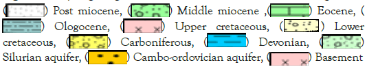
Tertiary (Post-Eocene aquifer): Post Eocene Aquifer occurs to the north of the 26˚N in GSS and is represented Miocene Aquifer. It is recorded as Moghra south Qattara Depression in Egypt and the Sarir well field in Libya that discharge about 1,000,000 m/day groundwater in The Great Libyan Man-made River (GLMMR). The aquifer overlies shale layers and is overlain by post-Miocene sediments i.e. free to the unconfined aquifer. While in Sarir, the aquifer consists of two water-bearing, the upper (unconfined) with depth to water table about 60 m, and deeper productive (confinedsemi- artesian) with depth to water is around 220 m [50]. In Egypt, the water table is shallower and ranges from 30 to 120 m [51]. The aquifer has a variable thickness, which is around 250 m west GSS and increases eastward to about 700 m [51]. It is consists of sandstone with shale and limestone layers that are deposited under shallow marine to the deltaic environment. The TDS of artisan aquifer in Libya is varying between 587 to 980 mg/l, and in Egypt ranging from 1400 to 7001 ppm of deep meteoric water origin [47,51]. North of the 28˚N, there is a sharp change in the water quality, with a high concentration of gypsum and anhydrite in the formations which increases the dry residue to 5000 ppm in Libya. The aquifer transmissivity is between 4.63 × 10-03 to 0.0694 m2/s, and storativity is between 2.1 × 10-04 to 3.77 × 10-04 [47]. The post- Eocene aquifer is recharged by some modern recharge that may be recharged by underflow from the deeper NSSAS [52-54]. The aquifer to the NW of GSS has an average stable isotope composition of δD=-73.7% and δ18O=-9.3%, which generally these values are indicated Holocene ages, while the 14C ages range of 9.9 kyr to 15.2 kyr and δ13C at from -25.7% to -8.8% [47,55].
Cretaceous Aquifers: Cretaceous Aquifers are represented by U. Cretaceous karst, Cenomanian, and Lower Cretaceous water bearings.
Upper Cretaceous Karst Aquifer: Upper Cretaceous Karst Aquifer is recorded in the central and northern parts. The aquifer is consists of hard limestone with shale and marl intercalations and has a thickness from 100 to 700 m. It is covered by the shale in the northern part and outcropped in the west-central part i.e. confined to the unconfined aquifer. The aquifer recharged mostly from underlain Nubian aquifer system through fault systems. The groundwater is characterized by a relatively moderate temperature (~26˚C) in free condition [9] that increases northward to about 34˚C [51]. The transmissivity of the aquifer in Libya is 3.6 to l0-3 m2/s and the storage coefficient is around 10-3. The aquifer's capacity declines towards the west [55]. With the increase of temperature, the TDS increase from about 450 to more than 30000 ppm owing to leaching processes and aquifer matrix. They are chloride-sodium water type, meteoric that increase to the mixed northward, and the main salts are NaCl and MgCl2 and CaSO4.
Cenomanian Aquifer: The Cenomanian Aquifer is widespread and has good porosity and is equivalent to the Nubia "A" [56]. It is mostly overlain shale and overlain by carbonate rocks i.e. confined to semi-confined. The aquifer thickness increase northward from about 140 m to more than 800 m northward. It is consists of sandstone with thin shale layers that are deposited greatly under continental environment [31] to shallow marine. The groundwater level is about 100 m above sea level that decreases northward. The transmissivity values range from 1.3 × 10⁻² to 2.8 × 10⁻³ m2/s, the storage coefficient is 2 × 10⁻⁴, the porosity is 20% to 40%, and is 21000 years old of the aquifer in Libya [55]. The average transmissivity decreases westward to 1.72 × 10⁻³ m2/s in Farafra Oasis of Egypt [9]. The aquifer salinity increase from ~ 350 to ~ 900 ppm northward owing to aquifer matrix and leaching processes. The groundwater is meteoric water, NaCl, and Na2SO4 water types, the main salts are NaCl and CaHCO3.
Lower Cretaceous aquifers: The Lower Cretaceous aquifer acts as the main groundwater resource that can be differentiated into two layers, upper (Kharita) and lower (Alam El Beuib). The upper layer is overlain and underlain by shale layers i.e. confined to the semiconfined aquifer. It has a thickness of about 200 m in the southern part that increases northward to about 1000 m. It is composed of sandstone with shale layers that are deposited under continental to the shallow environment [57], has average effective porosity is 15% [58], and transmissivity as 1612.5 m2/day [9]. The groundwater level decreases northward from about +105 above sea level. The aquifer may hydraulically connect with overlaying Cenomanian aquifer through pores and faults. The groundwater salinity increases dramatically from about 140 ppm in the southern part to about 3500 ppm that reflecting the impact of the environment of deposition and groundwater flow. They are deep meteoric water, NaCl, and Na2SO4 water types, and the main salts are NaCl.
The lower layer (Alam El Buieb) overlies Late Jurassic carbonates and/or the shale layer of Carboniferous and underlain shale and dolomitic layers i.e. confined to the semi-confined aquifer. The water-bearing thickness increases northward from about 50 m to about 1000 m. It is consists of sandstone with calcareous shale intercalations that are deposited under a continental environment [57]. The average is transmissivity 1641.5 m2/day in the southern part [9] that decreases northward. Their water level decreases northward from about 130 m above sea level. In contrast, the groundwater salinity increases also northward from about 130 ppm to about 460 ppm to the northeast [51]. He recorded that it has a high temperature (57˚C), high pressure (5 kg/cm2), and productivity of 406 m3/hr. The groundwater is deep meteoric water, NaCl and Na2SO4 water type and the main salts are NaCl. The aquifer needs a lot of groundwater explorations owing their low salinity and high productivity.
Paleozoic aquifers: Paleozoic is represented by four water bearings belonging to Carboniferous, Devonian, Silurian, and Cambro- Ordovician. They are hydraulically connected through facies and fault systems. They are overlain by the Lower Jurassic Bahrein sandstone deposits and/or younger sediments and are underlain by basement rocks i.e. confined to the semi-confined aquifer. It has a huge thickness that reaches more than 2100 m. Paleozoic is composed of sandstones with limestone and shale interbeds. They are deposited under shallow marine to delta complex conditions [59-61]. Paleozoic needs a lot of groundwater explorations. The Cambrian-Ordovician aquifer was recorded SW of GSS in Libya with good water quality, fairly warm (35˚C to 40˚C) and the transmissivity ranges from 10-2 to 10-3 m2/s [55].
Farooqui, et al. recorded a very good reservoir of Devonian and Silurian in the Ammonits-1 well near the Egyptian-Libyan border and west Farafra Oasis [26]. One of the main water fields of GLMMR is Tazerbo that is tapping Lower Devonian, southwestern part of GSS, reaching up to 800 m thickness. The water field is designed to yield one million cubic meters per day. It is the buildup of marginal marine deposits [62]. Three water bearings have been identified in Devonian Aquifer (shallow, intermediate, and deep) with relatively uniform and extensive layering separated by thick aquitards. The deeper one is the main target of GLMRA that is covered by shale, fine-grained argillaceous, ferruginous sandstones with mudstone interbeds [62]. It has a thickness of 100-120 m and consists of medium-grained sandstone. The depth to water is from 260 m in the NE to 400 m SE with TDS varying between 212 to 266 ppm. The aquifer has a temperature (35°C to 40°C), transmissivity between 3.71 × 10-02 to 7.92 × 10-03 m2/s, and the storativity is between 2.1 × -04-3 to 0.77 × 10-04, the average stable isotope compositions are δD=-84.6% and δ18O=-11.8%, the 14C ages range between 23.4 kyr to 27.5 kyr and δ13C ranging from -8.2% to -5.99% that means Pleistocene age and no evidence of modern recharge [47].
Cretaceous and Paleozoic multilayered aquifer system have been assumed on a regional basis, hydraulically connected through faults and/or facies and for all practical purposes to behave as a one-layer aquifer system (Nubian Sandstone). The concept of the Nubian Sandstone Aquifer System (NSSAS) was first described by Ball, et al. and Sandford, et al. [4,63]. The aquifer unconformably overlies the basement and is overlain by the transgressive marine Cretaceous. NSSAS extends over 2 × 10⁶ km2 in Egypt, Libya, Chad, and Sudan [38]. This aquifer is under unconfined conditions south of 25˚N and confined conditions north of it. Hydraulic conductivity for Mesozoic (Cretaceous) 5 × 10⁻⁵ and Paleozoic deposits 5 × 10⁻⁶ m/s, the transmissivity of Dakhla Basin (the main basin of GSS) is 10000 m2/day, where the thickness of Nubian exceeds 3000 m [7], the average bulk porosity is about 20% [64,65]. The average aquifer thickness, transmissivity, and hydraulic conductivity of NSSAS in the oases have been tabulated in Table 2. The total volume of groundwater in storage in the unconfined part of mega Nubian is about 259.3 × 10¹² m3, while the total groundwater volume stored in the confined part is about 265 × 1012 m3, of which 151 × 1012 m3 is hypersaline occurring north of salt water-fresh water interface and the rest of 114 × 1012 m3 is freshwater [7]. Therefore, it can be concluded that the total volume of fresh groundwater stored in the mega NSSA is about 373 × 1012 m3. It has been recharged in previous pluvial periods in the Quaternary by the intensification of paleomonsoons [66-68] or intensification of paleowesterlies [69-71]. The average annual recharge to the aquifer system is estimated at 2.22 ± 0.64 km3/yr [38]. The average water level decreases by 0.19, 0.39, 0.41, 1.09, and 2.28 m/year in west GSS, Dakhla, Kufra, Kharga, and west Sarir [7]. The low rate of decline west GSS may be due to the high recharge from it, while the higher rate is owing to the presence of the east-west–trending Uweinat-Aswan basement uplift, which impedes the south-to-north groundwater flow and hence reduces replenishment from recharge areas in the south in Egypt [38] and GLMRA in Libya.
| Area | Average thickness (m) | Average transmissivity (m2/s) | Average hydraulic conductivity (m/s) | Storage coefficient (s) |
|---|---|---|---|---|
| Kharga | 1250 | 3.2 × 10⁻² | 2.5 × 10⁻⁵ | 2.84 × 10⁻⁴ |
| Dakhla | 1750 | 7.5 × 10⁻² | 4.8 × 10⁻⁵ | 6.35 × 10⁻⁴ |
| Farafra | 2600 | 1.2 × 10⁻² | 4.2 × 10⁻⁵ | |
| Bahariya | 1880 | 8.8 × 10⁻³ | 4.5 × 10⁻⁵ | 8.0 × 10⁻⁴ |
| Kufra | 2850 | 1.1 × 10⁻² | 5.9 × 10⁻⁵ | |
| Tazerbo | 2500 | 1.88 10-2 | 9.4 × 10⁻⁵ |
Table 2: Average aquifer thickness, transmissivity, and hydraulic conductivity of the oases of the Nubian Sandstone Aquifer System.
Using head data from 23 wells in Egypt and Libya, they identified a regional SW to NE and SE to NW in Libya. NE direction may be owing to the effect of the SW-NE Pelusium megashear in the Western Desert that causes extensive brittle deformation, high hydraulic conductivity, and replenishment [38]. Now the groundwater table is decreasing and today, the GSS receives no recharge or negligible recharge, which means the basin is slowly depleting because of the long period of high pumping around it that took place several years ago. The ages of groundwater in NSSA increase progressively along the groundwater flow direction. Krypton81 and chlorine36 data [70,72] show a progression of groundwater ages reaching 680 ka in Kharga and up to 1000 ka in the Bahariya northeastward (Figure 14).

Figure 14: The groundwater level in GSS and its vicinities.
The stored groundwater quantity
The groundwater quantity in the aquifer depends principally on the saturated thickness and effective porosity. Kheir, et al. obtained an average effective porosity of 25% for the outcropped Mesozoic sediments in Northern Sudan, while Schneider, et al. detected in the laboratory from core samples it ranges from 25 to 31% in southern Egypt. However, lower figures are recorded by different workers for NSSA Thoreweih, et al. is 7%; Issar, et al. is 10%; Burdon, et al. is 5%-10% [73-77]. The average effective porosity of all of them is 16%. The average saturated thickness of fresh and brackish water in Cenomanian (420 m), Lower Cretaceous (580 m), and Paleozoic (2000 m) aquifers are ~3000 m. The groundwater storage can be calculated based on the following Darcy, et al. [78] equation:
Q=φeff D A
Q: is the stored groundwater quantity in the aquifer in m3
D: is the average saturated thickness of the aquifer in m
φeff: is the effective porosity of the concerned aquifer in decimal (0.16)
A: is the area of fresh and slightly saline in the aquifers (~14000 km2)
The stored groundwater quantity is calculated for an area of (~14000 km2) and attains ~ 94 × 1012 m3. The groundwater in Post Eocene (~200 m) and Upper Cretaceous karst aquifer (~200 m) may increase the groundwater storage to ~ 12.5 × 10¹² m3.
If we calculate the minimum average effective porosity of 7%, the stored groundwater quantity is ~ 41 × 1012 m3. The groundwater in Post Eocene (~200 m) and Upper Cretaceous karst aquifer (~200 m) may increase the groundwater storage to ~ 5.5 × 10¹² m3.
This study is to shed the light on GSS in Northeast Africa for future and sustainable development surrounding areas based on groundwater. Where this is the first time to record that there are groundwater aquifers in GSS with a huge thickness that can change the face of the development in Egypt and Libya. They are differentiated into:
• Post Eocene, ~200 m thick, low productive, salinity from 1400 to more than 7000 ppm, dominated by clastic sediments.
• Karst, ~200 m thick, low productive, salinity from 450 to more than 30000 ppm and dominated by carbonate sediments.
• NSAS that divided into three hydrogeological units:
■ An Upper unit (Lower Upper Cretaceous (Cenomanian)), average thickness ~ 420 m, highly productive, salinity from ~ 350 to ~ 900 ppm, and dominated by clastic facies.
■ Middle unit (Lower Cretaceous), average thickness ~ 580 m, very high productive and dominated by sand facies with interbeds of carbonate facies.
■ A lower unit (Paleozoic), average thickness ~ 2000 m, very high productive and dominated by sand facies with interbeds of carbonate.
The average estimated groundwater storage in the Nubian Sandstone Aquifer System (NSAS) in the GSS is ~ 94 × 1012 m3 and ~ 12.5 × 10¹² m3 in Post Eocene and karst aquifer. No recent recharge of the aquifer systems except Post Eocene to the north which receives the little modern recharge. But, the groundwater depletion in GSS is very low owing to the poor activities in and out of it. Exploratory drilling in the GSS in eastern Sahara and similar desert regions worldwide will confirm the presence of the groundwater thickness, potentiality, salinity, and relationships with surrounding aquifers. Using the new groundwater resources will face a shortage of food. It is hoped that the theory is tested in the rest of similar deserts in arid and semi-arid of the world.
Citation: Yousef AF (2022) Sand Sea in Northeast Africa and Future Sustainable Development. J Geol Geophys. 11:1018.
Received: 04-Feb-2022, Manuscript No. JGG-22-15873; Editor assigned: 08-Feb-2022, Pre QC No. JGG-22-15873 (PQ); Reviewed: 22-Feb-2022, QC No. JGG-22-15873; Revised: 28-Feb-2022, Manuscript No. JGG-22-15873 (R); Published: 07-Mar-2022 , DOI: 10.35248/2381-8719.22.11.1018
Copyright: © 2022 Yousef AF. This is an open-access article distributed under the terms of the Creative Commons Attribution License, which permits unrestricted use, distribution, and reproduction in any medium, provided the original author and source are credited.