Journal of Geology & Geophysics
Open Access
ISSN: 2381-8719
ISSN: 2381-8719
Research Article - (2023)Volume 12, Issue 4
Intense rainfall events are known to be important controls on landslide activity in the UK. This paper presents an analysis of daily rainfall records from 56 stations throughout the UK involving the application of a non-parametric statistical test to evaluate the significance of any trends in these time series. Four intense rainfall scenarios are considered: >25 mm/day; >40 mm over 2 days; >60 mm over 3 days and >80 mm over 7 days. The results indicate that there is significant spatial variation in the long-term trends. A positive trend of increasing intense rainfall event frequency is not present across the UK except at some upland stations in the Scottish Highlands and Southern Uplands, and the Northern Pennines.
Landslide; Rainfall; Hypotheses
“There are many definitions of ‘trend’, but none apply to differences that have already been found to be non-significant in a statistical test [1].”
The evaluation of trends in climatic time series is an important factor for risk assessment and the long-term design of services and infrastructure. This is so in the UK where rainfall is a common trigger for landslide activity [2-5]. Reactivation of pre-existing deep-seated landslides is generally associated with prolonged heavy rainfall. Shallow translational (debris) slides, peat slides and debris flows in steep catchments are often associated with high intensity rainstorms. Such landslides tend to be triggered within minutes or hours of the event, although the antecedent rainfall prior to the landslide event can also be significant.
Rainfall generates landslides by infiltrating into the slope while increasing positive pore-water pressures within the material above the potential surface of rupture to a critical level. The infiltration rate is influenced by factors such as the slope angle, the vegetation cover, surface stoniness, and the permeability of the slope materials. On the other hand, resistance of the slope depends on soil or rock strength and on its geometry. As a result, the critical rainfall necessary to cause the slope failure will vary from one slope to another, and one environment to another [6].
Although many attempts have been made to determine the minimum rainfall required for causing slope failures (see the discussions in Corominas et al. [6], and Winter et al. [7]) few have focussed on conditions in the UK. Pennington et al. [8], demonstrated that a marked increase in the number of reported landslides in SW England and Wales during the very wet period between November 2012 and January 2013 was closely correlated with the antecedent precipitation over 1-7 day periods. The threshold rainfall levels associated with the triggering of 6 or more landslides in the region were around 25 mm in 1 day and around 100 mm in 7 days.
In the Scottish Highlands, Winter et al. [8], developed a deterministic rainfall threshold for debris flow potential, based on 16 past events that had caused disruption to the road network and for which information on the timing and rainfall intensities was known (Figure 1). Rainfall events that plot above the threshold line triggered landslides. The time limit of antecedent rainfall duration was considered to be 288 hours (45 mm of rain over 12 days). Probabilistic thresholds were subsequently developed [9], primarily for the area around the A83 Rest and be Thankful [10,11].
This paper presents an analysis of long-term daily rainfall records from stations throughout the UK and applies a non-parametric statistical test to evaluate the significance of any trends in these time series. In doing so, the objectives are to establish whether one of the major controls on landslide activity in the UK has changed significantly over the last century or more, and whether there is a consistent pattern across the UK as a whole.
Intense rainfall events in the UK
By comparison with global maxima, the UK experiences relatively low intensity rainfall (Figures 1 and 2; the highest daily rainfall in the UK, 297 mm is around 15% of the world record value of 1825 mm recorded at Foc Foc, Réunion Island in the Indian Ocean). However, a daily rainfall of 100 mm of more has been surpassed in many parts of the country [12]. These extreme events can be associated with a variety of weather conditions, including summer convective storms, prolonged frontal (widespread) or winter orographically forced events [13].

Figure 1: Debris flow triggering threshold: Plot of rainfall intensity (mm/hour) and duration (modified, after Winter et al 2019). Note that the 2 extremes of the original threshold (prior to 10 hours and after 12 days) have been removed, as suggested by Winter (2020). Note: 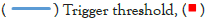 intense rainfall scenario.

Figure 2: Magnitude-duration relationships for the World (top line) and UK (bottom line) record rainfall events.
The 1 in 100 year return period 24-hour rainfall total varies with the average annual rainfall [13]:
• Annual rainfall >2800 mm: 228 mm (high ground in the Scottish Western Highlands, parts of the Lake District and Snowdonia).
• Annual rainfall 1400-2800 mm: 152 mm (parts of the Scottish Highlands, high ground in the Southern Uplands, the Lake District and the Pennines, mid Wales, the Mendips, Exmoor and Dartmoor, and high ground in Northern Ireland).
• Annual rainfall 500-1400 mm: 100 mm (the rest of the UK, notably eastern Scotland and much of eastern, central and southern England).
Although the largest multiple-day totals occur in upland areas (Table 1a), most of the heaviest daily falls recorded have occurred in lowland UK [13], most notably in south west England (Table 1b):
| Days | Rainfall (mm) | Date | Location |
|---|---|---|---|
| Highest 2-day total | 405 | 4 to 5 December 2015 | Thirlmere (Cumbria) |
| Highest 3-day total | 456.4 | 17 to 19 November 2009 | Seathwaite (Cumbria) |
| Highest 4-day total | 495 | 16 to 19 November 2009 | Seathwaite (Cumbria) |
| Highest monthly total | 1396.4 | 1 to 31 December 2015 | Crib Goch (Snowdon) |
Table 1a: UK rainfall records: Highest 2 to 4 day and 1 monthly totals.
| Country | Rainfall (mm) | Date | Location |
|---|---|---|---|
| England* | 279 | 18-Jul-1955 | Martinstown (Dorset) |
| Northern Ireland | 159 | 31-Oct-1968 | Tollymore Forest (County Down) |
| Scotland | 238 | 17-Jan-1974 | Sloy Main Adit (Argyll and Bute) |
| Wales | 211 | 11-Nov-1929 | Lluest Wen Reservoir (Mid Glamorgan) |
Note: * The highest 24-hour total for any 24-hour period is 341.4 mm from 18:00 GMT on 4th to 18:00 GMT on 5th December 2015 at Honister Pass (Cumbria).
Table 1b: UK rainfall records: Highest daily totals.
These daily totals disguise the intensity of the extreme short duration storms that have been reported (Table 1c). For example, during the Hampstead storm of 14 August 1975 169 mm fell in 155 minutes. Such intense storms generally affect only small areas, although the resultant flash floods can have a devastating impact in small, steep catchments, (e.g. the Lynmouth floods of 15th August 1952, Bleasedale et al. [14]; the Boscastle flood of 16th August 2004, Golding et al. [15]).
| Minutes | Rainfall (mm) | Date | Location |
|---|---|---|---|
| Highest 5-minute total | 32 | 10 August 1893 | Preston (Lancashire) |
| Highest 30-minute total | 80 | 26-Jun-1953 | Eskdalemuir (Dumfriesshire) |
| Highest 60-minute total | 92 | 12-Jul-1901 | Maidenhead (Berkshire) |
| Highest 90-minute total | 117 | 08-Aug-1967 | Dunsop Valley (Lancashire) |
| Highest 120-minute total | 155 | 11-Jun-1956 | Hewenden Reservoir (West Yorkshire) |
| Highest 155-minute total | 169 | 14-Aug-1975 | Hampstead (Greater London) |
| Highest 180-minute total | 178 | 07-Oct-1960 | Horncastle (Lincolnshire) |
Table 1c: UK rainfall records: Highest short duration totals.
• Martintown, Dorset; 297.4 mm on 18 July 1955.
• Bruton, Somerset; 242.8 mm on 28 June 1917.
• Cannington, Somerset; 238.8 mm on 18 August 1924.
• Lynmouth, Devon; 229 mm on 15 and 16 August 1952.
Rodda et al. [12], suggested that site specific events of this nature may have had a return period of many thousands of years.
Intense rainfall scenarios
The intense rainfall scenarios used in this analysis are:
Scenario 1: >25 mm in 1 day (the equivalent of 1.04 mm/hour for 24 hours).
Scenario 2: >40 mm in 2 days (the equivalent of 0.83 mm/hour for 48 hours).
Scenario 3: >60 mm in 3 days (the equivalent of 0.83 mm/hour for 72 hours).
Scenario 4: >80 mm in 3 days (the equivalent of 0.47 mm/hour for 168 hours).
All 4 scenarios plot above the deterministic debris flow triggering threshold line developed by Winter et al. [9], for Scotland (Figure 1). However, this should not be taken as implying that the triggering threshold has universal applicability or that the occurrence of any of the scenarios would necessarily lead to shallow landsliding everywhere across the UK. The scenarios have been adopted simply as convenient measures of rainfall intensity as potential landslide triggers.
UK historic station data
Daily rainfall records for a variety of UK weather stations is available from the Koninklijk Nederlands Meteorologisch Instituut (KNMI) Climate Explorer website: https://climexp.knmi.nl/selectdailyseries.cgi?id=someone@somewhere
Records were accessed from this site for stations with over 50 years of daily data. A total of 56 stations were selected (Table 2), of which 9 sites had data for over 100 years (the longest records are for Oxford with 192 years of data and Armagh, Northern Ireland, with 180 years of data). Note that “rain days” are from 09:00 GMT to 09:00 GMT the next day.
| Station | LAT | LONG | Elevation (m) | Record | Record (Years) | Mean annual rainfall (mm) | |
|---|---|---|---|---|---|---|---|
| Start | End | ||||||
| Aberporth | 52.14 | -4.57 | 133 | 1960 | 2018 | 59 | 883 |
| Alice Holt Lodge | 51.18 | 0.85 | 115 | 1962 | 2017 | 56 | 782 |
| Alwen | 53.06 | -3.55 | 345 | 1961 | 2017 | 57 | 1263 |
| Ardtalnaig | 56.53 | -4.11 | 130 | 1961 | 2017 | 57 | 1343 |
| Armagh | 54.35 | -6.65 | 62 | 1838 | 2019 | 180 | 812 |
| Auchincruive | 55.48 | -4.57 | 48 | 1961 | 2017 | 57 | 978 |
| Benmore | 56.03 | -4.99 | 12 | 1961 | 2017 | 57 | 991 |
| Bognor Regis | 50.78 | 0.68 | 7 | 1960 | 2017 | 58 | 795 |
| Bowhill | 55.54 | -2.90 | 168 | 1961 | 2017 | 57 | 1521 |
| Bradford | 53.81 | -1.77 | 134 | 1960 | 2017 | 58 | 857 |
| Bude | 50.83 | -4.55 | 15 | 1960 | 2017 | 58 | 932 |
| Bute Rothesay | 55.84 | -5.06 | 43 | 1961 | 2012 | 52 | 1471 |
| Durham | 54.77 | -1.59 | 102 | 1880 | 2017 | 138 | 641 |
| Dyce | 57.21 | -2.20 | 65 | 1960 | 2017 | 58 | 814 |
| East Bergholt | 51.96 | 1.03 | 7 | 1961 | 2017 | 57 | 569 |
| Eastbourne | 50.76 | 0.29 | 7 | 1911 | 2016 | 106 | 794 |
| Edinburgh | 55.97 | -3.21 | 26 | 1961 | 2017 | 57 | 715 |
| Eskdalemuir | 55.31 | -3.21 | 242 | 1931 | 2017 | 87 | 1742 |
| Glenlee | 55.10 | -4.19 | 55 | 1961 | 2012 | 52 | 1638 |
| Hastings | 50.85 | 0.57 | 45 | 1961 | 2017 | 57 | 731 |
| Hawarden Bridge | 53.22 | -3.03 | 5 | 1951 | 2004 | 54 | 617 |
| Hayling Island | 50.78 | 0.98 | 4 | 1961 | 2016 | 56 | 703 |
| Heathrow | 51.48 | -0.45 | 25 | 1960 | 2018 | 59 | 754 |
| High Mowthorpe | 54.10 | 0.64 | 175 | 1961 | 2017 | 57 | 729 |
| Hull | 53.77 | 0.37 | 2 | 1931 | 1999 | 69 | 664 |
| Hurn | 50.78 | -1.84 | 10 | 1960 | 2018 | 59 | 789 |
| Inverness | 57.49 | -4.22 | 4 | 1961 | 2012 | 52 | 740 |
| Keele | 53.00 | -2.27 | 179 | 1961 | 2017 | 57 | 806 |
| Kielder Castle | 55.23 | -2.58 | 201 | 1961 | 2017 | 57 | 999 |
| Kilnochewe | 57.61 | -5.31 | 25 | 1961 | 2017 | 57 | 2282 |
| Leadhills | 55.42 | -3.76 | 393 | 1961 | 2017 | 57 | 1742 |
| Leckford | 51.12 | -1.44 | 117 | 1961 | 2012 | 52 | 779 |
| Lerwick | 60.14 | -1.18 | 82 | 1946 | 2018 | 73 | 1257 |
| Leuchars | 56.38 | -2.86 | 10 | 1960 | 2018 | 59 | 690 |
| Lyneham | 51.50 | -1.99 | 145 | 1960 | 2017 | 58 | 745 |
| Lyonshall | 52.21 | -2.97 | 155 | 1961 | 2013 | 53 | 793 |
| Malham Tarn | 54.10 | -2.16 | 381 | 1961 | 2017 | 57 | 1550 |
| Malvern | 52.11 | -2.31 | 62 | 1900 | 2008 | 109 | 738 |
| Morpeth | 55.22 | -1.69 | 95 | 1960 | 2017 | 58 | 693 |
| Newton Rigg | 54.67 | -2.79 | 169 | 1906 | 2017 | 112 | 867 |
| Nottingham | 53.01 | -1.25 | 117 | 1960 | 2017 | 58 | 709 |
| Oxford | 51.76 | -1.26 | 63 | 1827 | 2018 | 192 | 660 |
| Paisley | 55.85 | -4.43 | 32 | 1914 | 2010 | 97 | 1245 |
| Penicuik | 55.82 | -3.23 | 185 | 1961 | 2017 | 57 | 982 |
| Plymouth | 50.35 | -4.12 | 50 | 1960 | 2017 | 58 | 1007 |
| Ronaldsway | 54.08 | -4.63 | 16 | 1960 | 2017 | 58 | 864 |
| Rothamsted | 51.81 | 0.36 | 128 | 1916 | 2017 | 102 | 712 |
| Sheffield | 53.38 | -1.49 | 131 | 1883 | 2017 | 135 | 835 |
| Slapton | 50.29 | -3.65 | 32 | 1961 | 2017 | 57 | 1074 |
| Stormont | 54.06 | -5.83 | 56 | 1961 | 2017 | 57 | 861 |
| Stornoway | 58.21 | -6.32 | 9 | 1931 | 2017 | 87 | 1249 |
| Threave | 54.92 | -3.95 | 73 | 1961 | 2017 | 57 | 1142 |
| Tiree | 56.50 | -6.88 | 9 | 1960 | 2017 | 58 | 1255 |
| Waddington | 53.18 | -0.52 | 68 | 1949 | 2018 | 70 | 614 |
| Wick | 58.45 | -3.09 | 36 | 1931 | 2018 | 88 | 814 |
| Wisley | 51.31 | 0.47 | 38 | 1908 | 2017 | 110 | 656 |
Table 2: Stations used in this analysis: Basic statistics.
Most of the time series include a small number of missing daily values for rainfall. These have been infilled by taking the average of the previous and following days; thus, if the missing data value was for 10 January 2000, the infilled value would be the average of the values for 9 and 11 January 2000.
A summary of the data is presented in Table 3 and Figure 3 which reveals marked contrasts across the UK. In very broad terms, three groups of stations can be identified on the basis of the frequency of events >25 mm/day:
| Station | Events/Year Daily Rainfall (>25mm) | Events/Year 2 Day Rainfall (>40mm) | Events/Year 3 Day Rainfall (>60mm) | Events/Year 7 Day Rainfall (>80mm) | ||||||||
|---|---|---|---|---|---|---|---|---|---|---|---|---|
| Minimum | Maximum | Mean | Minimum | Maximum | Mean | Minimum | Maximum | Mean | Minimum | Maximum | Mean | |
| Aberporth | 0 | 6 | 2.1 | 0.0 | 4.0 | 1.4 | 0 | 4 | 0.4 | 0 | 9 | 1.4 |
| Alice Holt Lodge | 0 | 6 | 2.5 | 0.0 | 7.0 | 1.8 | 0 | 5 | 0.7 | 0 | 12 | 1.9 |
| Alwen | 1 | 10 | 5.7 | 0.0 | 15.0 | 6.6 | 0 | 13 | 3.1 | 0 | 6 | 0.6 |
| Ardtalnaig | 0 | 13 | 6.6 | 0.0 | 16.0 | 6.9 | 0 | 15 | 4.4 | 0 | 47 | 15.8 |
| Armagh | 0 | 8 | 1.6 | 0.0 | 6.0 | 0.9 | 0 | 4 | 0.3 | 0 | 11 | 0.6 |
| Auchincruive | 0 | 7 | 1.9 | 0.0 | 8.0 | 1.2 | 0 | 10 | 0.7 | 0 | 28 | 8.7 |
| Benmore | 11 | 42 | 23.1 | 12.0 | 46.0 | 28.4 | 6 | 48 | 22.4 | 27 | 128 | 70.8 |
| Bognor Regis | 1 | 10 | 2.3 | 0.0 | 7.0 | 1.2 | 0 | 3 | 0.3 | 0 | 10 | 1.2 |
| Bowhill | 0 | 7 | 2.3 | 0.0 | 7.0 | 2.0 | 0 | 5 | 1.0 | 0 | 12 | 2.4 |
| Bradford | 0 | 6 | 2.3 | 0.0 | 7.0 | 1.9 | 0 | 5 | 0.9 | 0 | 14 | 1.8 |
| Bude | 0 | 7 | 1.8 | 0.0 | 8.0 | 1.2 | 0 | 5 | 0.5 | 0 | 9 | 1.3 |
| Bute Rothesay | 1 | 12 | 5.1 | 0.0 | 10.0 | 4.2 | 0 | 6 | 1.5 | 0 | 26 | 9.1 |
| Durham | 0 | 7 | 1.4 | 0.0 | 7.0 | 1.0 | 0 | 5 | 0.5 | 0 | 12 | 1.0 |
| Dyce | 0 | 7 | 2.8 | 0.0 | 8.0 | 2.2 | 0 | 7 | 1.1 | 0 | 17 | 2.5 |
| East Bergholt | 0 | 4 | 1.1 | 0.0 | 5.0 | 0.7 | 0 | 3 | 0.1 | 0 | 4 | 0.2 |
| Eastbourne | 0 | 7 | 2.4 | 0.0 | 6.0 | 1.9 | 0 | 5 | 0.6 | 0 | 14 | 2 |
| Edinburgh | 0 | 7 | 1.6 | 0.0 | 16.0 | 5.4 | 0 | 5 | 0.6 | 0 | 13 | 1.2 |
| Eskdalemuir | 2 | 23 | 10.2 | 1.0 | 29.0 | 29.0 | 1 | 25 | 6.3 | 0 | 62 | 23.8 |
| Glenlee | 2 | 22 | 11.9 | 2.0 | 34.0 | 12.6 | 0 | 19 | 7.6 | 3 | 59 | 28.0 |
| Hastings | 0 | 8 | 2.5 | 0.0 | 5.0 | 1.4 | 0 | 3 | 0.5 | 0 | 12 | 1.5 |
| Hawarden Bridge | 0 | 5 | 1.4 | 0.0 | 4.0 | 0.7 | 0 | 3 | 0.2 | 0 | 8 | 0.5 |
| Hayling Island | 0 | 5 | 1.7 | 0.0 | 7.0 | 1.2 | 0 | 3 | 0.4 | 0 | 9 | 1.3 |
| Heathrow | 0 | 3 | 1.4 | 0.0 | 6.0 | 0.8 | 0 | 3 | 0.3 | 0 | 6 | 0.5 |
| High Mowthorpe | 0 | 5 | 1.7 | 0.0 | 6.0 | 1.6 | 0 | 5 | 0.6 | 0 | 13 | 1.1 |
| Hull | 0 | 6 | 1.6 | 0.0 | 4.0 | 1.1 | 0 | 5 | 0.4 | 0 | 7 | 0.4 |
| Hurn | 0 | 6 | 2.7 | 0.0 | 9.0 | 2.1 | 0 | 5 | 0.7 | 0 | 11 | 2.6 |
| Inverness | 0 | 5 | 1.5 | 0.0 | 4.0 | 1.0 | 0 | 4 | 0.7 | 0 | 9 | 0.9 |
| Keele | 0 | 5 | 1.5 | 0.0 | 5.0 | 1.0 | 0 | 3 | 0.3 | 0 | 5 | 0.5 |
| Kielder Castle | 0 | 16 | 6.6 | 0.0 | 21.0 | 5.9 | 0 | 16 | 3.6 | 0 | 42 | 12.4 |
| Kilnochewe | 4 | 37 | 18.5 | 2.0 | 47.0 | 24.3 | 1 | 44 | 20.3 | 0 | 102 | 57.4 |
| Leadhills | 3 | 23 | 11.5 | 10.0 | 73.0 | 39.5 | 0 | 21 | 8.1 | 1 | 63 | 30.0 |
| Leckford | 0 | 7 | 2.3 | 0.0 | 6.0 | 1.6 | 0 | 3 | 0.5 | 0 | 12 | 2.2 |
| Lerwick | 0 | 5 | 2.1 | 0.0 | 7.0 | 1.5 | 0 | 4 | 0.6 | 0 | 15 | 2.7 |
| Leuchars | 0 | 7 | 1.9 | 0.0 | 6.0 | 1.4 | 0 | 5 | 0.4 | 0 | 7 | 1.0 |
| Lyneham | 0 | 5 | 1.4 | 0.0 | 4.0 | 0.8 | 0 | 3 | 0.3 | 0 | 7 | 0.7 |
| Lyonshall | 0 | 7 | 2.2 | 0.0 | 7.0 | 1.8 | 0 | 4 | 0.7 | 0 | 12 | 1.5 |
| Malham Tarn | 1 | 16 | 8.6 | 2.0 | 19.0 | 8.7 | 0 | 13 | 4.8 | 3 | 39 | 19.2 |
| Malvern | 0 | 6 | 2.0 | 0.0 | 6.0 | 1.2 | 0 | 3 | 0.4 | 0 | 11 | 1.1 |
| Morpeth | 0 | 7 | 2.6 | 0.0 | 7.0 | 1.8 | 0 | 7 | 0.8 | 0 | 12 | 2.0 |
| Newton Rigg | 0 | 7 | 2.2 | 0.0 | 7.0 | 1.7 | 0 | 5 | 0.6 | 0 | 12 | 1.4 |
| Nottingham | 0 | 4 | 1.7 | 0.0 | 4.0 | 1.1 | 0 | 2 | 0.3 | 0 | 4 | 0.4 |
| Oxford | 0 | 6 | 1.4 | 0.0 | 6.0 | 0.8 | 0 | 3 | 0.2 | 0 | 7 | 0.5 |
| Paisley | 0 | 9 | 4.1 | 0.0 | 11.0 | 3.1 | 0 | 7 | 1.1 | 0 | 23 | 5.3 |
| Penicuik | 0 | 7 | 2.6 | 0.0 | 7.0 | 2.4 | 0 | 6 | 1.3 | 0 | 13 | 3.1 |
| Plymouth | 0 | 8 | 3.3 | 0.0 | 9.0 | 1.9 | 0 | 10 | 0.7 | 0 | 16 | 3.1 |
| Ronaldsway | 0 | 7 | 2.3 | 0.0 | 7.0 | 1.6 | 0 | 6 | 0.6 | 0 | 14 | 1.3 |
| Rothamsted | 0 | 4 | 1.3 | 0.0 | 5.0 | 0.7 | 0 | 6 | 0.3 | 0 | 11 | 0.7 |
| Sheffield | 0 | 6 | 2.3 | 0.0 | 7.0 | 1.6 | 0 | 6 | 0.7 | 0 | 15 | 1.7 |
| Slapton | 1 | 10 | 4.4 | 0.0 | 14.0 | 3.6 | 0 | 11 | 1.5 | 0 | 26 | 6.4 |
| Stormont | 0 | 9 | 2.7 | 0.0 | 10.0 | 2.1 | 0 | 7 | 1.0 | 0 | 12 | 2.4 |
| Stornoway | 0 | 5 | 1.7 | 0.0 | 6.0 | 1.1 | 0 | 6 | 0.4 | 0 | 14 | 2.3 |
| Threave | 0 | 12 | 6.3 | 0.0 | 13.0 | 5.2 | 0 | 8 | 2.1 | 0 | 34 | 8.8 |
| Tiree | 0 | 6 | 2.1 | 0.0 | 7.0 | 1.6 | 0 | 3 | 0.6 | 0 | 19 | 2.9 |
| Waddington | 0 | 4 | 1.3 | 0.0 | 5.0 | 0.9 | 0 | 3 | 0.2 | 0 | 7 | 0.4 |
| Wick | 0 | 4 | 1.1 | 0.0 | 4.0 | 0.6 | 0 | 3 | 0.2 | 0 | 7 | 0.3 |
| Wisley | 0 | 5 | 1.6 | 0.0 | 4.0 | 1.1 | 0 | 3 | 0.3 | 0 | 7 | 0.7 |
Table 3: Stations used in this analysis: Basic statistics.

Figure 3: Mean values of intense rainfall scenario frequencies at different stations.
1. Group 1 with very frequent high intensity rainfall events (e.g. on average, >10 daily rainfall events >25 mm, per year): Benmore, Eskdalemuir, Glenlee, Kilnochewe and Leadhills. These stations occur in the Western Highlands and Southern Uplands of Scotland.
2. Group 2 with frequent high intensity rainfall events (e.g. on average, 5-10 daily rainfall events >25 mm, per year): Alwen (Snowdonia, North Wales), Malham Tarn and Kielder (Northern Pennines, England), Bute Rothesay, Ardtalnaig (Highlands, Scotland) and Threave (Southern Uplands, Scotland).
3. Group 3 with relatively infrequent high intensity rainfall events (e.g. on average, <5 daily rainfall events >25 mm, per year): The remaining 46 sites which typically occur in lowland and eastern UK.
Elevation, latitude and west to east rain-shadow effects have important influences on these groupings, but the patterns are complex (Figure 4; see Hulme et al. [16], for a detailed discussion about the variation in precipitation across the UK). The stations with the most extreme rainfall climate include Benmore (Scenario 1: On average 23.1 events/year; Scenario 2: On average 28.4 events/year; Scenario 3: On average 22.4 events/year; Scenario 4: On average 71 events/year), Kilnochewe (Scenario 1: 18.5 events/ year; Scenario 2: 24.3 events/year; Scenario 3: 20.3 events/year; Scenario 4: on average 57 events/year), both of which are in the Western Highlands.

Figure 4: The relationship between intense rainfall events (>25mm/day) and elevation (Top), and latitude (Middle) and mean annual rainfall (Bottom) for the different stations. Note: 
Intense rainfall frequency
For each station a count was made of the number of times the intense rainfall scenarios occurred per year over the available record. Figures 5 and 6 present the time series for Oxford (England) and Eskdalemuir (southern Scotland) as examples.

Figure 5: Oxford, England: Frequency of rainfall intensity scenarios (1827 to 2017).

Figure 6: Eskdalemuir, Scotland: Frequency of rainfall intensity scenarios (1931 to 2017).
The non-parametric Mann-Kendall (MK) test [17,18], has been used to assess if there is a monotonic upward or downward trend (i.e. not cyclic or stepped) of the frequency of intense rainfall events over time, and whether the trend is statistically significant or not.
The Mann-Kendall (MK) test
The MK test analyses the sign of the difference between latermeasured data (e.g. an individual annual rainfall total) and earliermeasured data (i.e. from previous years). Each later-measured value is compared to all values measured earlier, resulting in a total of n(n-1)/2 possible pairs of data, where n is the total number of observations (for 100 years of records there will be 4950 pairs for comparison). The test compares the relative magnitudes of the data points rather than the data values themselves [19]. In contrast to linear regression, there is no requirement that the measurements be normally distributed.
The version of the test used in this study was the modification proposed by Hamed et al. [20], which takes account of possible autocorrelation (serial correlation) between the individual records (e.g. Fatichi et al. [21]). The modified MK method tests whether to reject the null hypothesis (Ho; no monotonic trend i.e. the data are independent and randomly ordered) and accept the alternative hypothesis (Ha; monotonic trend is present). The initial assumption is that the null hypothesis (Ho) is true and that the data must be convincing beyond a reasonable doubt before it is rejected and the alternative (Ha) is accepted.
The test S statistic provides an indication of the presence of a trend and whether it is increasing or decreasing; the closer S is to zero the less likely that a trend is present. The null hypothesis is rejected when S is significantly different from zero. When S is a large positive number, later-measured values tend to be larger than earlier values and an upward trend is indicated. When S is a large negative number, later values tend to be smaller than earlier values and a downward trend is indicated. When the value of S is small, no trend is indicated.
It is necessary to compute the Probability (p) associated with S and the sample size to statistically quantify the significance of the trend. The p-value (the “observed significance level”) is a measure of the statistical compatibility of the time series data with the null hypothesis (0 for complete incompatibility, 1 for perfect compatibility).
The significance test threshold (alpha) in this analysis has been pre-set at 0.05 significance level. Thus if p<alpha (<0.05 i.e. <5% chance of no monotonic trend) the null hypothesis can be rejected and a statistically significant trend is considered to be present (Ha accepted).
The Sen’s slope estimator [22], provides a measure of the slope of the trend; it is considered more accurate than simple linear regression. A positive value indicates an ‘upward trend’ (increasing values with time), while a negative value indicates a ‘downward trend’.
Further details about the Mann-Kendall (MK) test can be found in Lee et al. [23].
The results of the analysis are presented in Table 4 and summarized in Table 5 and Figure 7. The modified MK test (with the alternative hypothesis Ha for any trend, positive or negative) indicates that positive (increasing) trends were found for:
| Station | Daily Rainfall (>25mm) | 2 Day Rainfall (>40mm) | 3 Day Rainfall (>60mm) | 7 Day Rainfall (>80mm) | ||||||||
|---|---|---|---|---|---|---|---|---|---|---|---|---|
| S statistic | p-value | Trend | S statistic | p-value | Trend | S statistic | p-value | Trend | S statistic | p-value | Trend | |
| Aberporth | -55.0 | 0.72 | No trend | -30 | 0.74 | No trend | 33 | 0.77 | No trend | -162.0 | 0.22 | No trend |
| Alice Holt Lodge | -132.0 | 0.34 | No trend | -145 | 0.35 | No trend | -45 | 0.76 | No trend | -101.0 | 0.27 | No trend |
| Alwen | 100.0 | 0.47 | No trend | 70 | 0.60 | No trend | 88 | 0.54 | No trend | 209.0 | 0.08 | No trend |
| Ardtalnaig | 286.0 | 0.01 | Trend | 417 | 0.00 | Trend | 404 | 0.01 | Trend | 566.0 | 0.01 | Trend |
| Armagh | -1171.0 | 0.22 | No trend | 91 | 0.90 | No trend | 462 | 0.44 | No trend | 763.0 | 0.15 | No trend |
| Auchincruive | -21.0 | 0.89 | No trend | 53 | 0.67 | No trend | 22 | 0.85 | No trend | 30.0 | 0.84 | No trend |
| Benmore | 464.0 | 0.00 | Trend | 480 | 0.00 | Trend | 427 | 0.00 | Trend | 452.0 | 0.00 | Trend |
| Bognor Regis | -105.0 | 0.54 | No trend | -234 | 0.10 | No trend | 43 | 0.74 | No trend | -138.0 | 0.28 | No trend |
| Bowhill | -24.0 | 0.90 | No trend | 66 | 0.54 | No trend | 191 | 0.13 | No trend | 337.0 | 0.01 | Trend |
| Bradford | 13.0 | 0.90 | No trend | -29 | 0.85 | No trend | -54 | 0.55 | No trend | 23.0 | 0.80 | No trend |
| Bude | -53.0 | 0.72 | No trend | -34 | 0.82 | No trend | -86 | 0.48 | No trend | 68.0 | 0.58 | No trend |
| Bute Rothesay | 111.0 | 0.38 | No trend | 99 | 0.44 | No trend | 137 | 0.26 | No trend | 297.0 | 0.00 | Trend |
| Durham | 248.0 | 0.64 | No trend | -394 | 0.35 | No trend | -193 | 0.57 | No trend | 479.0 | 0.26 | No trend |
| Dyce | 35.0 | 0.82 | No trend | 103 | 0.48 | No trend | 22 | 0.87 | No trend | 36.0 | 0.79 | No trend |
| East Bergholt | 142.0 | 0.37 | No trend | 230 | 0.06 | No trend | 46 | 0.55 | No trend | 94.0 | 0.20 | No trend |
| Eastbourne | 521.0 | 0.09 | No trend | 264 | 0.46 | No trend | 141 | 0.64 | No trend | -79.0 | 0.84 | No trend |
| Edinburgh | 268.0 | 0.06 | No trend | 307 | 0.03 | Trend | 97 | 0.38 | No trend | -56.0 | 0.71 | No trend |
| Eskdalemuir | 1165.0 | 0.00 | Trend | 1021 | 0.00 | Trend | 792 | 0.00 | Trend | 1227.0 | 0.00 | Trend |
| Glenlee | 428.0 | 0.00 | Trend | 416 | 0.00 | Trend | 331 | 0.01 | Trend | 421.0 | 0.00 | Trend |
| Hastings | 68.0 | 0.54 | No trend | -85 | 0.55 | No trend | -175 | 0.17 | No trend | -130.0 | 0.33 | No trend |
| Hawarden Bridge | 38.0 | 0.77 | No trend | 70 | 0.53 | No trend | -53 | 0.54 | No trend | -94.0 | 0.39 | No trend |
| Hayling Island | 140.0 | 0.35 | No trend | 130 | 0.39 | No trend | 115 | 0.24 | No trend | 182.0 | 0.18 | No trend |
| Heathrow | -356.0 | 0.01 | Trend | -333 | 0.02 | Trend | -29 | 0.76 | No trend | -40.0 | 0.70 | No trend |
| High Mowthorpe | 143.0 | 0.26 | No trend | -74 | 0.60 | No trend | 74 | 0.53 | No trend | 145.0 | 0.20 | No trend |
| Hull | 153.0 | 0.48 | No trend | -8 | 0.97 | No trend | -105 | 0.41 | No trend | 128.0 | 0.23 | No trend |
| Hurn | -168.0 | 0.10 | No trend | -187 | 0.21 | No trend | -161 | 0.24 | No trend | 8.0 | 0.96 | No trend |
| Inverness | 85.0 | 0.39 | No trend | 135 | 0.41 | No trend | 170 | 0.23 | No trend | 113.0 | 0.27 | No trend |
| Keele | -32.0 | 0.78 | No trend | -13 | 0.93 | No trend | 91 | 0.41 | No trend | 70.0 | 0.49 | No trend |
| Kielder Castle | 428.0 | 0.02 | Trend | 452 | 0.01 | Trend | 468 | 0.00 | Trend | 592.0 | 0.00 | Trend |
| Kilnochewe | 153.0 | 0.21 | No trend | 326 | 0.00 | Trend | 269 | 0.07 | No trend | 135.0 | 0.34 | No trend |
| Leadhills | 617.0 | 0.00 | Trend | 688 | 0.00 | Trend | 559 | 0.00 | Trend | 579.0 | 0.00 | Trend |
| Leckford | 155.0 | 0.14 | No trend | 2 | 0.99 | No trend | -47 | 0.65 | No trend | 50.0 | 0.68 | No trend |
| Lerwick | 269.0 | 0.11 | No trend | 27 | 0.87 | No trend | 205 | 0.24 | No trend | 683.0 | 0.00 | Trend |
| Leuchars | 114.0 | 0.36 | No trend | 261 | 0.08 | No trend | -67 | 0.61 | No trend | 213.0 | 0.12 | No trend |
| Lyneham | -110.0 | 0.44 | No trend | -253 | 0.10 | No trend | -138 | 0.25 | No trend | -112.0 | 0.31 | No trend |
| Lyonshall | 200.0 | 0.12 | No trend | 161 | 0.21 | No trend | 131 | 0.39 | No trend | 247.0 | 0.03 | Trend |
| Malham Tarn | 139.0 | 0.34 | No trend | 186 | 0.20 | No trend | 290 | 0.01 | Trend | 345.0 | 0.02 | Trend |
| Malvern | 41.0 | 0.83 | No trend | 467 | 0.05 | Trend | 618 | 0.08 | No trend | 416.0 | 0.19 | No trend |
| Morpeth | 111.0 | 0.45 | No trend | 32 | 0.83 | No trend | 140 | 0.27 | No trend | 211.0 | 0.12 | No trend |
| Newton Rigg | 80.0 | 0.82 | No trend | 358 | 0.35 | No trend | -205 | 0.58 | No trend | 41.0 | 0.91 | No trend |
| Nottingham | -259.0 | 0.07 | No trend | -167 | 0.23 | No trend | -115 | 0.41 | No trend | 80.0 | 0.45 | No trend |
| Oxford | -79.0 | 0.92 | No trend | 1031 | 0.22 | No trend | 375 | 0.22 | No trend | -628.0 | 0.31 | No trend |
| Paisley | 848.0 | 0.01 | Trend | 731 | 0.07 | No trend | 373 | 0.21 | No trend | 750.0 | 0.06 | No trend |
| Penicuik | 97.0 | 0.50 | No trend | 144 | 0.32 | No trend | -62 | 0.64 | No trend | 15.0 | 0.92 | No trend |
| Plymouth | -329.0 | 0.03 | Trend | -357 | 0.00 | Trend | -204 | 0.08 | No trend | -293.0 | 0.03 | Trend |
| Ronaldsway | 50.0 | 0.71 | No trend | 56 | 0.70 | No trend | -25 | 0.85 | No trend | 122.0 | 0.34 | No trend |
| Rothamsted | 516.0 | 0.11 | No trend | 260 | 0.39 | No trend | 19 | 0.92 | No trend | -33.0 | 0.89 | No trend |
| Sheffield | 739.0 | 0.15 | No trend | 915 | 0.07 | No trend | 717 | 0.16 | No trend | 1120.0 | 0.03 | Trend |
| Slapton | 321.0 | 0.03 | Trend | 157 | 0.28 | No trend | -104 | 0.45 | No trend | -115.0 | 0.37 | No trend |
| Stormont | 25.0 | 0.87 | No trend | 23 | 0.88 | No trend | 22 | 0.88 | No trend | 148.0 | 0.28 | No trend |
| Stornoway | -18.0 | 0.95 | No trend | 26 | 0.93 | No trend | -137 | 0.54 | No trend | 326.0 | 0.29 | No trend |
| Threave | 79.0 | 0.48 | No trend | 88 | 0.55 | No trend | 91 | 0.43 | No trend | 214.0 | 0.14 | No trend |
| Tiree | 232.0 | 0.11 | No trend | 38 | 0.80 | No trend | 141 | 0.10 | No trend | 283.0 | 0.16 | No trend |
| Waddington | -52.0 | 0.76 | No trend | 48 | 0.82 | No trend | -45 | 0.65 | No trend | -103.0 | 0.35 | No trend |
| Wick | -353.0 | 0.19 | No trend | 19 | 0.94 | No trend | 11 | 0.96 | No trend | -10.0 | 0.96 | No trend |
| Wisley | 587.0 | 0.09 | No trend | 261 | 0.47 | No trend | -355 | 0.27 | No trend | -264.0 | 0.40 | No trend |
Table 4: Modified MK test statistics: Intense rainfall scenarios (alpha=0.05).

Figure 7: Stations used in this analysis: Black circles indicate statistically significant positive trends for all 4 rainfall intensity scenarios, grey circles indicate positive trends for 1 or 2 of the scenarios, and white circles indicate no statistically significant positive trends.
• Group 1 stations in the Western Highlands and Southern Uplands of Scotland (Benmore, Eskdalemuir, Glenlee and Leadhills). Kilnochewe only has a positive trend for the 2 Day>40 mm event.
• Group 2 stations at Malham Tarn and Kielder Castle (Northern Pennines, England), and Ardtalnaig (Highlands, Scotland). However, Alwen (Snowdonia, North Wales), and Threave (Southern Uplands, Scotland) show no positive trends.
In general, there has been no statistically significant change in the intense rainfall scenario frequency for most Group 3 stations (the exceptions are shown in Table 5). However, negative (decreasing trends for found at Heathrow, Malvern and Plymouth).
| Group | Number of Stations | >25mm/day | 2 Day>40mm | 3 Day>60mm | 7 Day>80mm | ||||
|---|---|---|---|---|---|---|---|---|---|
| Trend | No Trend | Trend | No Trend | Trend | No Trend | Trend | No Trend | ||
| Group 1 Stations | 5 | Benmore Eskdalemuir Glenlee Leadhills |
Kilnochewe | Benmore Eskdalemuir Glenlee Kilnochewe Leadhills |
No stations | Benmore Eskdalemuir Glenlee Leadhills |
Kilnochewe | Benmore Eskdalemuir Glenlee Leadhills |
Kilnochewe |
| Group 2 Stations | 5 | Ardtalnaig Kielder Castle |
Alwen Malham Tarn Threave |
Ardtalnaig Kielder Castle |
Alwen Malham Tarn Threave |
Ardtalnaig Kielder Castle Malham Tarn |
Alwen Threave |
Ardtalnaig Kielder Castle Malham Tarn |
Alwen Threave |
| Group 3 Stations | 46 | Heathrow* Paisley Plymouth* Slapton |
42 stations | Edinburgh Heathrow* Malvern* Plymouth* |
42 stations | No stations | 46 stations | Bowhill Bute Rothesay Lerwick Lyonshall Plymouth* Sheffield |
40 stations |
Note: * The trends for Heathrow, Malvern and Plymouth are negative i.e. decreasing over time.
Table 5: Intense rainfall scenarios: Summary of the stations where statistically significant trends have been identified.
The rate of change for those Group 1 and 2 stations with positive trends, as measured by the Sen’s slope value, is shown in Table 6:
| Station | Group | Sen’s Slope Value (Increase in Event Frequency/Decade)* | |||
|---|---|---|---|---|---|
| >25mm/Day | 2 Day>40mm | 3 Day>60mm | 7 Day>80mm | ||
| Ardtalnaig | 2 | 0.56 | 1.04 | 0.79 | 3.3 |
| Benmore | 1 | 1.89 | 2.79 | 2.34 | 5.45 |
| Bute Rothesay | 3 | N/A | N/A | N/A | 1.4 |
| Edinburgh | 3 | N/A | 0.50 | N/A | N/A |
| Eskdalemuir | 1 | 0.80 | 0.71 | 0.5 | 2.18 |
| Glenlee | 1 | 1.54 | 1.67 | 1.03 | 3.64 |
| Kielder Castle | 2 | 0.81 | 1.0 | 0.67 | 2.71 |
| Kilnochewe | 1 | N/A | 1.33 | N/A | N/A |
| Leadhills | 1 | 1.60 | 4.79 | 1.54 | 5.29 |
| Lerwick | 3 | N/A | N/A | N/A | 0.34 |
| Malham Tarn | 2 | N/A | N/A | 0.46 | 1.91 |
| Paisley | 3 | 0.17 | N/A | N/A | N/A |
| Slapton | 3 | 0.38 | N/A | N/A | N/A |
Note: * The trends for Heathrow, Malvern and Plymouth are negative i.e. decreasing over time.
Table 6: Intense rainfall scenarios: Rate of increase in scenario frequency for stations with statistically significant positive trends.
• The most rapid changes have occurred at Benmore, Glenlee and Leadhills where the frequency of all 4 scenarios has increased at over 1.5 additional event per decade. At Kilnochewe the 2 Day>40mm scenario has increased at 1.33 additional events per decade.
• At Ardtalnaig, Eskdalemuir and Kielder Castle the increase has typically been between 0.5 and 1 additional event per decade.
• The largest increase in frequency has been for scenario 4, with over 5 additional events per decade record for Benmore and Leadhills.
In this paper the “statistical significance” of two different hypotheses has been tested; no monotonic trend (the null hypothesis) and a monotonic trend. The compatibility of these two hypotheses with the recorded daily rainfall data is described by a test statistic (the S statistic) and a p-value. If the p-value falls below the pre-defined cut-off threshold of 0.05 (alpha) then the null hypothesis is rejected and the presence of a trend is described as “statistically significant”. Some issues associated with the use of p-values in statistical significance testing are presented in Lee et al. [23], and will not be repeated here.
A positive trend of increasing intense rainfall event frequency is not present across the UK except at some (not all) upland stations. As a result, 20th century landslide activity in much of the UK should not be seen in the context of long-term changes in the frequency of intense rainfall; the time series has had shortterm variability but over the longer term it has probably remained statistically stationary.
There has been a clear increase in the frequency of the intense rainfall scenarios at many (not all) stations in the Scottish Highlands and Southern Uplands, and the Northern Pennines. The most rapid changes have occurred at Benmore, Glenlee and Leadhills where the frequency of all 4 scenarios has increased at over 1.5 additional event per decade (Table 6). The positive trend in the Scottish Highlands is consistent with the findings of Barnett et al. [24], who found that heavy rainfall events over 10 mm/day have increased in winter, particularly in northern and western regions of Scotland (1961-2004; statistically significant where alpha=0.01; note that 10 mm/day is a less intense event than used in this analysis and would plot below Winter et al. [c], threshold line shown in Figure 1).
Whilst temperatures across the UK have increased by over 1ºC over the last century, this does not appear to have led to an increase in extreme rainfall event frequency except in the Scottish Highlands and Southern Uplands, and the Northern Pennines. These changes in upland UK have been noted by other researchers. For example, Otto et al. [25], estimated that the frequency of intense rainfall events in northern England and southern Scotland (such as the December 2015 storm Desmond with 341.4 mm of rainfall in 24-hours) had increased by 59% (albeit with broad confidence limits around this value) over the last century or so. Burt et al. [26], undertook an analysis of rain gauge records along a transect across northern England (including the Lake District and the Pennines) and found that the frequency of heavy falls per decade had increased at the upland sites (e.g. Ambleside), but not at lowland sites such as Barrow and Durham. On the other hand, Dawson et al. [27], analyzed the frequency of historical storms in Scotland since the 19th century and found no increase in storm occurrence.
It remains unclear, however, about the extent to which the stations included in this analysis are representative of the UK as a whole. Indeed, the rain-gauge network is biased in the sense that the focus is mainly on flood forecasting and synoptic purposes and that remote mountain areas with mean annual rainfall >2500 mm are under-represented (e.g. Rodda et al. [12], McGregor et al. [28]). For example, it is entirely possible that sites at higher altitude in the west of Scotland have experienced a more rapid increase in event frequency than that detected in this analysis. Perhaps it could be argued that there is a split between upland UK (in the north and west) and lowland UK in terms of changing rainfall patterns.
It is also important to emphasize that this analysis has focused on the historical trends in selected intense rainfall scenarios. Although these scenarios are relevant to debris flow triggering in parts of Scotland (see Figure 1), whether they have represented shallow landslide triggering events over the rest of the UK is uncertain. More detailed research of the kind undertaken by Winter and his co-workers linking landslide events to rainfall thresholds in Scotland is clearly needed for other parts of the UK.
Lee et al. [23], presented an analysis of long-term trends in annual and winter effective rainfall in the UK, concluding that for much of the country there have been no statistically significant changes in effective rainfall. The exception to this pattern was in Scotland (except the east coast) which appears to have experienced significant increases in both annual and winter effective rainfall. These findings are similar to those presented in this paper. It follows that there is no simple picture for the recent rainfall trends across whole of the country; parts of Scotland have experienced statistically significant changes in rainfall–both the frequency of intense rainfall events and annual and winter effective rainfall– whilst for the rest of the UK the rainfall time series has probably been close to being stationary (i.e. parameters such as mean and variance do not change over time) or cyclic (e.g. related to natural variations in the North Atlantic Oscillation; e.g. Allan et al. [29], Jones et al. [30], and Marsh et al. [31]. However, even under a stationary time series, extreme events do occur.
Intense rainfall events are important controls on landslide activity in the UK, but there is significant spatial variation in long-term trends. A positive trend of increasing intense rainfall event frequency is not present across the UK. The overall conclusion that there is no uniform pattern across the UK is consistent with the findings of previous studies. For example, in an assessment of changes in seasonal and annual extreme rainfall trends in the UK: “The magnitude of changes in estimated return periods (of seasonal and annual extremes) are spatially varied, and dominated in northern and western parts of the UK by a periodic forcing such as the North Atlantic Oscillation (NAO), superimposed on normal seasonal fluctuations.”
A big thank you to those friends who took the time to read an earlier draft of the paper. Your comments and encouragements were much appreciated. Special thanks to Mike Winter who took the time to comment on an early draft and explain the various studies that he and his colleagues had undertaken in Scotland.
[Crossref] [Google Scholar] [PubMed]
Citation: Lee EM (2023) Landsliding in the UK: A Statistical Analysis of Long-Term Trends in Intense Rainfall Events. J Geol Geophys. 12:1094.
Received: 02-Apr-2023, Manuscript No. JGG-23-22805; Editor assigned: 04-Apr-2023, Pre QC No. JGG-23-22805 (PQ); Reviewed: 18-Apr-2023, QC No. JGG-23-22805; Revised: 25-Apr-2023, Manuscript No. JGG-23-22805 (R); Published: 02-May-2023 , DOI: 10.35248/2381-8719.23.12.1094
Copyright: © 2023 Lee EM. This is an open-access article distributed under the terms of the Creative Commons Attribution License, which permits unrestricted use, distribution, and reproduction in any medium, provided the original author and source are credited.