Journal of Geology & Geophysics
Open Access
ISSN: 2381-8719
ISSN: 2381-8719
Research Article - (2022)Volume 11, Issue 3
This work confirms the effectiveness of hand-digitized aeromagnetic data as shown in different works by the authors. A qualitative and quantitative approach was used to demonstrate the viability of hand-digitized aeromagnetic data. Forward and inverse modelling technique was applied. Results show a NW-NE trending of the anomalous bodies characterized by high and low magnetization. It ranges from -65 nT to 87 nT. The profiles indicate the presence of magnetic anomaly in the study area. Amplitudes of profiles 1-4 show lithological contrasts. Summary of quantitative analysis of the data is presented in results. The modelled depth was multiplied by a factor f=1000 due to the fact that data used was Hand-digitized. New depth obtained ranges from -0.3 km to -1.1 km indicating shallow and deep seated structures. Susceptibility values reveal the presence of diamagnetic rocks and suggested rocks and minerals such as gabbro, quartzite, Diabase, and Peridotite. Profile 2 suggests the presence of intrusive bodies in the area.
Anomaly; Lithology contrast; Qualitative; Quantitative; Modeling; Susceptibility
The overall aim of magnetometry in prospection geophysics is subsurface differentiation according to its magnetic characteristics. It is a long standing and reliable geophysical method useful in mineral exploration, oil and gas exploration, geothermal studies, archeological studies and structural delineation. Magnetic survey can be carried out on land, air and sea. Data obtained can be analyzed and interpreted either qualitatively or quantitatively. In this work, we will focus on data obtained from airborne magnetic survey. The used of airborne magnetic survey in Nigeria for the interpretation of linear features and other geological structures has seen overwhelming success over the past few decades. It has been proven as one of the verifiable tools used by geoscientist in carrying out depth-to source estimation and interpretation of geologic features that may lead to identification of mineral fetch areas [1]. Generally, geologic features do carry magnetic signatures that are different from their surrounding environment. These signatures when analyzed reveal the nature of such features as well as their depth of burial. These anomaly signature characteristics maybe due to physical parameters such as magnetic susceptibility, configuration of the anomalous zone, and depth to the anomalous body. The lateral extent of the anomalous body maybe another parameter to consider. Results of airborne survey are usually data set in sheet as a map or computer digitized data [2]. Suffice to say that aeromagnetic data displayed as magnetic contour lines can be hand digitized and interpreted c2]. The main use of any aeromagnetic data and their derivative maps in mineral prospecting is to make geological deduction from them [3]. This article however looks at the interpretation of hand digitized aeromagnetic map with a view of showing its effectiveness in interpreting aeromagnetic data. Our experience over the years in working with aeromagnetic hand digitized data reveals its effectiveness in qualitative and quantitative interpretation of aeromagnetic data. However, it does not provide reliable results on the depth to top of anomalous bodies. On this, we multiply the depth obtained with a factor ‘f’ in order to obtain useful values for depth to top of anomalous bodies within the area of interest [4-cc].
Geology of study area
Naraguta is located in North Central Nigeria and covers an area of about 3025 km2. It lies between Latitude 90 30’N-100 00’N, and Longitude 80 30’E-90 00’E. It is underlain by three main rock groups namely the Basement Complex rocks, the Younger Granite and the Basalts. At the Northern part of the study area lies the basement complex rocks, the Younger Granites Ring Complexes at the northeastern and south eastern parts while the Basalts are around the south western and central parts. The basement rocks are characterized by mainly migmatite and granite gneiss subjected to multiple episodes of deformation such as the Eburnean Orogeny (2000±200 Ma), Kibaran (1100±150 Ma) and Pan-African (6000±1500 Ma). These later culminated in the emplacement of the Older Granites [7,8].
The Younger Granites are a series of petrologically distinctive crystalline igneous rocks of granitic composition. Several individual complexes have been identified with varying sizes and named after their localities with individual massifs ranging from 640 km2 to less than 1.68 km2. It maintains a distinct topographic expression, forming a range of plateau which rises between 300-1100 m above the surrounding basement rocks. It is composed mainly of four major recognizable lithological units namely: a). Hornblende- Pyroxene-Fayalite granite: Greenish in nature and porphyritic with phenocrysts of quartz and feldspars. b). Hornblende-Biotite granite. Characterized by mafic dots and needles of apatite outcropped in all the Younger Granite complexes. c). Biotite granite. It is a granular rock and is very abundant. d). Riebeckite granite, rhyolites, gabbros and dolerites. These are not very noticeable. The sequence of magmatic activities in the complexes can be divided into an early volcanic cycle and four later separate cycles, while the emplacement of the magmatic fluids that yielded the Younger Granites is believed to be controlled by deep seated Paleo-lineaments of the Precambrian Basement Complex. The geological map of the study area (Figure 1) revealed that the area is underlain by the Precambrian crystalline basement of MigmatiteGneiss complex which is directly overlain by older granites, subsequently by younger granites and newer basalts of quaternary-tertiary age that occurs as lava flows and volcanic cone [9].

Figure 1: Geological map of Naraguta and environs.

 Minor road.
Aeromagnetic survey measures total magnetic field which comprises of the Earth normal field, anomalous fields caused by magnetized bodies and magnetic field variations mostly related to the solar activity. Our interest as geophysicist is the anomaly associated with the region of interest caused by magnetized bodies. We can identify this by considering the normal field and measuring magnetic variations in the vicinity of a survey area. In all these, the operative physical property is the magnetic susceptibility of the magnetizing rocks [10,11].
Magnetic susceptibility of rocks and ores
The most important magnetic property of rocks is magnetic susceptibility, k which influences the degree of magnetization of materials and rocks. It is a dimensionless parameter measured in 10-5 SI units. For different rocks it can range from 0 to 10 units. Table 1 shows the average magnetic susceptibilities of some rock types [12].
| Rocks | Average magnetic suceptlbility (SI) |
|---|---|
| Dolomite | 0.00012 |
| Lime stone | 0.00031 |
| Sands stone | 0.00038 |
| Shale | 0.00063 |
| Amphibclite | 0.00075 |
| Schist | 0.00126 |
| Quartzite | 0.00440 |
| Slate | 0.00628 |
| Granite | 0.00281 |
| Olivine-diabase | 0.02513 |
| Diabase | 0.05655 |
| Porphyry | 0.06283 |
| Gabro | 0.07540 |
| Basalt | 0.07540 |
| Diorite | 0.08797 |
| Peridolite | 0.16336 |
| Acidic Igneous | 0.00817 |
Table 1: Magnetic susceptibilities of some mineral.
Generally, minerals and rocks are divided into three groups according to their magnetic susceptibility. These are: diamagnetic, paramagnetic, and ferromagnetic. Diamagnetic rocks are characterized by very low magnetic susceptibility (less than 10-5 SI units) and have negative value. This is because their magnetization is directed against magnetizing field. Example of diamagnetic rocks and minerals are marble, graphite, silver, oil, salt, quartz, etc. On the other hand, Paramagnetic rocks have low values with positive magnetic susceptibility. Most sedimentary, methamorphic and volcanic rocks are paramagnetic [13,14]. Ferromagnetic minerals have very large susceptibility values. Rock and minerals such as ilmenite, magnetite, titaniferous magnetite and pyrrhotite are common examples of Ferromagnetic minerals. Magnetic susceptibility of the majority of rocks depends largely on the presence and percentage of ferromagnetic minerals in their composition.
The magnetic field on the Earth surface can be represented as a vector sum: n a v T T TT = ++δ n T , a T and v T δ are normal, anomalous magnetic fields and magnetic field variations respectively. The normal field, n T is subdivided into dipole and non-dipole field represented a d T and m T respectively. The dipole field is a homogenous magnetized sphere approximated as the magnetic field of the earth. The non-dipole field is often referred to as the residual field obtained by finding the difference between the normal field and the dipole field [15,16]. The residual field is characterized by the local anomaly of the study area and it is often what geophysicists seek to delineate.
In this work, four profiles were taken on the aeromagnetic map of Naraguta. They were hand-digitized using a clear calibrated ruler. The four profiles were merged thereafter using suffer 8 to produce the TMI, residual, 1st and 2nd vertical derivatives of the region of interest. Hand-digitized data were modeled using Potent v4.11.06 geophysical software [17]. Qualitative and quantitative data interpretation was carried out (Figures 2-4).

Figure 2: Magnetic contour map of Naraguta for the 4 profiles taken.

Figure 3: TMI map for the 4 profiles taken.

Figure 4: Showing peaks and depressions in the region of the 4 profiles
taken. 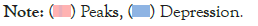
In this work, profile method of aeromagnetic data presentation was adopted. Four profiles were taken on the sheet across areas of interest as displayed in profile 1-4. Summary of the modeled profiles are shown in Table 2.
| Profiles | X(m) | Y(m) | No. of bodies | K values (SI) | Dept.(m) | New depth (km) | Type of body | Dip (deg.) | Plunge (deg.) | Strike (deg.) | Suspected rock type based on value of K | Depth characteristics |
|---|---|---|---|---|---|---|---|---|---|---|---|---|
| 1 | 2.7 | -1.7 | 2 | -0.7777 | -1 | -1 | Dyke | 1.2 | 3.5 | -42 | (Diamagnetic) | Deep |
| 5.9 | -0.6 | -0.0391 | -0.3 | -300 | Dyke | 3 | 1.6 | 88.8 | Olivine diabase | Shallow | ||
| 2 | 5.5 | -0.9 | 2 | 0.1248 | -0.5 | -500 | Dyke | 3.9 | 5.8 | 103.1 | Peridotite | Shallow |
| 9.5 | -2.9 | 0.0049 | -0.3 | -300 | Dyke | 8.2 | 3.4 | -102.8 | Quartzite | Shallow | ||
| 3 | 0.7 | -2 | 2 | 0.0755 | -0.7 | -700 | Dyke | 1 | 2 | 11 | Gabbro | Shallow |
| 3.5 | -2.2 | 0.01 | -0.3 | -300 | Dyke | -7 | -5 | 13 | Shallow | |||
| 4 | 10 | -1.9 | 1 | 0.0085 | -1.1 | -1100 | RecPrism | 0.1 | 5 | 1.8 | Basalt/gabbro | Deep |
Table 2: Summary of result.
The residual map of the region of interest indicates a NW-NE trending of the anomalous bodies characterized by high and low magnetization. It ranges from -65 nT to 87 nT. The profiles indicate the presence of magnetic anomaly in the study area. Amplitudes of profile 1-4 shows lithologic contrast. Table 2 shows summary of results for the four profiles. The modelled depth was multiplied by a factor f=1000 due to the fact that data used was Hand-digitized. New depth obtained ranges from -0.3 km to -1.1 km indicating shallow and deep seated structures. Susceptibility values reveals the presence of diamagnetic rocks and suggested rocks and minerals such as gabbro, quartzite, Diabase, and Peridotite. Profile 2 suggests the presence of intrusive bodies in the area (Figures 5-10).

Figure 5: Residual map for the 4 profiles taken.

Figure 6: Characteristics features of the anomalies.

Figure 7: Observed and calculated TMI, Profile one.

Figure 8: Observed and calculated TMI, Profile two.

Figure 9: Observed and calculated TMI, Profile three.

Figure 10: Observed and calculated TMI, Profile four.
This work has once again demonstrated the effectiveness of hand-digitized aeromagnetic data in the delineation of magnetic anomalies across areas of interest. Qualitatively, the results obtained agree favourably with those. Anomalous bodies recorded include granite, diabase, basalt/gabbro, quartzite and Peridotite. Susceptibility values with negative sign suggest that the area is characterized by diamagnetic materials. Positive susceptibility values and large susceptibility values indicates the presence of paramagnetic and ferromagnetic materials.
Citation: Umera RB, Odong P (2022) Demonstration of the Effectiveness of Hand-Digitized Aeromagnetic Data: A Case Study of Naraguta. J Geol Geophys. 11:1022.
Received: 06-Apr-2022, Manuscript No. JGG-22-17279; Editor assigned: 08-Apr-2022, Pre QC No. JGG-22-17279 (PQ); Reviewed: 22-Apr-2022, QC No. JGG-22-17279; Revised: 27-Apr-2022, Manuscript No. JGG-22-17279 (R); Published: 09-May-2022 , DOI: 10.35248/2381-8719.22.11.1022
Copyright: © 2022 Umera RB, et al. This is an open-access article distributed under the terms of the Creative Commons Attribution License, which permits unrestricted use, distribution, and reproduction in any medium, provided the original author and source are credited.