Journal of Geology & Geophysics
Open Access
ISSN: 2381-8719
ISSN: 2381-8719
Research Article - (2016) Volume 5, Issue 1
This study is aimed at assessing the soil and sub-soil characteristics around Veritas University, Obehie, Abia State, Nigeria. The study revealed that the soils are loose, coarse texture with 78 – 80% sandy fractions having single grain structure from unconsolidated materials of recent alluvial deposits, with soil pH values between 4.8 and 5.8 which could be attributed to leaching of the basic cations to lower depth. Organic carbon content ranged from moderately low 1.50% to high 2.38% due probably to high surface litter and vegetation cover. The low levels of total nitrogen could be attributed to the heavy losses through leaching and responsible for the very low levels of available phosphorus (0.96 - 2.81 μg/g). Nitrate levels are very low (4.33 - 7.80 μg/g) due to the combined effects of intensive cultivations, poor nitrification as well as high leaching processes which occurred in the soils as evidenced in the moderate/high carbon-nitrogen ratio (15 - 43) indicating slow mineralization and humidification process. The three boreholes reveal an overburden brown, medium grained, stiff consistency silty clay soil with thickness of 6-8 meters and underlain by 1 to 2 m depth of brown, medium grained clayey sand. Below this stratum is the aquiferous brown, coarse-grained, gravelly sand to the bored depth of 10 m. Results obtained from the grain size analysis of samples from the boreholes show that the fine to medium grained soils of silty clay and clayey sand have moderate to high fines passing sieve No. 200 (22 to 75%) while the coarse grained gravelly sands have much less silty/clay fractions (10 to 15%). The results show a low plasticity range (6 to 8.7%) for the cohesive soils, while the gravelly sands are non-plastic. The low values of plasticity indices of the plastic soils are an indication of their low water retaining capacity. The soils were classified under the unified soil classification system as SW, SC and CL implying well-graded gravelly sand, clayey sands and low plasticity clays. The permeability test results reveal low values of 1.65 x 10⁻⁸ to 1.60 x 10⁻⁵ cm/sec. for the clayey soils. The gravelly sand shows a high coefficient of permeability of 1.36 x10⁻² cm/sec.
Keywords: Sub-soil, Soil characterization, Aquifer, Permeability, Obehie, Abia state
This study provides a detailed assessment of the suitability of the soils of the area, the sub-soil conditions and suggests relevant soil improvements where necessary as well as recommend appropriate foundation type and design parameters. Numerous studies have been carried out on geotechnical properties of the subsoils generally [1-4].
The study location is within the coast plan sand of the Niger Delta area. The area lies within a sub-horizontal geomorphologic terrain with a measure of undulations arising from uneven surface area erosion. Ground elevation ranges between 10-12 meters above mean sea level. The local geology is of the coastal plain sand, which is Miocene in age and form parts of the most strata of the outcropping Benin Formation. These consist of extensive thickness of brownish, coarse to medium sand with subordinate clay and silt. The area is associated with luxuriant freshwater vegetation typical of a tropical rainforest. Mean annual rainfall exceeds 2000 m.
The study area is endowed with the sedimentary rocks characteristic of the Niger Delta (Figure 1). The detailed geology of the area has been described by Allen [5], Reyment [6], Short and Stauble [7]. Lithostratigraphically, the rocks are divided into the oldest Akata Formation (Paleoceone), the Agbada Formation (Eocene) and the youngest Benin Formation (Miocene to Recent). The wells and boreholes tap water from the overlaying Benin Formation (Coastal Plain Sands). This formation comprises of lacustrine and fluvial deposits whose thicknesses are variable. The Benin Formation has lithology consisting of sands, silts, gravel and clayey intercalations.
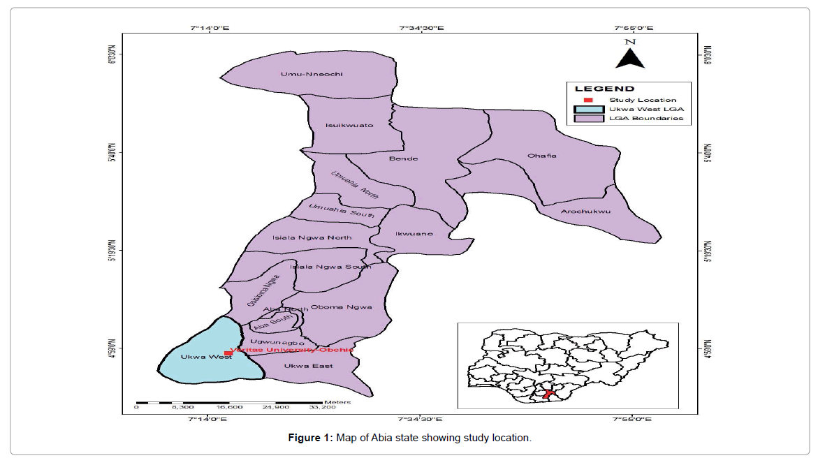
Figure 1: Map of Abia state showing study location.
The hydrology of the study site is influenced by its high precipitation rate with a mean annual rainfall of over 2,500 mm, the over burden lithologic strata that over lie the aquifer, and the sometimes undulating topography. Surface waters are received from non-tidal seasonal fresh water flows. Recharge of the aquifer will be by rainwater that eventually moves through the over burden into the aquifer. Recharge depends on rainfall intensity and distribution and amount of surface runoff. Groundwater occurs under confined conditions at the site on account of the essentially clayey soil overlying the aquifer. The existence of this over burden-confining layer will determine whether or not groundwater contaminants introduced into the soil will reach the aquifer. During construction at the site, the protective soil vegetation is removed. Concentrated surface flow of rainwater rills the soil and changes the slope value, which may eventually result in sheet/gully erosion. The cohesive, stiff consistency of the over lying clayey soil will help to limit the degree of this environmental hazard.
Field and laboratory methods
Soil samples were collected using the grid format and sampling location selected in such a manner as to adequately represent the ecological conditions of the study area [8]. At the grid intersection, soil samples were collected by taking about five auger borings at random around the sampling station to depths of 0 – 15 cm and compositing the soils from similar depth into well-labelled plastic bags. The quantity of composite samples collected was processed for analyses in the laboratory without sub-sampling in the field. This allowed for more accurate sub-samples that better represented the area and remove errors due to sample splitting and sub-sampling in the field. The analyses were performed on sub-samples of the air-dried soil samples using materials less than 2 mm diameter of the fine earth. Concentrations were expressed on a dry weight basis and the following physico-chemical parameters were determined: Soil pH, electrical conductivity, organic carbon, total and mineral nitrogen, exchangeable cations, available phosphorus, and particle size analyses. Analyses for oil content (THC) were measured using fresh soil samples.
Three water wells were bored at the site to obtain water quality data, water level monitoring and sub-soil analysis for infiltration characteristics. The boreholes were drilled with the use of light cable percussion rig to a depth of 10 m for each borehole. This drill type permits more accurate determination of groundwater levels and sampling of groundwater for quality analysis. The wells were logged on site with soil samples recovered at intervals where distinct changes in soil type occur, for laboratory analysis. Static water levels recorded in the boreholes were 9.40 m, 9.00 m and 9.00 m for boreholes 1, 2 and 3, respectively. The water level in the boreholes is subject to seasonal fluctuations. The values were observed during the rainy season. The physical properties of the soil samples recovered from the boreholes were examined to obtain parameters used as indices of the infiltration of the soils at the site.
Laboratory tests were carried out on representative sub-soil samples in accordance with British Standards 1377 [9], which are equivalent to the American Standards for Testing Materials (ASTM) [10]. The tests were conducted to enable the evaluation of the gradation, hydraulic conductivity (coefficient of permeability) and consistency (water absorbing and adsorbing ability) properties of the soil samples, as well as their classification.
Physico-chemical properties
The physico-chemical properties of soils of the study area are presented in Table 1. Typically the soils are loose, coarse texture with 78 – 80% sandy fractions having single grain structure from unconsolidated materials of recent alluvial deposits. The soils are strongly acid in reaction with pH values between 4.8 and 5.8 which could be attributed to leaching of the basic cations to lower depth. Organic carbon content ranged from moderately low 1.50% to high 2.38% due probably to high surface litter and vegetation cover. Total nitrogen ranged between 0.05 – 0.12%, the low levels could be attributed to the heavy losses through leaching which is responsible also for the very low levels of available phosphorus (0.96 – 2.81 μg/g). Nitrate levels are very low (4.33 – 7.80 μg/g) due to the combined effects of intensive cultivations, poor nitrification and high leaching processes occurring in the soils. This is evidenced in the moderate/high carbon-nitrogen ratio (15 – 43) indicating that mineralization and humification process will be slow.
| S/N | Sample | Cm | pH | µS/cm | mg/kg | % | C/N | µg/g | Cmo1/kg | % | Textural | ||||||||
| Station | Depth | Electrical Cond. | THC | Org. | Total N | Ratio | AV.P | NO3- | K+ | Na+ | Ca+ | Mg2+ | CEC | Sand | Silt | Clay | |||
| 1. | CW A 01 | 0-15 | 2.7 | 37 | 21.82 | 2.30 | 0.10 | 23 | 2.80 | 7.12 | 2.80 | 1.01 | 5.86 | 6.04 | 4.20 | 78 | 8 | 14 | Sandy loam |
| 2. | 15-30 | 2.3 | 21 | 18.45 | 2.01 | 0.08 | 25 | 1.90 | 6.62 | 1.80 | 0.80 | 6.38 | 7.04 | 3.60 | 78 | 9 | 13 | Sandy loam | |
| 3. | 02 | 0-15 | 2.3 | 46 | 13.08 | 2.38 | 0.11 | 21 | 0.96 | 7.00 | 1.85 | 0.90 | 6.20 | 6.33 | 2.67 | 78 | 6 | 16 | Sandy loam |
| 4. | 15-30 | 2.1 | 40 | 26.18 | 2.08 | 0.09 | 23 | 1.92 | 5.50 | 2.81 | 1.01 | 6.60 | 8.12 | 3.18 | 78 | 10 | 12 | Sandy loam | |
| 5. | CW B 01 | 0-15 | 2.6 | 25 | 26.18 | 2.02 | 0.07 | 28 | 2.78 | 5.68 | 1.68 | 0.68 | 5.78 | 6.28 | 4.16 | 80 | 8 | 12 | Sandy loam |
| 6. | 15-30 | 2.6 | 43 | 26.18 | 1.98 | 0.09 | 22 | 1.98 | 4.34 | 0.81 | 0.58 | 4.20 | 5.40 | 5.20 | 79 | 7 | 14 | Sandy loam | |
| 7. | 02 | 0-15 | 2.5 | 29 | 47.99 | 2.16 | 0.05 | 43 | 2.81 | 6.20 | 2.38 | 1.20 | 4.40 | 7.71 | 5.22 | 78 | 7 | 15 | Sandy loam |
| 8. | 15-30 | 2.3 | 14 | 56.72 | 1.50 | 0.10 | 15 | 1.48 | 4.32 | 0.52 | 0.58 | 1.32 | 5.33 | 6.28 | 80 | 10 | 10 | Sandy loam | |
| 9. | CW C 01 | 0-15 | 2.0 | 26 | 17.45 | 2.10 | 0.08 | 26 | 0.84 | 7.02 | 1.78 | 0.54 | 5.60 | 6.20 | 6.10 | 80 | 5 | 15 | Sandy loam |
| 10. | 15-30 | 2.1 | 39 | 8.72 | 2.11 | 0.07 | 30 | 1.04 | 6.24 | 0.60 | 0.48 | 1.98 | 2.48 | 4.78 | 77 | 8 | 15 | Sandy loam | |
| 11. | 02 | 0-15 | 2.3 | 18 | 43.63 | 2.00 | 0.06 | 33 | 0.94 | 5.54 | 2.10 | 1.01 | 6.18 | 6.20 | 3.84 | 80 | 8 | 12 | Sandy loam |
| 12. | 15-30 | 2.1 | 19 | 100.34 | 1.78 | 0.05 | 36 | 1.92 | 6.14 | 0.40 | 0.30 | 5.68 | 5.84 | 3.90 | 78 | 8 | 14 | Sandy loam | |
| 13. | CW D 01 | 0-15 | 2.0 | 20 | 30.54 | 2.04 | 0.08 | 26 | 2.42 | 7.24 | 1.84 | 1.11 | 4.12 | 5.24 | 5.20 | 78 | 9 | 13 | Sandy loam |
| 14. | 15-30 | 2.2 | 34 | 13.08 | 1.87 | 0.06 | 31 | 0.96 | 6.12 | 0.54 | 0.50 | 3.44 | 4.24 | 6.10 | 77 | 8 | 14 | Sandy loam | |
| 15. | 02 | 0-15 | 2.1 | 26 | 4.36 | 2.23 | 0.12 | 19 | 0.98 | 7.80 | 1.88 | 0.40 | 5.61 | 6.04 | 3.00 | 78 | 6.5 | 15.5 | Sandy loam |
| 16 | 15-30 | 2.2 | 18 | 30.54 | 1.79 | 0.09 | 20 | 1.04 | 5.62 | 0.86 | 0.78 | 3.42 | 4.10 | 4.37 | 79 | 10 | 11 | Sandy loam | |
THC=Total Hydrocarbon
Org. C=Organic Carbon
C/N ratio=Carbon-Nitrogen ratio
Av.P.=Available Phosphorus
CEC=Cation Exchangeable Capacity
Table 1: Physico- Chemical Properties of Soils around Catholic University, Obehie, Abia State.
The soils are moderate to high in exchangeable bases. Potassium, calcium and magnesium were dominant while sodium is low for Nigerian soils [11]. The moderate to high levels of exchangeable bases found in the soils could be attributed to the nature of the parent materials.
The cation exchange capacity is very low (2.67 – 6.28 Cmol/kg) indicating the type of clay minerals. The results revealed that fertility ratings of the soils are moderately low when compared with fertility indices of soils in Nigeria [12]. Total hydrocarbon (oil) concentration in the soil is low indicating very low hydrocarbon contamination. The amount detected could be attributed to biogenic sources.
The study revealed from the logs a uniform correlation in the three boreholes of an overburden brown, medium grained, stiff consistency silty clay soil with thickness of 6-8 m. This is underlain by 1 to 2 m depth of brown, medium grained clayey sand. Below this stratum is the aquiferous brown, coarse-grained, gravelly sand to the bored depth of 10 m. Grain size analysis involved dry sieving on field obtained samples. Results obtained from the grain size analysis of samples from the boreholes show that the fine to medium grained soils of silty clay and clayey sand have moderate to high fines passing sieve No. 200 (22 to 75%) while the coarse grained gravelly sands have much less silty/ clay fractions (10 to 15%). The fine grained nature of the clays mean that fluid flow through them will be slow, as the number of particles per unit area is relatively small and void spaces are fewer. The clayey soils therefore have relatively low permeabilities on account of their fine grains.
Atterberg limits (also known as consistency limits) expresses the water absorbing and adsorbing ability of fine grained, cohesive soil, with the plasticity index indicating the range of water content, through which the soil remains plastic. The results show a low plasticity range (6 to 8.7%) for the cohesive soils, while the gravelly sands are non-plastic (Table 2). Atterberg limit tests are applicable only to fine grained, cohesive soils. The low values of plasticity indices of the plastic soils are an indication of their low water retaining capacity.
| Borehole Number | Sample Number & Depth | Soil Type | Grain Size Distribution (Percent Passing Sieves) | Atterberg Limits | Permeability (cm/sec.) | Classification | |||||
|---|---|---|---|---|---|---|---|---|---|---|---|
| NO. 4 (4.75mm) | No. 10 (2.00mm) | No. 40 (0.42mm) | No. 200 (0.075mm) | LL (%) | PL (%) | PL (%) | Unified Soil Classification System (U.S.C) | ||||
| BH1 | BH1 (0.5m) | Silty Clay | 92.0 | 84.0 | 80.0 | 80.0 | 75.0 | 16.6 | 7.9 | 1.65 X 10⁻⁸ | CL |
| BH1 (9m) | Clay Sand | 38.0 | 31.0 | 29.0 | 22.0 | 12.2 | 5.8 | 6.4 | 1.45 x 10⁻⁵ | SC | |
| HH1 (10m) | Gravelly Sand | 26.0 | 22.0 | 18.0 | 15.0 | - | - | Non Plastic | 1-36 x 10-5 | SW | |
| BH2 | BH2 (0.5m) | Silty Clay | 90.0 | 87.0 | 81.0 | 76.0 | 15.8 | 7.2 | 8.6 | 1.72 x 10⁻⁸ | CL |
| BH2 (7m) | Clay Sand | 35.0 | 33.0 | 31.0 | 30.0 | 12.4 | 6.0 | 6.4 | 1.60 x 10⁻⁵ | SC | |
| BH2 (9m) | Gravelly Sand | 32.0 | 29.0 | 18.0 | 15.0 | - | - | Non plastic | - | SW | |
| BH3 | BH3 (0.5m) | Silty Clay | 92.0 | 86.0 | 81.0 | 75.0 | 16.6 | 7.9 | 8.7 | 1.70 x 10⁻⁸ | CL |
| BH3 (7m) | Clay Sand | 32.0 | 31.0 | 30.0 | 28.0 | 12.2 | 6.2 | 6.0 | 1.50 x 10⁻⁵ | SC | |
| BH3 (9m) | Gravelly Sand | 22.0 | 18.0 | 15.0 | 10.0 | - | - | Non plastic | - | SW | |
Table 2: Summary of laboratory sub-soil test results (Veritas University Site, Obehie).
The soils were classified under the unified soil classification system as SW, SC and CL implying well-graded gravelly sand, clayey sands and low plasticity clays (Table 2). The permeability test results reveal low values of 1.65×10⁻⁸ to 1.60×10⁻⁵ cm/sec. for the clayey soils. The gravelly sand display a high coefficient of permeability of 1.36×10⁻² cm/ sec. Infiltration capacity of soil depends on the permeability, degree of saturation, vegetation and amount and duration of rainfall [13].
The study revealed that the soils are loose, coarse texture with 78 – 80% sandy fractions having single grain structure from unconsolidated materials of recent alluvial deposits. The soils are strongly acid in reaction with pH values between 4.8 and 5.8 which could be attributed to leaching of the basic cations to lower depth. Organic carbon content ranged from moderately low 1.50% to high 2.38% due probably to high surface litter and vegetation cover. The low levels of total nitrogen could be attributed to the heavy losses through leaching which is responsible also for the very low levels of available phosphorus (0.96 – 2.81 μg/g). Nitrate levels are very low (4.33 – 7.80 μg/g) due to the combined effects of intensive cultivations, poor nitrification and high leaching processes occurring in the soils, evidenced in the moderate/ high carbon-nitrogen ratio (15 – 43) indicating slow mineralization and humification process.
The physical properties of the sub-soils were determined and used as indices of their infiltration capacity and classification. Boreholes logged to the maximum-drilled depth of 10 m reveal fine-grained, stiff consistency silty clay overlying medium grained clayey sand. Beneath this is the aquiferous coarse gravelly sand. The aquifer is confined and this condition may help to seal off the lower strata and aquifer from pollutants. However, environmental hazards that may occur at the site may include sheet erosion and flooding.